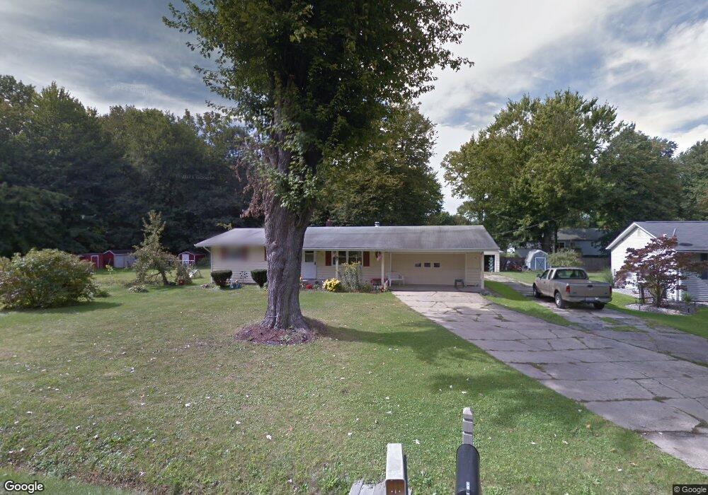
397 Morgan Dr Painesville, OH 44077
Estimated Value: $210,000 - $249,000
3
Beds
2
Baths
1,120
Sq Ft
$198/Sq Ft
Est. Value
About This Home
This home is located at 397 Morgan Dr, Painesville, OH 44077 and is currently estimated at $221,516, approximately $197 per square foot. 397 Morgan Dr is a home located in Lake County with nearby schools including Henry F. Lamuth Middle School, Riverside Junior/Senior High School, and Summit Academy Community School - Painesville.
Ownership History
Date
Name
Owned For
Owner Type
Purchase Details
Closed on
Dec 11, 2017
Sold by
Sampson John L and Sampson Anan M
Bought by
March Sandra K
Current Estimated Value
Purchase Details
Closed on
Jun 6, 2001
Sold by
Sampson John L and Sampson Anna M
Bought by
Sampson John L and Sampson Anna M
Purchase Details
Closed on
Nov 17, 1993
Bought by
Sampson John L
Create a Home Valuation Report for This Property
The Home Valuation Report is an in-depth analysis detailing your home's value as well as a comparison with similar homes in the area
Home Values in the Area
Average Home Value in this Area
Purchase History
| Date | Buyer | Sale Price | Title Company |
|---|---|---|---|
| March Sandra K | -- | Ohio Real Title | |
| Sampson John L | -- | -- | |
| Sampson John L | -- | -- |
Source: Public Records
Tax History Compared to Growth
Tax History
| Year | Tax Paid | Tax Assessment Tax Assessment Total Assessment is a certain percentage of the fair market value that is determined by local assessors to be the total taxable value of land and additions on the property. | Land | Improvement |
|---|---|---|---|---|
| 2024 | -- | $67,290 | $25,170 | $42,120 |
| 2023 | $5,624 | $51,610 | $20,330 | $31,280 |
| 2022 | $3,091 | $51,610 | $20,330 | $31,280 |
| 2021 | $3,102 | $51,610 | $20,330 | $31,280 |
| 2020 | $3,056 | $44,880 | $17,680 | $27,200 |
| 2019 | $3,079 | $44,880 | $17,680 | $27,200 |
| 2018 | $3,089 | $39,720 | $16,800 | $22,920 |
| 2017 | $2,167 | $39,720 | $16,800 | $22,920 |
| 2016 | $1,910 | $39,720 | $16,800 | $22,920 |
| 2015 | $1,776 | $39,720 | $16,800 | $22,920 |
| 2014 | $1,806 | $39,720 | $16,800 | $22,920 |
| 2013 | $1,765 | $39,720 | $16,800 | $22,920 |
Source: Public Records
Map
Nearby Homes
- V/L Morgan Dr
- 43 Bristol Ave
- 396 Park Rd
- 525 Morgan Dr
- 500 Park Rd
- 67 Tanners Farm Dr
- 65 Tanners Farm Dr
- 5406 Pebble Creek Ln
- 1182 Dalton Dr
- 269 Hale Rd
- 1172 Dalton Dr
- 108 Birch Dr
- 4505 Lane Rd
- 1787 Muirfield Ln
- 0 N Ridge Rd Unit 5110949
- 30 Orton Rd
- 44 Grove Ave
- 58 Deerfield Dr
- 3147 Maine Ave
- 238 Radley Dr
- 0 Morgan Dr
- 1596 Queens Ct
- 405 Morgan Dr
- 1586 Queens Ct
- 400 Morgan Dr
- 1595 Queens Ct
- 417 Morgan Dr
- 1589 Queens Ct
- 300 Manhattan Pkwy
- 310 Manhattan Pkwy
- 424 Morgan Dr
- 427 Morgan Dr
- 1581 Queens Ct
- 1586 Greenwich Ct
- 434 Morgan Dr
- 348 Manhattan Pkwy
- 1596 Greenwich Ct
- 440 Morgan Dr
- 356 Manhattan Pkwy
- 311 Manhattan Pkwy