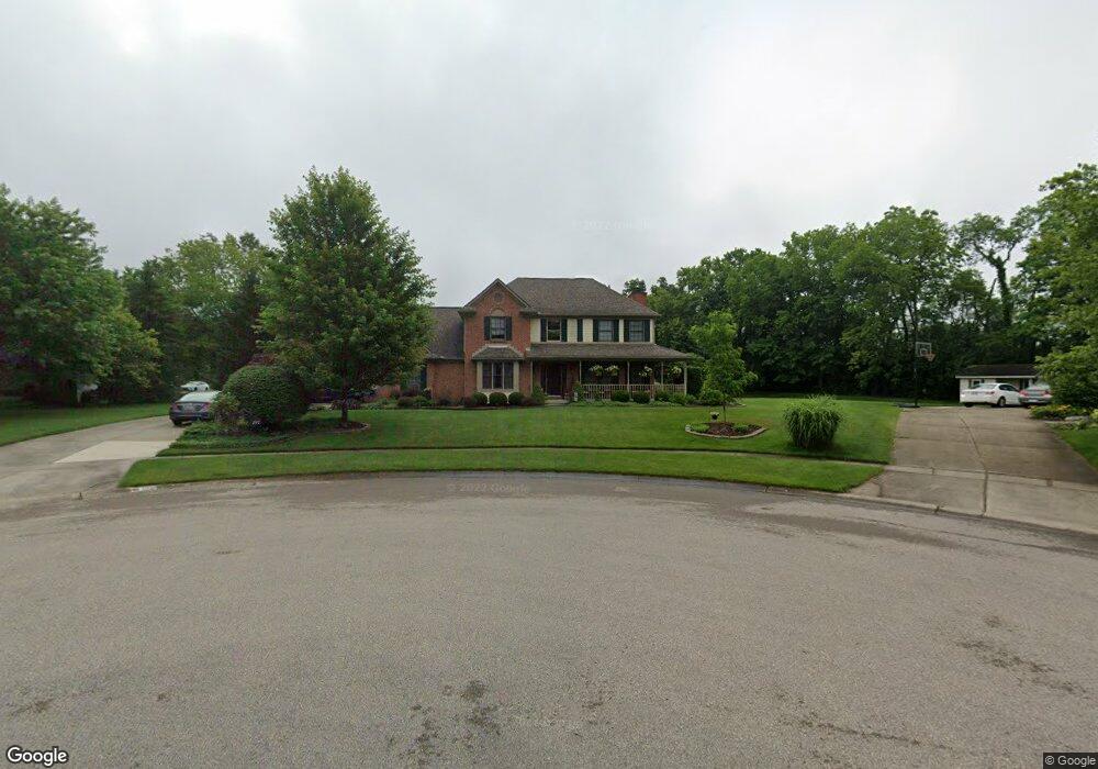
397 Patton Dr Springboro, OH 45066
Estimated Value: $409,000 - $453,067
4
Beds
3
Baths
2,409
Sq Ft
$182/Sq Ft
Est. Value
About This Home
This home is located at 397 Patton Dr, Springboro, OH 45066 and is currently estimated at $437,267, approximately $181 per square foot. 397 Patton Dr is a home located in Warren County with nearby schools including Clearcreek Elementary School, Springboro Intermediate School, and Springboro Junior High School.
Ownership History
Date
Name
Owned For
Owner Type
Purchase Details
Closed on
Dec 19, 2016
Sold by
Leis Jeffrey J and Leis Christine E
Bought by
Leis Jeffrey J and Leis Christine E
Current Estimated Value
Purchase Details
Closed on
Jun 29, 1994
Sold by
Kahmann Const Co Inc
Bought by
Leis Jeffrey J and Leis Christine E
Home Financials for this Owner
Home Financials are based on the most recent Mortgage that was taken out on this home.
Original Mortgage
$173,600
Interest Rate
8.66%
Mortgage Type
New Conventional
Purchase Details
Closed on
Jan 19, 1993
Sold by
Roger-Anderson Partnershi
Bought by
Kahmann Construction Co &
Purchase Details
Closed on
Aug 13, 1991
Sold by
Roger-Anderson Partnershi
Bought by
Roger-Anderson Partnershi
Create a Home Valuation Report for This Property
The Home Valuation Report is an in-depth analysis detailing your home's value as well as a comparison with similar homes in the area
Home Values in the Area
Average Home Value in this Area
Purchase History
| Date | Buyer | Sale Price | Title Company |
|---|---|---|---|
| Leis Jeffrey J | $16,667 | None Available | |
| Leis Jeffrey J | $223,702 | -- | |
| Kahmann Construction Co & | $35,000 | -- | |
| Roger-Anderson Partnershi | -- | -- |
Source: Public Records
Mortgage History
| Date | Status | Borrower | Loan Amount |
|---|---|---|---|
| Closed | Leis Jeffrey J | $173,600 |
Source: Public Records
Tax History
| Year | Tax Paid | Tax Assessment Tax Assessment Total Assessment is a certain percentage of the fair market value that is determined by local assessors to be the total taxable value of land and additions on the property. | Land | Improvement |
|---|---|---|---|---|
| 2025 | $5,546 | $136,080 | $31,500 | $104,580 |
| 2024 | $5,546 | $136,080 | $31,500 | $104,580 |
| 2023 | $4,876 | $109,816 | $17,220 | $92,596 |
| 2022 | $4,769 | $109,816 | $17,220 | $92,596 |
| 2021 | $4,487 | $109,816 | $17,220 | $92,596 |
| 2020 | $4,217 | $89,282 | $14,000 | $75,282 |
| 2019 | $3,908 | $89,282 | $14,000 | $75,282 |
| 2018 | $3,910 | $89,282 | $14,000 | $75,282 |
| 2017 | $3,789 | $77,903 | $12,429 | $65,475 |
| 2016 | $3,943 | $77,903 | $12,429 | $65,475 |
| 2015 | $3,942 | $77,903 | $12,429 | $65,475 |
| 2014 | $3,976 | $74,190 | $11,840 | $62,360 |
| 2013 | $3,974 | $87,750 | $14,000 | $73,750 |
Source: Public Records
Map
Nearby Homes
- 8638 Sycamore Trails Dr
- 811 Wind Bluff Point
- 678 Grand Wood Ct
- 701 Grand Wood Ct
- 8711 Nicole Ln
- 9048 Bedford Ct
- 9229 Bennington Way
- 855 Willow Oak Ct
- 9195 Glenridge Blvd
- 8234 Voltaire Ct
- 710 White Cedar Way
- 91 Hillcrest Dr
- 9079 Bunnell Hill Rd
- 0 Voltaire Ct Unit 1863060
- 9378 Remington Hill Rd
- 9175 Bunnell Hill Rd
- 9101 Remy Ct
- 1198 Normandy Rue
- 1211 Normandy Rue
- 9155 Remy Ct
- 391 Patton Dr
- 555 Oaknoll Dr
- 411 Patton Dr
- 556 Oaknoll Dr
- 561 Oaknoll Dr
- 379 Patton Dr
- 382 Patton Dr
- 8554 Silver Oak Ct
- 429 Patton Dr
- 560 Oaknoll Dr
- 8549 Silver Oak Ct
- 571 Oaknoll Dr
- 428 Patton Dr
- 367 Patton Dr
- 576 Oaknoll Dr
- 557 Highpoint Dr
- 8450 London Ct
- 555 Highpoint Dr
- 447 Patton Dr
- 591 Oaknoll Dr
Your Personal Tour Guide
Ask me questions while you tour the home.