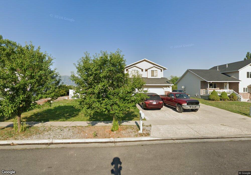
397 S 1200 W Logan, UT 84321
Woodruff NeighborhoodEstimated Value: $427,000 - $436,943
3
Beds
3
Baths
1,625
Sq Ft
$266/Sq Ft
Est. Value
About This Home
This home is located at 397 S 1200 W, Logan, UT 84321 and is currently estimated at $432,736, approximately $266 per square foot. 397 S 1200 W is a home located in Cache County with nearby schools including Mountainside School, South Cache Middle School, and Mountain Crest High School.
Ownership History
Date
Name
Owned For
Owner Type
Purchase Details
Closed on
Jan 26, 2021
Sold by
Cornia Braxton and Tolle Macaela
Bought by
Coronado Jose Luis Garnica
Current Estimated Value
Home Financials for this Owner
Home Financials are based on the most recent Mortgage that was taken out on this home.
Original Mortgage
$299,250
Outstanding Balance
$265,942
Interest Rate
2.6%
Mortgage Type
New Conventional
Estimated Equity
$166,794
Purchase Details
Closed on
May 1, 2018
Sold by
Cornia Braxton
Bought by
Cornia Braxton and Tolle Macaela
Home Financials for this Owner
Home Financials are based on the most recent Mortgage that was taken out on this home.
Original Mortgage
$227,797
Interest Rate
4.5%
Mortgage Type
FHA
Purchase Details
Closed on
Apr 30, 2018
Sold by
Spruell David M and Spruell Alicia R
Bought by
Cornia Braxton
Home Financials for this Owner
Home Financials are based on the most recent Mortgage that was taken out on this home.
Original Mortgage
$227,797
Interest Rate
4.5%
Mortgage Type
FHA
Purchase Details
Closed on
Apr 27, 2017
Sold by
Pritchard Seth B
Bought by
Spruell David M and Spruell Alicia R
Home Financials for this Owner
Home Financials are based on the most recent Mortgage that was taken out on this home.
Original Mortgage
$173,500
Interest Rate
4.14%
Mortgage Type
New Conventional
Purchase Details
Closed on
Oct 15, 2012
Sold by
Hair Jeremy
Bought by
Pritchard Seth B
Home Financials for this Owner
Home Financials are based on the most recent Mortgage that was taken out on this home.
Original Mortgage
$137,750
Interest Rate
3.52%
Mortgage Type
New Conventional
Purchase Details
Closed on
Jul 31, 2006
Sold by
Balling Robert H and Balling Debra S
Bought by
Hair Jeremy
Home Financials for this Owner
Home Financials are based on the most recent Mortgage that was taken out on this home.
Original Mortgage
$150,000
Interest Rate
6.69%
Mortgage Type
Seller Take Back
Purchase Details
Closed on
Oct 24, 2005
Sold by
Balling Robert H
Bought by
Balling Robert H and Balling Debra S
Create a Home Valuation Report for This Property
The Home Valuation Report is an in-depth analysis detailing your home's value as well as a comparison with similar homes in the area
Home Values in the Area
Average Home Value in this Area
Purchase History
| Date | Buyer | Sale Price | Title Company |
|---|---|---|---|
| Coronado Jose Luis Garnica | -- | Northern Title Company | |
| Cornia Braxton | -- | American Secure Title | |
| Cornia Braxton | -- | American Secure Title | |
| Spruell David M | -- | None Available | |
| Pritchard Seth B | -- | Title Guarantee | |
| Hair Jeremy | -- | Heritage West Title | |
| Balling Robert H | -- | Hickman Land Title Company |
Source: Public Records
Mortgage History
| Date | Status | Borrower | Loan Amount |
|---|---|---|---|
| Open | Coronado Jose Luis Garnica | $299,250 | |
| Previous Owner | Cornia Braxton | $227,797 | |
| Previous Owner | Spruell David M | $173,500 | |
| Previous Owner | Pritchard Seth B | $137,750 | |
| Previous Owner | Hair Jeremy | $150,000 |
Source: Public Records
Tax History Compared to Growth
Tax History
| Year | Tax Paid | Tax Assessment Tax Assessment Total Assessment is a certain percentage of the fair market value that is determined by local assessors to be the total taxable value of land and additions on the property. | Land | Improvement |
|---|---|---|---|---|
| 2025 | $1,965 | $254,200 | $0 | $0 |
| 2024 | $2,032 | $254,515 | $0 | $0 |
| 2023 | $2,112 | $252,140 | $0 | $0 |
| 2022 | $1,936 | $215,845 | $0 | $0 |
| 2021 | $187 | $322,350 | $42,000 | $280,350 |
| 2020 | $1,398 | $216,697 | $42,000 | $174,697 |
| 2019 | $1,461 | $216,696 | $42,000 | $174,696 |
| 2018 | $1,432 | $193,910 | $42,000 | $151,910 |
| 2017 | $1,345 | $96,305 | $0 | $0 |
| 2016 | $1,395 | $96,305 | $0 | $0 |
| 2015 | $1,356 | $93,555 | $0 | $0 |
| 2014 | $1,226 | $93,555 | $0 | $0 |
| 2013 | -- | $93,555 | $0 | $0 |
Source: Public Records
Map
Nearby Homes
- 1227 W 500 S Unit 151
- 370 S 1200 W Unit 2
- 506 S 1225 W
- 518 S 1225 W
- 1099 Three Pointe Ave
- 542 S 1225 W Unit 116
- 548 S 1225 W Unit 115
- 1271 W 350 S
- 1239 W 575 S Unit 152
- Hemlock Plan at Sugar Creek - Logan
- Eucalyptus Plan at Sugar Creek - Logan
- Blackberry Plan at Sugar Creek - Logan
- Magnolia Plan at Sugar Creek - Logan
- 1220 W 575 S
- 2399 W 430 S Unit 33
- 542 1225 W
- 1585 W Silver Canoe Way
- 1615 Silver Canoe Way
- 1506 Silver Canoe Loop
- 1506 Silver Canoe Loop Unit 102
- 397 S 1200 W Unit 2
- 387 S 1200 W Unit 1
- 387 S 1200 W
- 409 S 1200 W Unit 3
- 409 S 1200 W
- 427 S 1200 W Unit 4
- 427 S 1200 W
- 390 S 1200 W Unit 10
- 390 S 1200 W
- 1194 W 400 S
- 433 S 1200 W Unit 5
- 433 S 1200 W
- 1234 W 350 S
- 428 S 1200 W Unit 12
- 428 S 1200 W
- 380 S 1200 W Unit 3
- 1189 W 400 S
- 441 S 1200 W Unit 6
- 1182 W 400 S Unit 38
- 1182 W 400 S