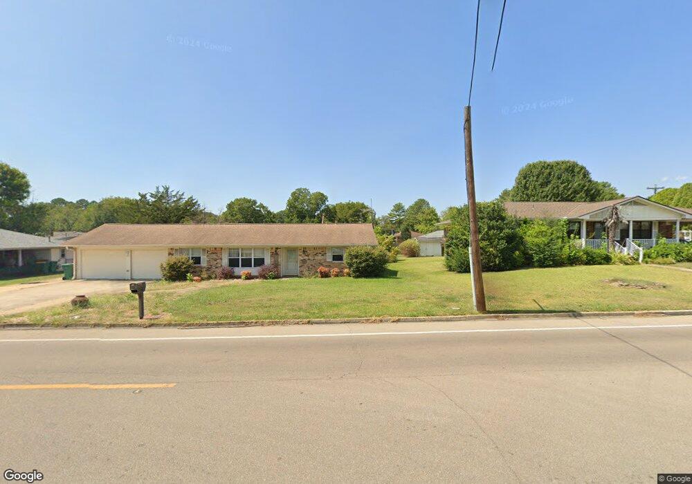
397 S Thomas St Tupelo, MS 38801
Thomas Street NeighborhoodEstimated Value: $161,000 - $228,000
Studio
--
Bath
1,792
Sq Ft
$110/Sq Ft
Est. Value
About This Home
This home is located at 397 S Thomas St, Tupelo, MS 38801 and is currently estimated at $197,000, approximately $109 per square foot. 397 S Thomas St is a home located in Lee County with nearby schools including Thomas Street Elementary School, Pierce Street Elementary School, and Tupelo Middle School.
Ownership History
Date
Name
Owned For
Owner Type
Purchase Details
Closed on
Apr 19, 2023
Bought by
Unadkat Manan
Current Estimated Value
Purchase Details
Closed on
Sep 26, 2019
Bought by
Walser Elizabeth
Home Financials for this Owner
Home Financials are based on the most recent Mortgage that was taken out on this home.
Original Mortgage
$123,190
Interest Rate
3.5%
Mortgage Type
New Conventional
Purchase Details
Closed on
May 12, 2008
Sold by
Kelly Kimberly J and Dyer Kimberly Jane
Bought by
Us Bank Nat'L Assoc
Create a Home Valuation Report for This Property
The Home Valuation Report is an in-depth analysis detailing your home's value as well as a comparison with similar homes in the area
Home Values in the Area
Average Home Value in this Area
Purchase History
| Date | Buyer | Sale Price | Title Company |
|---|---|---|---|
| Unadkat Manan | $169,000 | -- | |
| Walser Elizabeth | $127,000 | -- | |
| Walser Elizabeth | -- | None Available | |
| Us Bank Nat'L Assoc | -- | -- |
Source: Public Records
Mortgage History
| Date | Status | Borrower | Loan Amount |
|---|---|---|---|
| Previous Owner | Walser Elizabeth | $123,190 |
Source: Public Records
Tax History
| Year | Tax Paid | Tax Assessment Tax Assessment Total Assessment is a certain percentage of the fair market value that is determined by local assessors to be the total taxable value of land and additions on the property. | Land | Improvement |
|---|---|---|---|---|
| 2025 | $1,884 | $13,859 | $0 | $0 |
| 2024 | $2,826 | $20,789 | $0 | $0 |
| 2023 | $1,611 | $12,039 | $0 | $0 |
| 2022 | $2,417 | $18,059 | $0 | $0 |
| 2021 | $2,417 | $18,059 | $0 | $0 |
| 2020 | $2,417 | $18,059 | $0 | $0 |
| 2019 | $508 | $11,292 | $0 | $0 |
| 2018 | $508 | $11,292 | $0 | $0 |
| 2017 | $506 | $11,292 | $0 | $0 |
| 2016 | $506 | $11,292 | $0 | $0 |
| 2015 | $373 | $10,309 | $0 | $0 |
| 2014 | $373 | $10,309 | $0 | $0 |
Source: Public Records
Map
Nearby Homes
- 503 S Thomas St
- 610 Trout St
- 2516 Hampton Ave
- 405 S Foster Dr
- 401 S Foster Dr
- 2404 Crestwood Dr
- 914 Dogwood Dr
- Lot 26 Spring Lake (Jasmine)
- 219 Lakeview Dr
- 214 Nanney Dr
- 2872 Orchid Cir
- 2700 W Main St
- 25 ac Mississippi 6
- 1523 Boggan Dr
- 404 Smith St
- 400 Smith St
- 9 Cambridge Dr
- 1587 Larkspur Cir
- 2266 Crabapple Dr
- Lot 1 Dunbarton Place
- 397 S Thomas St
- 383 S Thomas St
- 417 S Thomas St
- 383 S Thomas St
- 603 Stewart Dr
- 605 Stewart Dr
- 433 S Thomas St
- 2403 Confederate Ave
- 701 Stewart Dr
- 701 Stewart Dr
- 2501 Hood
- 451 S Thomas St
- 451 S Thomas St
- 347 S Thomas St
- 347 S Thomas St
- 2500 Confederate
- 2500 Hood Ave
- 703 Stewart Dr
- 2402 Confederate Ave
- 2501 Hood Ave
Your Personal Tour Guide
Ask me questions while you tour the home.