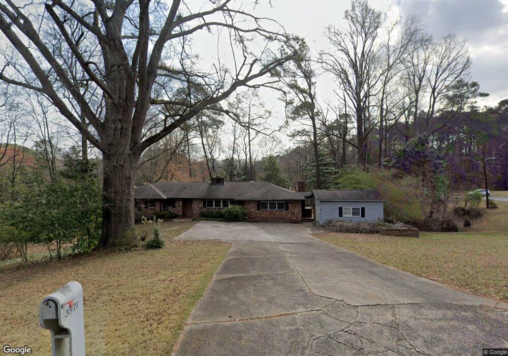
3971 Randall Farm Rd SE Atlanta, GA 30339
Estimated Value: $706,000
4
Beds
2
Baths
2,174
Sq Ft
$325/Sq Ft
Est. Value
About This Home
This home is located at 3971 Randall Farm Rd SE, Atlanta, GA 30339 and is currently estimated at $706,000, approximately $324 per square foot. 3971 Randall Farm Rd SE is a home located in Cobb County with nearby schools including Teasley Elementary School, Campbell Middle School, and Campbell High School.
Ownership History
Date
Name
Owned For
Owner Type
Purchase Details
Closed on
Apr 12, 2016
Sold by
Nationstar Mtg Llc
Bought by
Harris James and Harris Ann
Current Estimated Value
Home Financials for this Owner
Home Financials are based on the most recent Mortgage that was taken out on this home.
Original Mortgage
$306,400
Interest Rate
3.73%
Mortgage Type
Commercial
Purchase Details
Closed on
Jun 24, 2015
Sold by
Generation Mtg Co
Bought by
Nationstar Mtg Llc
Purchase Details
Closed on
Jun 2, 2015
Sold by
Robinson William
Bought by
Generation Mtg Co
Create a Home Valuation Report for This Property
The Home Valuation Report is an in-depth analysis detailing your home's value as well as a comparison with similar homes in the area
Home Values in the Area
Average Home Value in this Area
Purchase History
| Date | Buyer | Sale Price | Title Company |
|---|---|---|---|
| Harris James | $383,000 | -- | |
| Nationstar Mtg Llc | -- | -- | |
| Generation Mtg Co | -- | -- |
Source: Public Records
Mortgage History
| Date | Status | Borrower | Loan Amount |
|---|---|---|---|
| Closed | Harris James | $306,400 |
Source: Public Records
Tax History Compared to Growth
Tax History
| Year | Tax Paid | Tax Assessment Tax Assessment Total Assessment is a certain percentage of the fair market value that is determined by local assessors to be the total taxable value of land and additions on the property. | Land | Improvement |
|---|---|---|---|---|
| 2025 | $7,262 | $261,876 | $220,564 | $41,312 |
| 2024 | $7,262 | $261,876 | $220,564 | $41,312 |
| 2023 | $7,262 | $240,868 | $199,556 | $41,312 |
| 2022 | $6,402 | $210,945 | $179,600 | $31,345 |
| 2021 | $6,402 | $210,945 | $179,600 | $31,345 |
| 2020 | $6,402 | $210,945 | $179,600 | $31,345 |
| 2019 | $7,569 | $249,392 | $209,912 | $39,480 |
| 2018 | $4,650 | $153,200 | $128,080 | $25,120 |
| 2017 | $4,405 | $153,200 | $128,080 | $25,120 |
| 2016 | $6,306 | $219,332 | $183,400 | $35,932 |
| 2015 | $5,598 | $190,036 | $132,576 | $57,460 |
| 2014 | $5,646 | $190,036 | $0 | $0 |
Source: Public Records
Map
Nearby Homes
- 2872 Bainbridge Way SE
- 3773 Randall Rd SE
- 3191 Lemons Ridge
- 2966 Waverly Ct SE
- 3680 Tanglewood Dr SE
- 3201 Teton Dr SE
- 4220 Paces Ferry Rd SE
- 3099 Farmington Dr SE
- 4101 Brookview Dr SE
- 3600 Tanglewood Dr SE
- 3772 Paces Ferry West SE
- 2400 Cumberland Pkwy SE Unit 614
- 2400 Cumberland Pkwy SE Unit 213
- 2400 Cumberland Pkwy SE Unit 611
- 2400 Cumberland Pkwy SE Unit 411
- 2400 Cumberland Pkwy SE Unit 613
- 3200 Farmington
- 2792 Broughton Ln SE Unit 3
- 3621 Vinings Slope SE Unit 3406
- 3621 Vinings Slope SE Unit 2115
- 3095 Brandy Station SE
- 3007 Paces Lake Dr SE
- 4011 Randall Farm Rd SE
- 3091 Brandy Station SE
- 3101 Brandy Station SE
- 4027 Randall Farm Rd SE
- 3019 Paces Lake Dr SE
- 0 Randall Farm Rd SE Unit 7168521
- 0 Randall Farm Rd SE Unit 7368937
- 0 Randall Farm Rd SE Unit 8318422
- 0 Randall Farm Rd SE Unit 7543523
- 0 Randall Farm Rd SE Unit 8072896
- 0 Randall Farm Rd SE Unit 8047882
- 0 Randall Farm Rd SE Unit 7143830
- 0 Randall Farm Rd SE Unit 7146751
- 0 Randall Farm Rd SE Unit 7143794
- 0 Randall Farm Rd SE Unit 7449964
- 0 Randall Farm Rd SE
- 3109 Brandy Station SE
- 4029 Randall Farm Rd SE