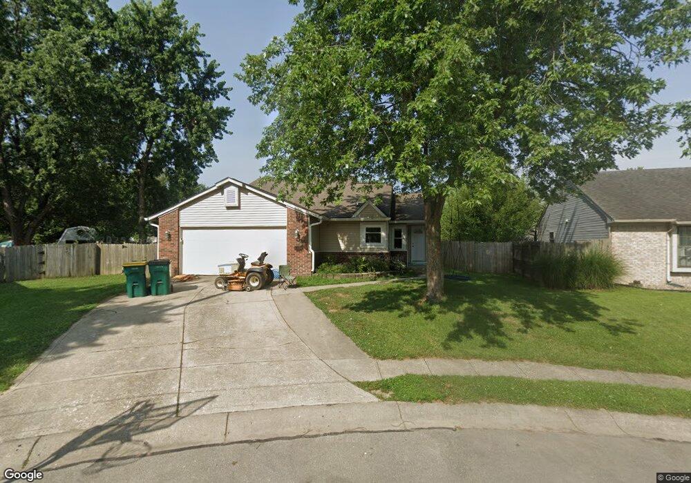
3972 Leslie Ct Franklin, IN 46131
Estimated Value: $221,000 - $255,000
3
Beds
2
Baths
1,180
Sq Ft
$199/Sq Ft
Est. Value
About This Home
This home is located at 3972 Leslie Ct, Franklin, IN 46131 and is currently estimated at $234,254, approximately $198 per square foot. 3972 Leslie Ct is a home located in Johnson County with nearby schools including Creekside Elementary School, Franklin Community Middle School, and Custer Baker Intermediate School.
Ownership History
Date
Name
Owned For
Owner Type
Purchase Details
Closed on
Apr 28, 2023
Sold by
John And Carolin Peterson Trust
Bought by
Foster Dylan
Current Estimated Value
Home Financials for this Owner
Home Financials are based on the most recent Mortgage that was taken out on this home.
Original Mortgage
$193,935
Outstanding Balance
$188,138
Interest Rate
5.99%
Mortgage Type
FHA
Estimated Equity
$46,116
Purchase Details
Closed on
Feb 12, 2013
Sold by
Peterson John E and Peterson Carolin A
Bought by
Peterson John and Peterson Carolin
Create a Home Valuation Report for This Property
The Home Valuation Report is an in-depth analysis detailing your home's value as well as a comparison with similar homes in the area
Home Values in the Area
Average Home Value in this Area
Purchase History
| Date | Buyer | Sale Price | Title Company |
|---|---|---|---|
| Foster Dylan | $200,000 | None Listed On Document | |
| Peterson John | -- | None Available |
Source: Public Records
Mortgage History
| Date | Status | Borrower | Loan Amount |
|---|---|---|---|
| Open | Foster Dylan | $193,935 |
Source: Public Records
Tax History
| Year | Tax Paid | Tax Assessment Tax Assessment Total Assessment is a certain percentage of the fair market value that is determined by local assessors to be the total taxable value of land and additions on the property. | Land | Improvement |
|---|---|---|---|---|
| 2025 | $2,211 | $220,000 | $32,000 | $188,000 |
| 2024 | $2,211 | $200,800 | $32,000 | $168,800 |
| 2023 | $2,066 | $187,700 | $32,000 | $155,700 |
| 2022 | $3,372 | $151,200 | $28,200 | $123,000 |
| 2021 | $2,569 | $115,200 | $28,200 | $87,000 |
| 2020 | $2,569 | $115,200 | $28,200 | $87,000 |
| 2019 | $2,569 | $115,200 | $10,000 | $105,200 |
| 2018 | $1,920 | $96,000 | $10,000 | $86,000 |
| 2017 | $1,930 | $96,000 | $10,000 | $86,000 |
| 2016 | $1,806 | $96,000 | $10,000 | $86,000 |
| 2014 | $1,806 | $90,300 | $16,000 | $74,300 |
| 2013 | $1,806 | $90,000 | $15,700 | $74,300 |
Source: Public Records
Map
Nearby Homes
- 3820 Jason Ave
- 4019 Magnolia Dr
- 1515 Cottonwood Dr
- 4058 Knollwood Ave
- 3704 Jason Ave
- 3643 Hanford Rd
- 3723 Hanford Rd
- 1534 Pine Cir
- 3771 Jason Ave
- 3667 Hanford Rd
- 0 Us 31 Unit MBR22038423
- Broadmoor Plan at Kingsbridge - SM Venture
- Alan Plan at Kingsbridge - SM Venture
- Paddington Plan at Kingsbridge - 3-Car Venture
- Kingston Plan at Kingsbridge - Venture
- Aspen Plan at Kingsbridge - SM Venture
- Hampshire Plan at Kingsbridge - Venture
- Jasper Plan at Kingsbridge - 3-Car Venture
- Alan Plan at Kingsbridge - Venture
- Wentworth Plan at Kingsbridge - 3-Car Venture
- 3966 Leslie Ct
- 3978 Leslie Ct
- 3973 Jason Ave
- 3967 Jason Ave
- 3979 Jason Ave
- 3984 Leslie Ct
- 3961 Jason Ave
- 3965 Leslie Ct
- 1472 Scarlet Ct
- 3985 Jason Ave
- 3971 Leslie Ct
- 3977 Leslie Ct
- 3959 Jason Ave
- 3990 Leslie Ct
- 1478 Scarlet Ct
- 3983 Leslie Ct
- 1464 Scarlet Ct
- 3991 Jason Ave
- 1478 Scarlett Ct
- 3974 Jason Ave