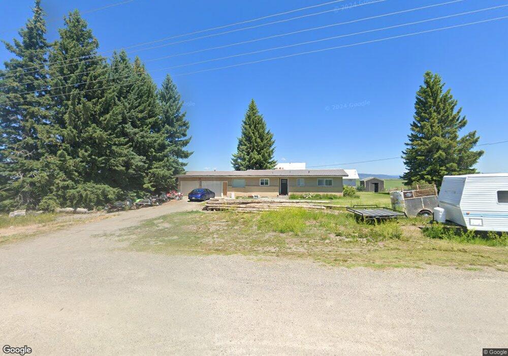
3973 Highway 32 Ashton, ID 83420
Estimated Value: $452,919 - $886,000
2
Beds
2
Baths
2,245
Sq Ft
$274/Sq Ft
Est. Value
About This Home
This home is located at 3973 Highway 32, Ashton, ID 83420 and is currently estimated at $614,480, approximately $273 per square foot. 3973 Highway 32 is a home located in Fremont County with nearby schools including Ashton Elementary School and North Fremont Junior/Senior High School.
Ownership History
Date
Name
Owned For
Owner Type
Purchase Details
Closed on
Oct 30, 2019
Sold by
Rigby Jake R and Rigby Karie J
Bought by
Rigby Karie and Rigby Jacob R
Current Estimated Value
Home Financials for this Owner
Home Financials are based on the most recent Mortgage that was taken out on this home.
Original Mortgage
$220,000
Outstanding Balance
$193,927
Interest Rate
3.7%
Mortgage Type
New Conventional
Estimated Equity
$420,553
Purchase Details
Closed on
Oct 1, 2009
Sold by
Pehrson Roger R and Pehrson Kathleen J
Bought by
Rigby Jake R and Rigby Karie J
Home Financials for this Owner
Home Financials are based on the most recent Mortgage that was taken out on this home.
Original Mortgage
$152,192
Interest Rate
5%
Mortgage Type
FHA
Create a Home Valuation Report for This Property
The Home Valuation Report is an in-depth analysis detailing your home's value as well as a comparison with similar homes in the area
Home Values in the Area
Average Home Value in this Area
Purchase History
| Date | Buyer | Sale Price | Title Company |
|---|---|---|---|
| Rigby Karie | -- | Alliance Ttl Rexburg Office | |
| Rigby Jake R | -- | -- |
Source: Public Records
Mortgage History
| Date | Status | Borrower | Loan Amount |
|---|---|---|---|
| Open | Rigby Karie | $220,000 | |
| Closed | Rigby Jake R | $152,192 |
Source: Public Records
Tax History Compared to Growth
Tax History
| Year | Tax Paid | Tax Assessment Tax Assessment Total Assessment is a certain percentage of the fair market value that is determined by local assessors to be the total taxable value of land and additions on the property. | Land | Improvement |
|---|---|---|---|---|
| 2025 | $1,486 | $250,887 | $41,900 | $208,987 |
| 2024 | $1,486 | $245,216 | $41,900 | $203,316 |
| 2023 | $1,437 | $245,216 | $41,900 | $203,316 |
| 2022 | $1,770 | $205,785 | $31,900 | $173,885 |
| 2021 | $1,886 | $170,689 | $23,175 | $147,514 |
| 2020 | $1,911 | $162,183 | $23,175 | $139,008 |
| 2019 | $1,854 | $161,071 | $21,063 | $140,008 |
| 2018 | $1,940 | $158,803 | $21,063 | $137,740 |
| 2017 | $22 | $156,502 | $20,431 | $136,071 |
| 2016 | $2,185 | $156,502 | $20,431 | $136,071 |
| 2015 | $2,338 | $217,188 | $0 | $0 |
| 2014 | $1,559 | $156,502 | $0 | $0 |
| 2013 | $1,559 | $156,502 | $0 | $0 |
Source: Public Records
Map
Nearby Homes
- TBD Hwy 32
- L2 BLK 2 Ice Tong Ln
- L5 BLK 2 Ice Tong Ln
- 3944 Schaefer Ln
- 3938 Schaefer Ln
- 951 N 3600 E
- 3887 Schaefer Ln
- 3660 E 1100 N
- 3537 Fall River Rd
- TBD 84AC E 1200 Rd N
- TBD 113AC E 1200 Rd N
- TBD E 900 N
- 3706 E 1300 Rd N
- 3541 850 N
- 950 N 3400 E
- 3660 E 1312 N
- 1331 N 3687 E
- TBD Annies Landing
- 268 10th St
- TBD N 4600 E
- 3973 Highway 32
- 3949 Highway 32
- 3949 Idaho 32
- 852 Market Way
- 863 Market Way
- 44.67 AC Market Way
- 3933 Highway 32
- 4008 Wheat Ridge Dr
- n/a Wheat Ridge Dr
- TBD 3600 E
- 3908 Highway 32
- 4011 Wheat Ridge Dr
- 3903 Highway 32
- 4023 Wheat Ridge Dr
- 4006 Brookside Ln
- 4018 Brookside Ln
- 4018 Brookside Dr
- 15.62 AC Market Way
- 40 AC Market Way
- 877 Market Way