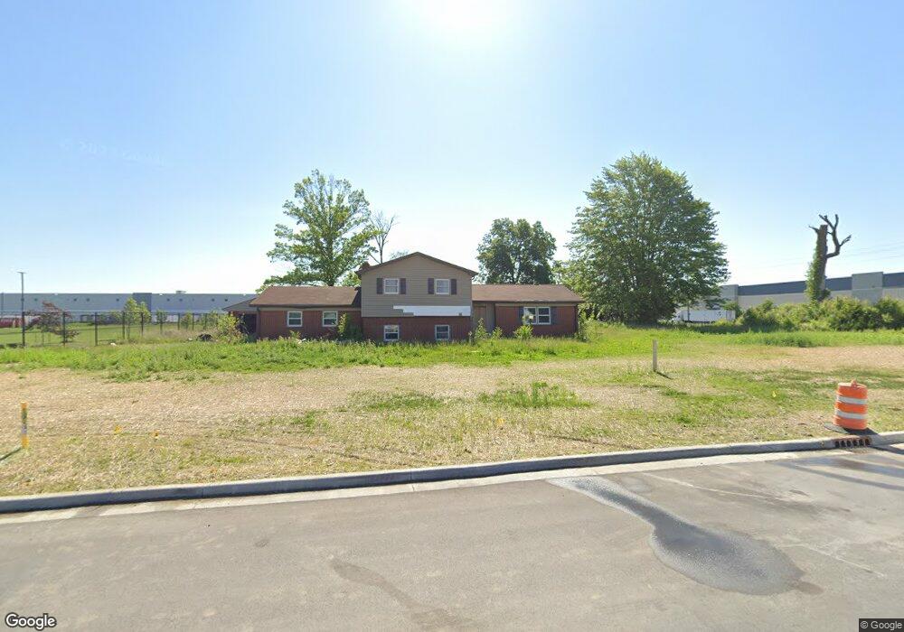
3973 S 450 E Whitestown, IN 46075
Estimated Value: $388,000
4
Beds
3
Baths
2,186
Sq Ft
$177/Sq Ft
Est. Value
About This Home
This home is located at 3973 S 450 E, Whitestown, IN 46075 and is currently priced at $388,000, approximately $177 per square foot. 3973 S 450 E is a home located in Boone County with nearby schools including Perry Worth Elementary School, Lebanon Middle School, and Lebanon Senior High School.
Ownership History
Date
Name
Owned For
Owner Type
Purchase Details
Closed on
Apr 20, 2011
Sold by
Pryor Ricky L and Pryor Shari L
Bought by
Pollard Ii Frank W and Pollard Janet
Current Estimated Value
Home Financials for this Owner
Home Financials are based on the most recent Mortgage that was taken out on this home.
Original Mortgage
$164,715
Outstanding Balance
$114,327
Interest Rate
4.93%
Mortgage Type
FHA
Create a Home Valuation Report for This Property
The Home Valuation Report is an in-depth analysis detailing your home's value as well as a comparison with similar homes in the area
Home Values in the Area
Average Home Value in this Area
Purchase History
| Date | Buyer | Sale Price | Title Company |
|---|---|---|---|
| Pollard Ii Frank W | -- | -- |
Source: Public Records
Mortgage History
| Date | Status | Borrower | Loan Amount |
|---|---|---|---|
| Open | Pollard Ii Frank W | $164,715 |
Source: Public Records
Tax History Compared to Growth
Tax History
| Year | Tax Paid | Tax Assessment Tax Assessment Total Assessment is a certain percentage of the fair market value that is determined by local assessors to be the total taxable value of land and additions on the property. | Land | Improvement |
|---|---|---|---|---|
| 2021 | $4,117 | $235,000 | $35,000 | $200,000 |
| 2020 | $1,996 | $213,900 | $35,000 | $178,900 |
| 2019 | $1,718 | $205,300 | $35,000 | $170,300 |
| 2018 | $1,984 | $209,200 | $35,000 | $174,200 |
| 2017 | $1,926 | $208,600 | $35,000 | $173,600 |
| 2016 | $1,573 | $194,100 | $35,000 | $159,100 |
| 2014 | $1,594 | $177,600 | $35,400 | $142,200 |
| 2013 | $1,508 | $177,600 | $35,400 | $142,200 |
Source: Public Records
Map
Nearby Homes
- 3550 Sugar Grove Dr
- 3575 Sugar Grove Dr
- 3610 Duncan Ct
- 5708 Harper Dr
- Roxbury II Plan at Peabody Farms West - Peabody Farms West Cottage
- Ironwood Plan at Peabody Farms West - Peabody Farms West Venture
- Trenton II Plan at Peabody Farms West - Peabody Farms West Cottage
- Broadmoor Plan at Peabody Farms West - Peabody Farms West Venture
- 2543 Lamar Dr
- 3922 Sterling Dr
- 5925 Sterling Dr
- 3902 Riverstone Dr
- 3070 S 575 E
- 3784 Dusty Sands Rd
- 3421 Firethorn Dr
- 5764 Bluff View Ln
- 3743 Indigo Blue Blvd
- 3460 Limelight Ln
- 3391 Roundlake Ln
- 6091 Green Willow Rd
- 3991 S 450 E
- 3947 S 450 E
- 3925 S 450 E
- 3961 S 450 E
- 3879 S 450 E
- 4321 E 400 S
- 4275 Albert S White Dr
- 4245 Albert S White Dr
- 3659 S 450 E
- 3527 S 450 E
- 3500+- 450 E
- 0 S 450 E Unit MBR2236247
- 0 S 450 E Unit MBR2212141
- 0 S 450 E Unit MBR2208357
- 3473 S 450 E
- 3444 S 450 E
- 3811 S 500 E
- 4102 Indiana 267
- 670 Indiana 267
- 7100 Indiana 267