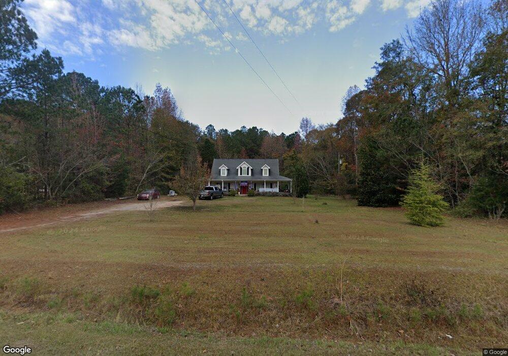
3974 Bartley Rd West Point, GA 31833
Estimated Value: $266,000 - $327,000
4
Beds
3
Baths
2,022
Sq Ft
$142/Sq Ft
Est. Value
About This Home
This home is located at 3974 Bartley Rd, West Point, GA 31833 and is currently estimated at $286,367, approximately $141 per square foot. 3974 Bartley Rd is a home located in Troup County with nearby schools including West Point Elementary School, Long Cane Elementary School, and Whitesville Road Elementary School.
Ownership History
Date
Name
Owned For
Owner Type
Purchase Details
Closed on
Jul 10, 2009
Sold by
Secretary Of Housing
Bought by
Fuller Jennifer S
Current Estimated Value
Home Financials for this Owner
Home Financials are based on the most recent Mortgage that was taken out on this home.
Original Mortgage
$96,000
Outstanding Balance
$62,584
Interest Rate
5.53%
Mortgage Type
New Conventional
Estimated Equity
$223,783
Purchase Details
Closed on
Nov 17, 2004
Sold by
Mccllum Michael
Bought by
Forbus Joshua and Forbus Martha L
Purchase Details
Closed on
Feb 20, 2004
Bought by
Mccllum Michael
Create a Home Valuation Report for This Property
The Home Valuation Report is an in-depth analysis detailing your home's value as well as a comparison with similar homes in the area
Home Values in the Area
Average Home Value in this Area
Purchase History
| Date | Buyer | Sale Price | Title Company |
|---|---|---|---|
| Fuller Jennifer S | $120,000 | -- | |
| Fuller Jennifer S | $120,000 | -- | |
| Forbus Joshua | $15,000 | -- | |
| Mccllum Michael | -- | -- |
Source: Public Records
Mortgage History
| Date | Status | Borrower | Loan Amount |
|---|---|---|---|
| Open | Fuller Jennifer S | $96,000 | |
| Closed | Fuller Jennifer S | $96,000 |
Source: Public Records
Tax History
| Year | Tax Paid | Tax Assessment Tax Assessment Total Assessment is a certain percentage of the fair market value that is determined by local assessors to be the total taxable value of land and additions on the property. | Land | Improvement |
|---|---|---|---|---|
| 2025 | $2,510 | $92,040 | $5,000 | $87,040 |
| 2024 | $2,241 | $82,160 | $5,000 | $77,160 |
| 2023 | $2,228 | $81,680 | $5,000 | $76,680 |
| 2022 | $2,108 | $75,520 | $5,000 | $70,520 |
| 2021 | $1,825 | $60,520 | $4,240 | $56,280 |
| 2020 | $1,825 | $60,520 | $4,240 | $56,280 |
| 2019 | $1,683 | $55,800 | $4,000 | $51,800 |
| 2018 | $1,541 | $51,080 | $4,000 | $47,080 |
| 2017 | $1,541 | $51,080 | $4,000 | $47,080 |
| 2016 | $1,514 | $50,208 | $4,000 | $46,208 |
| 2015 | $1,517 | $50,208 | $4,000 | $46,208 |
| 2014 | $1,446 | $47,776 | $4,000 | $43,776 |
| 2013 | -- | $50,803 | $4,000 | $46,803 |
Source: Public Records
Map
Nearby Homes
- 107 Amhurst Dr
- 101 Garden Walk
- 4172 Bartley Rd
- 648 Warner Rd
- 0 Warner Rd Unit 10686116
- 209 Harris Walk
- 211 Harris Walk
- 215 Harris Walk
- 223 Harris Walk
- 225 Harris Walk
- 221 Harris Walk
- 0 Johns Rd Unit 10615130
- 0 Sandtown Rd Unit 10255987
- Sandtown Road Unit: 1 2+ - Acre
- 1015 Adams Rd
- 0 Cannonville Rd
- 0 Lambert Rd
- 143 W Drummond Rd
- 151 W Drummond Rd
- 157 W Drummond Rd
- 3954 Bartley Rd
- 3978 Bartley Rd
- 3968 Bartley Rd
- 4008 Bartley Rd
- 3973 Bartley Rd
- 4040 Bartley Rd
- 3873 Bartley Rd
- 103 Amhurst Dr
- 105 Amhurst Dr
- 3850 Bartley Rd
- 4078 Bartley Rd
- 106 Amhurst Dr
- 109 Amhurst Dr Unit LOT 7
- 109 Amhurst Dr
- 108 Amhurst Dr
- 3885 Bartley Rd
- 111 Amhurst Dr Unit LOT 8
- 111 Amhurst Dr
- 110 Amhurst Dr
- 3817 Bartley Rd
Your Personal Tour Guide
Ask me questions while you tour the home.