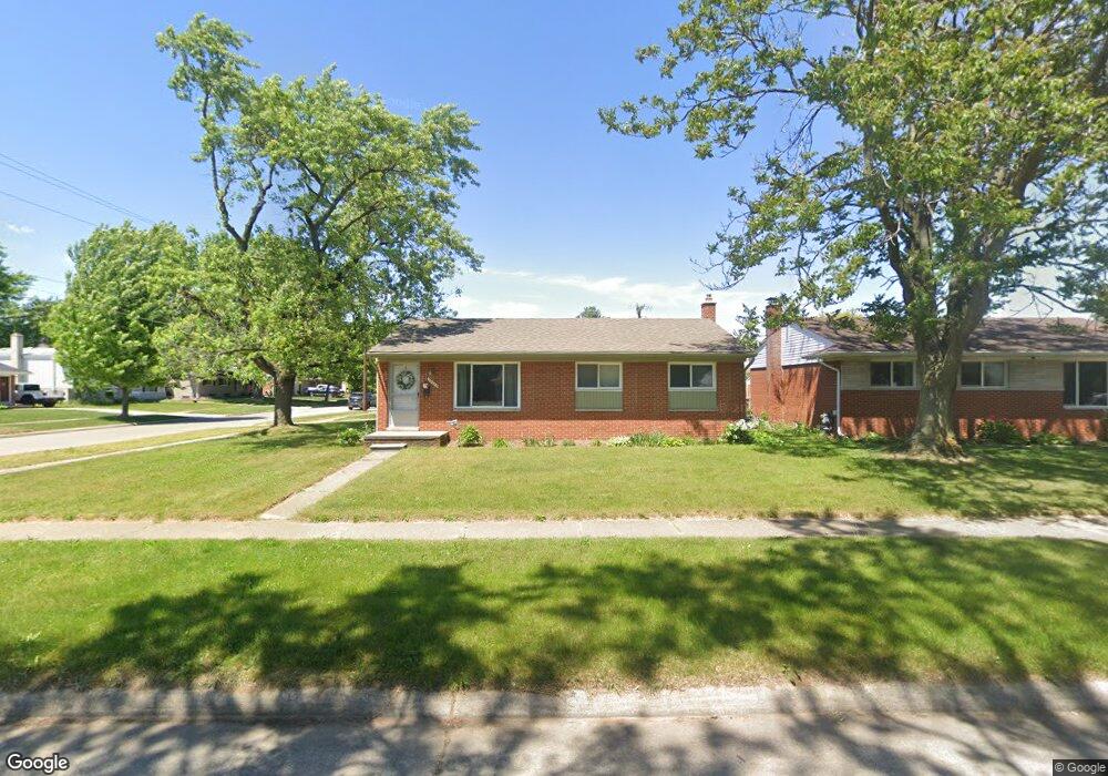
39774 Bart St Canton, MI 48187
Estimated Value: $300,000 - $325,000
About This Home
This home is located at 39774 Bart St, Canton, MI 48187 and is currently estimated at $309,848, approximately $253 per square foot. 39774 Bart St is a home located in Wayne County with nearby schools including Canton High School, East Middle School, and Salem High School.
Ownership History
We collect this data history from publicly available records. To have your information removed, we recommend requesting removal directly through your county’s website.
Purchase Details
Purchase Details
Home Financials for this Owner
Home Financials are based on the most recent Mortgage that was taken out on this home.Home Values in the Area
Average Home Value in this Area
Purchase History
We collect this data history from publicly available records. To have your information removed, we recommend requesting removal directly through your county’s website.
| Date | Buyer | Sale Price | Title Company |
|---|---|---|---|
| $118,150 | None Available | ||
| -- | Vanguard Title |
Mortgage History
We collect this data history from publicly available records. To have your information removed, we recommend requesting removal directly through your county’s website.
| Date | Status | Borrower | Loan Amount |
|---|---|---|---|
| Previous Owner | $157,250 |
Tax History
We collect this data history from publicly available records. To have your information removed, we recommend requesting removal directly through your county’s website.
| Year | Tax Paid | Tax Assessment Tax Assessment Total Assessment is a certain percentage of the fair market value that is determined by local assessors to be the total taxable value of land and additions on the property. | Land | Improvement |
|---|---|---|---|---|
| 2025 | $1,311 | $140,800 | $0 | $0 |
| 2024 | $1,274 | $124,800 | $0 | $0 |
| 2023 | $1,214 | $114,400 | $0 | $0 |
| 2022 | $2,730 | $103,600 | $0 | $0 |
| 2021 | $2,648 | $94,700 | $0 | $0 |
| 2020 | $2,615 | $91,100 | $0 | $0 |
| 2019 | $2,568 | $78,370 | $0 | $0 |
| 2018 | $1,032 | $74,980 | $0 | $0 |
| 2017 | $2,679 | $72,100 | $0 | $0 |
| 2016 | $2,341 | $69,400 | $0 | $0 |
| 2015 | $5,671 | $62,550 | $0 | $0 |
| 2013 | $5,501 | $57,170 | $0 | $0 |
| 2010 | -- | $62,260 | $32,852 | $29,408 |
Map
- 8485 Forrest Dr
- 8364 Holly Dr
- 39340 Armstrong Ln Unit 27
- 40344 Newport Dr
- 40318 Newport Dr
- 40504 Newport Dr
- 40524 Newport Dr
- 39770 Hillary Dr
- 40526 Newport Dr Unit 99
- 40592 Newport Dr Unit 125
- 38924 Dover St
- 40605 Newport Dr Unit 294
- 9310 Oakcliffe Dr
- 40815 Newport Dr Unit 237
- 38561 Belliveau St
- 38750 Grandon St
- 39857 John Dr
- 9498 Bassett St
- 9817 Eckles Rd
- 9292 Liberty Ct
Ask me questions while you tour the home.