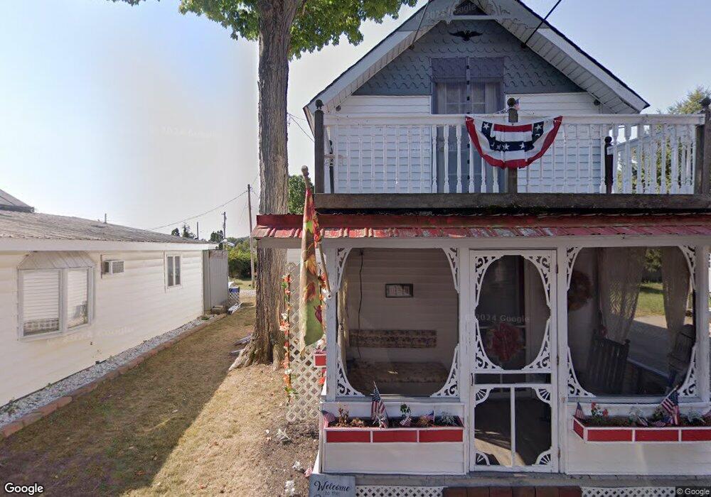
398 4th St Lancaster, OH 43130
Estimated Value: $70,072 - $92,000
3
Beds
1
Bath
653
Sq Ft
$125/Sq Ft
Est. Value
About This Home
This home is located at 398 4th St, Lancaster, OH 43130 and is currently estimated at $81,357, approximately $124 per square foot. 398 4th St is a home with nearby schools including General Sherman Junior High School, Lancaster High School, and St Mary Elementary School.
Ownership History
Date
Name
Owned For
Owner Type
Purchase Details
Closed on
Jul 28, 2016
Sold by
Davis Michael
Bought by
Earl Cornutte and Nancy Cornutte
Current Estimated Value
Home Financials for this Owner
Home Financials are based on the most recent Mortgage that was taken out on this home.
Interest Rate
3.48%
Purchase Details
Closed on
Oct 22, 2014
Sold by
Ground Lancaster Camp
Bought by
Davis Michael and Davis Michele
Purchase Details
Closed on
Oct 21, 2009
Sold by
Davis Amber
Bought by
Davis Lorna G
Create a Home Valuation Report for This Property
The Home Valuation Report is an in-depth analysis detailing your home's value as well as a comparison with similar homes in the area
Home Values in the Area
Average Home Value in this Area
Purchase History
| Date | Buyer | Sale Price | Title Company |
|---|---|---|---|
| Earl Cornutte | $29,500 | -- | |
| Davis Michael | -- | Attorney | |
| Davis Lorna G | -- | None Available |
Source: Public Records
Mortgage History
| Date | Status | Borrower | Loan Amount |
|---|---|---|---|
| Closed | Earl Cornutte | -- |
Source: Public Records
Tax History
| Year | Tax Paid | Tax Assessment Tax Assessment Total Assessment is a certain percentage of the fair market value that is determined by local assessors to be the total taxable value of land and additions on the property. | Land | Improvement |
|---|---|---|---|---|
| 2025 | $640 | $10,830 | -- | $10,830 |
| 2024 | $640 | $7,120 | -- | $7,120 |
| 2023 | $265 | $7,120 | -- | $7,120 |
| 2022 | $266 | $7,120 | $0 | $7,120 |
| 2021 | $227 | $5,700 | $0 | $5,700 |
| 2020 | $229 | $5,700 | $0 | $5,700 |
| 2019 | $208 | $5,700 | $0 | $5,700 |
| 2018 | $182 | $4,740 | $0 | $4,740 |
| 2017 | $182 | $4,740 | $0 | $4,740 |
| 2016 | $173 | $4,740 | $0 | $4,740 |
| 2015 | $170 | $4,530 | $0 | $4,530 |
| 2014 | $167 | $4,530 | $0 | $4,530 |
| 2013 | $167 | $4,530 | $0 | $4,530 |
Source: Public Records
Map
Nearby Homes
Your Personal Tour Guide
Ask me questions while you tour the home.