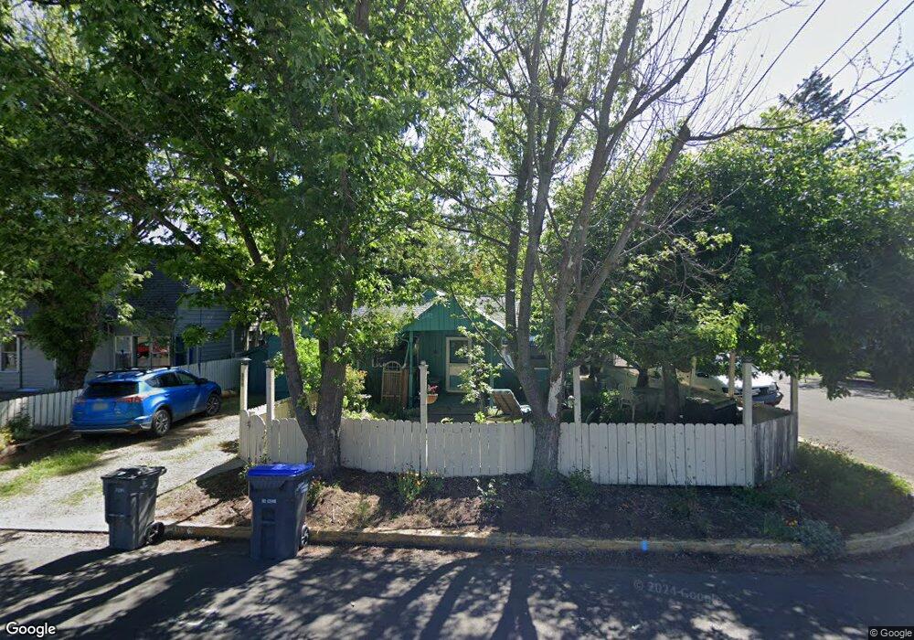
398 Bridge St Ashland, OR 97520
Central Ashland NeighborhoodEstimated Value: $505,353 - $556,000
4
Beds
2
Baths
1,998
Sq Ft
$262/Sq Ft
Est. Value
About This Home
This home is located at 398 Bridge St, Ashland, OR 97520 and is currently estimated at $522,838, approximately $261 per square foot. 398 Bridge St is a home located in Jackson County with nearby schools including Walker Elementary School, Ashland Middle School, and Ashland High School.
Ownership History
Date
Name
Owned For
Owner Type
Purchase Details
Closed on
Sep 26, 2013
Sold by
Gandesbery Peter M and Lehman Kara
Bought by
Gandersbery Peter and Gandersbery Kara
Current Estimated Value
Purchase Details
Closed on
Feb 5, 2003
Sold by
Harrell Joelle L
Bought by
Gandesbery Peter M and Lehman Kara
Purchase Details
Closed on
Jun 8, 2001
Sold by
Cox Bradley Paul
Bought by
Hariell Joelle L
Purchase Details
Closed on
Feb 23, 1999
Sold by
The Bank Of New York
Bought by
Cox Bradley P
Home Financials for this Owner
Home Financials are based on the most recent Mortgage that was taken out on this home.
Original Mortgage
$112,500
Interest Rate
6.78%
Purchase Details
Closed on
Sep 10, 1998
Sold by
Rhoades Michael J and Rhoades Lin L
Bought by
Master Servicer and Bank Of New York
Create a Home Valuation Report for This Property
The Home Valuation Report is an in-depth analysis detailing your home's value as well as a comparison with similar homes in the area
Home Values in the Area
Average Home Value in this Area
Purchase History
| Date | Buyer | Sale Price | Title Company |
|---|---|---|---|
| Gandersbery Peter | -- | None Available | |
| Gandesbery Peter M | $249,000 | First American | |
| Hariell Joelle L | $5,000 | -- | |
| Cox Bradley P | $116,000 | Crater Title Insurance | |
| Master Servicer | $112,000 | Key Title Company |
Source: Public Records
Mortgage History
| Date | Status | Borrower | Loan Amount |
|---|---|---|---|
| Previous Owner | Cox Bradley P | $112,500 |
Source: Public Records
Tax History Compared to Growth
Tax History
| Year | Tax Paid | Tax Assessment Tax Assessment Total Assessment is a certain percentage of the fair market value that is determined by local assessors to be the total taxable value of land and additions on the property. | Land | Improvement |
|---|---|---|---|---|
| 2025 | $4,182 | $269,750 | $166,750 | $103,000 |
| 2024 | $4,182 | $261,900 | $161,880 | $100,020 |
| 2023 | $4,046 | $254,280 | $157,170 | $97,110 |
| 2022 | $3,916 | $254,280 | $157,170 | $97,110 |
| 2021 | $3,783 | $246,880 | $152,600 | $94,280 |
| 2020 | $3,677 | $239,690 | $148,160 | $91,530 |
| 2019 | $3,619 | $225,940 | $139,670 | $86,270 |
| 2018 | $3,419 | $219,360 | $135,600 | $83,760 |
| 2017 | $3,394 | $219,360 | $135,600 | $83,760 |
| 2016 | $3,305 | $206,780 | $127,830 | $78,950 |
| 2015 | $3,178 | $206,780 | $127,830 | $78,950 |
| 2014 | $3,062 | $194,920 | $120,500 | $74,420 |
Source: Public Records
Map
Nearby Homes
- 0 Oregon 66 Unit 220203024
- 1372 Iowa St
- 303 Palm Ave
- 1245 Iowa St Unit 7
- 3727 Siskiyou Blvd
- 128 S Mountain Ave
- 496 Beach St
- 704 Elkader St
- 32 Lincoln St
- 2082 E Main St
- 759 S Mountain Ave
- 753 Siskiyou Blvd
- 1040 E Main St
- 620 Ray Ln
- 605 Liberty St
- 211 Normal Ave
- 811 Iowa St
- 770 Iowa St
- 681 Liberty St
- 124 Morton St