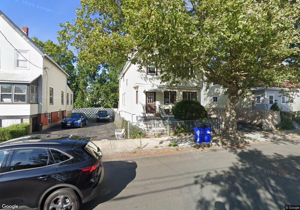
398 Bryant St Unit 1 Malden, MA 02148
Suffolk Square NeighborhoodEstimated Value: $739,806 - $1,084,000
2
Beds
1
Bath
850
Sq Ft
$1,078/Sq Ft
Est. Value
About This Home
This home is located at 398 Bryant St Unit 1, Malden, MA 02148 and is currently estimated at $916,452, approximately $1,078 per square foot. 398 Bryant St Unit 1 is a home located in Middlesex County with nearby schools including Malden High School, Cheverus Catholic School, and Malden Catholic.
Ownership History
Date
Name
Owned For
Owner Type
Purchase Details
Closed on
Jul 31, 2018
Sold by
Daveiga Betty S
Bought by
Chang Ft
Current Estimated Value
Purchase Details
Closed on
Oct 11, 2016
Sold by
Daveiga Raul R
Bought by
Daveiga Betty S
Purchase Details
Closed on
Aug 1, 1983
Bought by
Daveiga Paul R and Daveiga Betty S
Create a Home Valuation Report for This Property
The Home Valuation Report is an in-depth analysis detailing your home's value as well as a comparison with similar homes in the area
Home Values in the Area
Average Home Value in this Area
Purchase History
| Date | Buyer | Sale Price | Title Company |
|---|---|---|---|
| Chang Ft | $638,000 | -- | |
| Daveiga Betty S | -- | -- | |
| Daveiga Paul R | $76,500 | -- |
Source: Public Records
Mortgage History
| Date | Status | Borrower | Loan Amount |
|---|---|---|---|
| Previous Owner | Daveiga Paul R | $69,000 | |
| Previous Owner | Daveiga Paul R | $20,000 |
Source: Public Records
Tax History Compared to Growth
Tax History
| Year | Tax Paid | Tax Assessment Tax Assessment Total Assessment is a certain percentage of the fair market value that is determined by local assessors to be the total taxable value of land and additions on the property. | Land | Improvement |
|---|---|---|---|---|
| 2025 | $74 | $653,000 | $256,600 | $396,400 |
| 2024 | $7,155 | $612,100 | $240,600 | $371,500 |
| 2023 | $6,879 | $564,300 | $216,500 | $347,800 |
| 2022 | $6,780 | $549,000 | $212,500 | $336,500 |
| 2021 | $6,426 | $522,900 | $186,400 | $336,500 |
| 2020 | $6,195 | $489,700 | $176,800 | $312,900 |
| 2019 | $6,067 | $457,200 | $168,400 | $288,800 |
| 2018 | $5,735 | $407,000 | $134,300 | $272,700 |
| 2017 | $5,583 | $394,000 | $134,300 | $259,700 |
| 2016 | $5,239 | $345,600 | $134,300 | $211,300 |
| 2015 | $5,081 | $323,000 | $127,900 | $195,100 |
| 2014 | $4,778 | $296,800 | $116,300 | $180,500 |
Source: Public Records
Map
Nearby Homes
- 272-274 Cross St Unit 1
- 272-274 Cross St Unit 4
- 272-274 Cross St Unit 3
- 272-274 Cross St Unit 5
- 272-274 Cross St Unit 2
- 17 Ashton St
- 16 Boylston St
- 13-15 Benner Ave
- 40-42 Upham St Unit 1
- 10 Linwood St Unit 214
- 859 Broadway Unit 15
- 33 Lodgen Ct Unit 4G
- 30 Franklin St Unit 105
- 378 Ferry St
- 45 Richardson St
- 18 Lynn St
- 40 Wilbur St
- 98 Walnut St
- 40 Gledhill Ave
- 17 Garland Ave
- 398 Bryant St
- 404 Bryant St
- 404 Bryant St Unit 2
- 392 Bryant St
- 412 Bryant St Unit 2
- 412 Bryant St Unit 1
- 395 Bryant St
- 73 Suffolk St
- 69 Suffolk St
- 77 Suffolk St
- 77 Suffolk St Unit 2
- 409 Bryant St
- 387 Bryant St
- 133 Harvard St Unit 2
- 133 Harvard St Unit 1
- 133 Harvard St
- 194 Essex St
- 85 Suffolk St
- 152 Harvard St
- 158 Harvard St