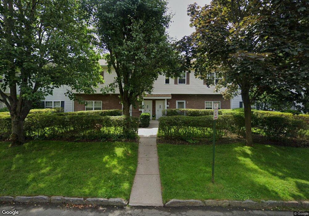
398 Cortland Ave Unit 5 Mamaroneck, NY 10543
Estimated Value: $483,659 - $617,000
2
Beds
2
Baths
1,054
Sq Ft
$510/Sq Ft
Est. Value
About This Home
This home is located at 398 Cortland Ave Unit 5, Mamaroneck, NY 10543 and is currently estimated at $537,415, approximately $509 per square foot. 398 Cortland Ave Unit 5 is a home located in Westchester County with nearby schools including Mamaroneck High School, French-American School of New York, and Westchester Day School.
Ownership History
Date
Name
Owned For
Owner Type
Purchase Details
Closed on
Jun 26, 2015
Sold by
Carroll Roger C and Carroll Martine D
Bought by
Burger David M and Spoonauer Michael
Current Estimated Value
Home Financials for this Owner
Home Financials are based on the most recent Mortgage that was taken out on this home.
Original Mortgage
$396,000
Outstanding Balance
$308,885
Interest Rate
3.87%
Mortgage Type
Commercial
Estimated Equity
$228,530
Purchase Details
Closed on
Jun 30, 2010
Sold by
Cahn Karen L
Bought by
Carroll Roger C and Carroll Martine D
Home Financials for this Owner
Home Financials are based on the most recent Mortgage that was taken out on this home.
Original Mortgage
$285,000
Interest Rate
4%
Mortgage Type
Commercial
Create a Home Valuation Report for This Property
The Home Valuation Report is an in-depth analysis detailing your home's value as well as a comparison with similar homes in the area
Home Values in the Area
Average Home Value in this Area
Purchase History
| Date | Buyer | Sale Price | Title Company |
|---|---|---|---|
| Burger David M | $440,000 | New York Title | |
| Carroll Roger C | $380,000 | Benchmark Title |
Source: Public Records
Mortgage History
| Date | Status | Borrower | Loan Amount |
|---|---|---|---|
| Open | Burger David M | $396,000 | |
| Previous Owner | Carroll Roger C | $285,000 |
Source: Public Records
Tax History Compared to Growth
Tax History
| Year | Tax Paid | Tax Assessment Tax Assessment Total Assessment is a certain percentage of the fair market value that is determined by local assessors to be the total taxable value of land and additions on the property. | Land | Improvement |
|---|---|---|---|---|
| 2024 | $4,539 | $198,800 | $106,600 | $92,200 |
| 2023 | $3,524 | $198,800 | $106,600 | $92,200 |
| 2022 | $2,645 | $198,800 | $106,600 | $92,200 |
| 2021 | $3,933 | $198,800 | $106,600 | $92,200 |
| 2020 | $3,877 | $198,800 | $106,600 | $92,200 |
| 2019 | $3,740 | $198,800 | $106,600 | $92,200 |
| 2018 | $3,698 | $198,800 | $106,600 | $92,200 |
| 2017 | $0 | $198,800 | $106,600 | $92,200 |
| 2016 | $2,358 | $198,800 | $106,600 | $92,200 |
| 2015 | -- | $198,800 | $106,600 | $92,200 |
| 2014 | -- | $198,800 | $106,600 | $92,200 |
| 2013 | -- | $198,800 | $106,600 | $92,200 |
Source: Public Records
Map
Nearby Homes
- 314 Livingston Ave Unit 101 E
- 300 Livingston Ave Unit 2D
- 304 Fenimore Rd Unit 7A
- 225 Stanley Ave Unit 119
- 400 Mount Pleasant Ave Unit 3-J
- 315 Palmer Terrace Unit 1D
- 325 Palmer Terrace Unit 2C
- 703 Palmer Ct Unit 2A
- 651 Plaza Ave
- 505 Rockland Ave
- 572 van Ranst Place
- 953 W Boston Post Rd Unit 3G
- 1015 Old Post Rd Unit MM
- 1015 Old Post Rd Unit 3N
- 101 Sheldrake Place Unit 101-10
- 101 Sheldrake Place Unit 14
- 207 Grand St
- 907 Palmer Ave Unit H1
- 604 Tompkins Ave Unit C1
- 604 Tompkins Ave Unit B-2
- 398 Cortlandt Ave Unit 8
- 398 Cortlandt Ave Unit 5
- 398 Cortlandt Ave Unit 6
- 398 Cortlandt Ave
- 398 Cortlandt Ave Unit 7
- 398 Cortland Ave Unit 8
- 398 Cortland Ave Unit 7
- 398 Cortland Ave Unit 6
- 398 Cortland Ave Unit 4
- 398 Cortland Ave Unit 3
- 398 Cortland Ave Unit 2
- 398 Cortland Ave Unit 1
- 131 Fenimore Rd
- 147 Fenimore Rd
- 147 Fenimore Rd Unit A
- 145 Fenimore Rd
- 145 Fenimore Rd Unit A
- 143 Fenimore Rd
- 143 Fenimore Rd Unit B
- 141 Fenimore Rd Unit 141B