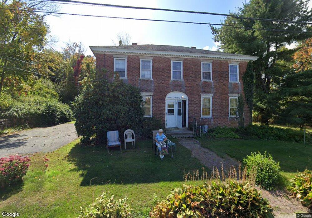
398 Sutton St Uxbridge, MA 01569
Estimated Value: $188,000 - $834,000
4
Beds
2
Baths
2,644
Sq Ft
$204/Sq Ft
Est. Value
About This Home
This home is located at 398 Sutton St, Uxbridge, MA 01569 and is currently estimated at $538,667, approximately $203 per square foot. 398 Sutton St is a home located in Worcester County with nearby schools including Uxbridge High School and Whitinsville Christian School.
Ownership History
Date
Name
Owned For
Owner Type
Purchase Details
Closed on
Aug 18, 2021
Sold by
Marshall Jeffrey P and Marshall Marie E
Bought by
Peneda Jose P and Kennedy Kendra M
Current Estimated Value
Purchase Details
Closed on
Jun 11, 1991
Sold by
Marshall Carlton H
Bought by
Marshall Jeffrey P
Home Financials for this Owner
Home Financials are based on the most recent Mortgage that was taken out on this home.
Original Mortgage
$54,000
Interest Rate
9.42%
Mortgage Type
Purchase Money Mortgage
Create a Home Valuation Report for This Property
The Home Valuation Report is an in-depth analysis detailing your home's value as well as a comparison with similar homes in the area
Home Values in the Area
Average Home Value in this Area
Purchase History
| Date | Buyer | Sale Price | Title Company |
|---|---|---|---|
| Peneda Jose P | $125,000 | None Available | |
| Marshall Jeffrey P | $80,000 | -- | |
| Marshall Jeffrey P | $80,000 | -- |
Source: Public Records
Mortgage History
| Date | Status | Borrower | Loan Amount |
|---|---|---|---|
| Previous Owner | Marshall Jeffrey P | $35,000 | |
| Previous Owner | Marshall Jeffrey P | $54,000 |
Source: Public Records
Tax History
| Year | Tax Paid | Tax Assessment Tax Assessment Total Assessment is a certain percentage of the fair market value that is determined by local assessors to be the total taxable value of land and additions on the property. | Land | Improvement |
|---|---|---|---|---|
| 2025 | $22 | $169,900 | $169,900 | $0 |
| 2024 | $2,308 | $178,600 | $161,200 | $17,400 |
| 2023 | $2,161 | $154,900 | $139,400 | $15,500 |
| 2022 | $5,206 | $343,400 | $109,800 | $233,600 |
| 2021 | $5,104 | $322,600 | $107,400 | $215,200 |
| 2020 | $4,448 | $265,700 | $105,900 | $159,800 |
| 2019 | $4,546 | $262,000 | $105,900 | $156,100 |
| 2018 | $4,116 | $239,700 | $105,900 | $133,800 |
| 2017 | $4,194 | $247,300 | $97,100 | $150,200 |
| 2016 | $3,807 | $216,700 | $92,300 | $124,400 |
| 2015 | $3,682 | $211,600 | $92,300 | $119,300 |
Source: Public Records
Map
Nearby Homes
- 22 Bayliss Way
- 37 Bayliss Way
- 201 Prescott Rd
- 79 Country Club Dr
- 128 Linwood Ave
- 14 C St
- 235 Rivulet St
- 34 Crescent St Unit 34
- 2 D St
- 30-32 Spring St
- 0 Homestead Ave
- 208-210 Church St
- 237 Heritage Dr Unit 237
- 240 Heritage Dr
- 164 Heritage Dr Unit 164
- 138 Elm St
- 125 Heritage Dr
- 21 Granite St
- 71 Rivulet St Unit B
- 127 Hillcrest Rd
- 444 Sutton St Unit Lot 1
- 410 Sutton St
- 430 Sutton St Unit Lot 12
- 32 Bayliss Way Unit Lot 8
- 26 Bayliss Way
- 26 Bayliss Way Unit Lot 9
- 22 Bayliss Way Unit Lot 10
- 427 Sutton St
- 376 Sutton St
- 38 Bayliss Way Unit Lot 7
- 10 Bayliss Way
- 8 Bayliss Way Unit Lot 11
- 439 Sutton St
- 23 Bayliss Way Unit Lot 4
- 37 Bayliss Way Unit Lot 6
- 15 Bayliss Way Unit Lot 9
- 15 Bayliss Way Unit Lot 2
- 15 Bayliss Way Unit Lot 4
- 9 Bayliss Way
- 346 Sutton St
Your Personal Tour Guide
Ask me questions while you tour the home.