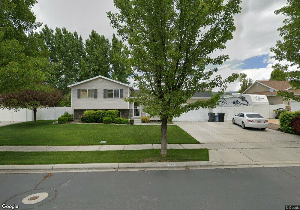
398 W 1280 N American Fork, UT 84003
Estimated Value: $522,000 - $626,000
6
Beds
3
Baths
1,878
Sq Ft
$311/Sq Ft
Est. Value
About This Home
This home is located at 398 W 1280 N, American Fork, UT 84003 and is currently estimated at $584,627, approximately $311 per square foot. 398 W 1280 N is a home located in Utah County with nearby schools including Legacy Elementary School, American Fork Junior High School, and American Fork High School.
Ownership History
Date
Name
Owned For
Owner Type
Purchase Details
Closed on
May 23, 2011
Sold by
Muhlestein Brent V and Muhlestein David R
Bought by
Anderson Jonathan D and Anderson Kimberly R
Current Estimated Value
Home Financials for this Owner
Home Financials are based on the most recent Mortgage that was taken out on this home.
Original Mortgage
$181,771
Outstanding Balance
$125,563
Interest Rate
4.75%
Mortgage Type
FHA
Estimated Equity
$459,064
Purchase Details
Closed on
Sep 22, 2009
Sold by
Palmer Rebecca
Bought by
Muhlestein Brent and Muhlestein David R
Purchase Details
Closed on
Feb 22, 2005
Sold by
Fowles David A and Fowles Stacy
Bought by
Palmer Nathan and Palmer Rebecca
Purchase Details
Closed on
Sep 27, 2002
Sold by
Salisbury Development Lc
Bought by
Fowles David A and Fowles Stacy
Home Financials for this Owner
Home Financials are based on the most recent Mortgage that was taken out on this home.
Original Mortgage
$144,433
Interest Rate
6.16%
Mortgage Type
FHA
Create a Home Valuation Report for This Property
The Home Valuation Report is an in-depth analysis detailing your home's value as well as a comparison with similar homes in the area
Home Values in the Area
Average Home Value in this Area
Purchase History
| Date | Buyer | Sale Price | Title Company |
|---|---|---|---|
| Anderson Jonathan D | -- | American Preferred Title | |
| Muhlestein Brent | -- | None Available | |
| Palmer Nathan | -- | Equity Title | |
| Fowles David A | -- | Provo Land Title Company |
Source: Public Records
Mortgage History
| Date | Status | Borrower | Loan Amount |
|---|---|---|---|
| Open | Anderson Jonathan D | $181,771 | |
| Previous Owner | Fowles David A | $144,433 |
Source: Public Records
Tax History Compared to Growth
Tax History
| Year | Tax Paid | Tax Assessment Tax Assessment Total Assessment is a certain percentage of the fair market value that is determined by local assessors to be the total taxable value of land and additions on the property. | Land | Improvement |
|---|---|---|---|---|
| 2025 | $2,332 | $282,920 | $229,800 | $284,600 |
| 2024 | $2,332 | $259,160 | $0 | $0 |
| 2023 | $2,167 | $255,310 | $0 | $0 |
| 2022 | $2,437 | $283,305 | $0 | $0 |
| 2021 | $1,941 | $352,400 | $130,800 | $221,600 |
| 2020 | $1,864 | $328,200 | $121,100 | $207,100 |
| 2019 | $1,654 | $301,200 | $121,100 | $180,100 |
| 2018 | $1,709 | $297,600 | $117,500 | $180,100 |
| 2017 | $1,575 | $148,005 | $0 | $0 |
| 2016 | $1,541 | $134,585 | $0 | $0 |
| 2015 | $1,483 | $122,870 | $0 | $0 |
| 2014 | $1,397 | $114,180 | $0 | $0 |
Source: Public Records
Map
Nearby Homes
- 356 W 1300 N
- 287 W 1360 N
- 1438 N 400 W
- 425 W 1120 N
- 179 W 1290 N
- 344 W 1080 N
- 471 W 1040 N
- 987 N 410 W
- 35 W 1350 N
- 984 N 300 W
- 3889 W 950 Cir N Unit 366
- 914 N 400 W Unit A
- 1071 Timpview Dr
- 9435 N Aspen Hollow Cir
- 9780 N 6000 W
- 602 W 860 N
- 6692 W 9770 N
- 3935 W 1000 N Unit 438
- 3983 W 1000 N Unit 442
- 4007 W 1000 N