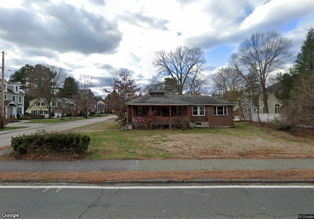
398 Weston Rd Wellesley, MA 02482
Estimated Value: $1,105,000 - $1,455,855
3
Beds
2
Baths
1,732
Sq Ft
$736/Sq Ft
Est. Value
About This Home
This home is located at 398 Weston Rd, Wellesley, MA 02482 and is currently estimated at $1,275,214, approximately $736 per square foot. 398 Weston Rd is a home located in Norfolk County with nearby schools including Katharine Lee Bates Elementary School, Wellesley Middle School, and Wellesley Sr High School.
Ownership History
Date
Name
Owned For
Owner Type
Purchase Details
Closed on
Apr 11, 2016
Sold by
Doherty Kevin C and Doherty Brid P
Bought by
Thomas Realty Developm
Current Estimated Value
Purchase Details
Closed on
Nov 30, 2012
Sold by
Ray Harry R
Bought by
Doherty Kevin C and Doherty Brid P
Home Financials for this Owner
Home Financials are based on the most recent Mortgage that was taken out on this home.
Original Mortgage
$402,000
Interest Rate
3.4%
Mortgage Type
New Conventional
Create a Home Valuation Report for This Property
The Home Valuation Report is an in-depth analysis detailing your home's value as well as a comparison with similar homes in the area
Home Values in the Area
Average Home Value in this Area
Purchase History
| Date | Buyer | Sale Price | Title Company |
|---|---|---|---|
| Thomas Realty Developm | -- | -- | |
| Doherty Kevin C | $427,000 | -- |
Source: Public Records
Mortgage History
| Date | Status | Borrower | Loan Amount |
|---|---|---|---|
| Previous Owner | Doherty Kevin C | $402,000 |
Source: Public Records
Tax History Compared to Growth
Tax History
| Year | Tax Paid | Tax Assessment Tax Assessment Total Assessment is a certain percentage of the fair market value that is determined by local assessors to be the total taxable value of land and additions on the property. | Land | Improvement |
|---|---|---|---|---|
| 2025 | $10,301 | $1,002,000 | $948,000 | $54,000 |
| 2024 | $9,484 | $911,000 | $858,000 | $53,000 |
| 2023 | $9,767 | $853,000 | $809,000 | $44,000 |
| 2022 | $8,059 | $690,000 | $630,000 | $60,000 |
| 2021 | $8,108 | $690,000 | $630,000 | $60,000 |
| 2020 | $7,976 | $690,000 | $630,000 | $60,000 |
| 2019 | $7,983 | $690,000 | $630,000 | $60,000 |
| 2018 | $7,529 | $630,000 | $584,000 | $46,000 |
| 2017 | $7,428 | $630,000 | $584,000 | $46,000 |
| 2016 | $7,358 | $622,000 | $574,000 | $48,000 |
| 2015 | $6,497 | $562,000 | $517,000 | $45,000 |
Source: Public Records
Map
Nearby Homes