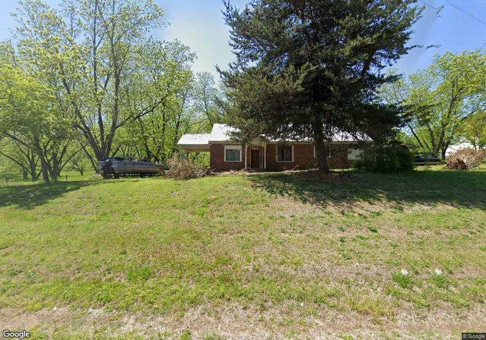
3984 Wildcat Bridge Rd Royston, GA 30662
Estimated Value: $335,000 - $612,641
3
Beds
3
Baths
3,040
Sq Ft
$158/Sq Ft
Est. Value
About This Home
This home is located at 3984 Wildcat Bridge Rd, Royston, GA 30662 and is currently estimated at $480,214, approximately $157 per square foot. 3984 Wildcat Bridge Rd is a home located in Madison County with nearby schools including Madison County High School.
Ownership History
Date
Name
Owned For
Owner Type
Purchase Details
Closed on
Apr 14, 2004
Sold by
Phillips Anthony G
Bought by
Dove David M and Dove Tracy L
Current Estimated Value
Purchase Details
Closed on
Jan 6, 2004
Sold by
Williams Dewayne
Bought by
Phillips Anthony G
Purchase Details
Closed on
Jan 1, 1995
Bought by
Williams Dewayne
Create a Home Valuation Report for This Property
The Home Valuation Report is an in-depth analysis detailing your home's value as well as a comparison with similar homes in the area
Home Values in the Area
Average Home Value in this Area
Purchase History
| Date | Buyer | Sale Price | Title Company |
|---|---|---|---|
| Dove David M | $55,000 | -- | |
| Phillips Anthony G | $27,100 | -- | |
| Williams Dewayne | $28,000 | -- |
Source: Public Records
Tax History Compared to Growth
Tax History
| Year | Tax Paid | Tax Assessment Tax Assessment Total Assessment is a certain percentage of the fair market value that is determined by local assessors to be the total taxable value of land and additions on the property. | Land | Improvement |
|---|---|---|---|---|
| 2024 | $4,750 | $222,999 | $57,548 | $165,451 |
| 2023 | $4,464 | $146,233 | $22,343 | $123,890 |
| 2022 | $3,407 | $125,507 | $15,362 | $110,145 |
| 2021 | $3,028 | $101,198 | $15,362 | $85,836 |
| 2020 | $2,981 | $98,964 | $13,128 | $85,836 |
| 2019 | $2,963 | $97,298 | $13,128 | $84,170 |
| 2018 | $2,897 | $94,894 | $12,010 | $82,884 |
| 2017 | $2,740 | $95,147 | $11,172 | $83,975 |
| 2016 | $2,346 | $83,741 | $11,172 | $72,569 |
| 2015 | $2,347 | $83,741 | $11,172 | $72,569 |
| 2014 | $2,323 | $82,412 | $9,144 | $73,268 |
| 2013 | -- | $82,412 | $9,144 | $73,268 |
Source: Public Records
Map
Nearby Homes
- 4059 Wildcat Bridge Rd
- 3657 Wildcat Bridge Rd
- 3322 Cheek Pulliam Rd
- 397 Reed Brawner Rd
- 2695 Wildcat Bridge Rd
- 384 Freedom Church Rd
- 417 Cheek Pulliam Rd
- 2246 Wildcat Bridge Rd
- 706 Sam Bruce Rd
- 1745 Hannah Creek Church Rd
- 1350 Baker Rd
- 233 Duncan Rd
- 0 Dickson Dr Unit 416392
- 0 Dickson Dr Unit 7594620
- 0 Dickson Dr Unit 23800701
- 0 Dickson Dr Unit 10539867
- 1458 & 1463 Parham Town Rd
- 2660 Parham Town Rd
- 0 S Tanglewood Dr Unit 1027287
- 0 S Tanglewood Dr Unit 10538269
- 3898 Wildcat Bridge Rd
- 4040 Wildcat Bridge Rd
- 3878 Wildcat Bridge Rd
- 3798 Wildcat Bridge Rd
- 156 Old Harrison School Rd
- 200 Dove Drake Rd
- 3763 Wildcat Bridge Rd
- 121 Old Harrison School Rd
- 4326 Wildcat Bridge Rd
- 85 Dove Drake Rd
- 3612 Wildcat Bridge Rd
- 3621 Wildcat Bridge Rd
- 445 Dove Drake Rd
- 630 Dove-Drake Rd
- 551 Old Harrison School Rd
- 3575 Wildcat Bridge Rd
- 3576 Wildcat Bridge Rd
- 0 Hendrix Rd
- 3760 Wildcat Bridge Rd
- 79 Hendrix Rd