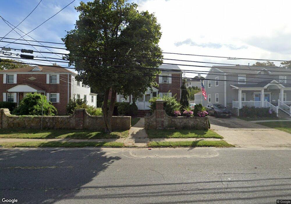
399 2nd Ave Long Branch, NJ 07740
Estimated Value: $671,728 - $904,000
4
Beds
2
Baths
1,632
Sq Ft
$491/Sq Ft
Est. Value
About This Home
This home is located at 399 2nd Ave, Long Branch, NJ 07740 and is currently estimated at $801,182, approximately $490 per square foot. 399 2nd Ave is a home located in Monmouth County with nearby schools including Long Branch High School, Holy Trinity School, and Bet Yaakov of the Jersey Shore.
Ownership History
Date
Name
Owned For
Owner Type
Purchase Details
Closed on
Jun 18, 2014
Sold by
Mari Michael W and Estate Of Elvira Mari
Bought by
Mari Michael W
Current Estimated Value
Purchase Details
Closed on
Oct 9, 1998
Sold by
Eilbott Eleanor
Bought by
Mari Michael
Home Financials for this Owner
Home Financials are based on the most recent Mortgage that was taken out on this home.
Original Mortgage
$82,350
Interest Rate
6.68%
Mortgage Type
Commercial
Create a Home Valuation Report for This Property
The Home Valuation Report is an in-depth analysis detailing your home's value as well as a comparison with similar homes in the area
Home Values in the Area
Average Home Value in this Area
Purchase History
| Date | Buyer | Sale Price | Title Company |
|---|---|---|---|
| Mari Michael W | -- | None Available | |
| Mari Michael | $91,500 | -- |
Source: Public Records
Mortgage History
| Date | Status | Borrower | Loan Amount |
|---|---|---|---|
| Previous Owner | Mari Michael | $82,350 |
Source: Public Records
Tax History
| Year | Tax Paid | Tax Assessment Tax Assessment Total Assessment is a certain percentage of the fair market value that is determined by local assessors to be the total taxable value of land and additions on the property. | Land | Improvement |
|---|---|---|---|---|
| 2025 | $6,893 | $495,400 | $193,200 | $302,200 |
| 2024 | $6,693 | $448,500 | $173,200 | $275,300 |
| 2023 | $6,693 | $431,000 | $168,200 | $262,800 |
| 2022 | $6,669 | $389,700 | $158,200 | $231,500 |
| 2021 | $6,669 | $333,300 | $136,200 | $197,100 |
| 2020 | $6,901 | $330,200 | $134,200 | $196,000 |
| 2019 | $6,644 | $316,100 | $129,200 | $186,900 |
| 2018 | $6,515 | $308,200 | $128,200 | $180,000 |
| 2017 | $6,282 | $304,800 | $128,200 | $176,600 |
| 2016 | $6,067 | $300,200 | $128,200 | $172,000 |
| 2015 | $6,427 | $288,600 | $144,700 | $143,900 |
| 2014 | $6,319 | $310,900 | $183,200 | $127,700 |
Source: Public Records
Map
Nearby Homes
- 448 Ocean Ave Unit 3A
- 448 Ocean Ave N Unit 8B
- 392 Ocean Ave N Unit 1203
- 392 Ocean Ave N Unit 1502
- 392 Ocean Ave N Unit 1703
- 392 Ocean Ave N Unit 1804
- 480 Ocean Ave Unit 2K
- 392 Ocean Ave Unit 1608
- 392 Ocean Ave Unit 1203
- 392 Ocean Ave Unit 1406
- 392 Ocean Ave Unit 1412
- 392 Ocean Ave Unit 1309
- 392 Ocean Ave Unit 1502
- 392 Ocean Ave Unit 1505
- 392 Ocean Ave Unit 1310
- 392 Ocean Ave Unit 1705
- 392 Ocean Ave Unit 1804
- 392 Ocean Ave Unit 1603
- 392 Ocean Ave Unit 1509
- 392 Ocean Ave Unit 1803
- 403 2nd Ave
- 395 2nd Ave
- 407 2nd Ave
- 391 2nd Ave
- 19 Tower Rd
- 15 Tower Rd
- 13 Tower Rd
- 13 Tower Rd Unit Winter
- 11 Tower Rd
- 23 Tower Rd
- 9 Tower Rd Unit D6
- 387 2nd Ave
- 22 Tower Rd Unit F3
- 413 2nd Ave
- 21 Tower Rd
- 410 2nd Ave
- 47 Cottage Place
- 47 Cottage Place Unit 1
- 47 Cottage Place Unit 2
- 41 Cottage Place
Your Personal Tour Guide
Ask me questions while you tour the home.