Estimated Value: $525,947 - $639,000
5
Beds
2
Baths
2,838
Sq Ft
$207/Sq Ft
Est. Value
About This Home
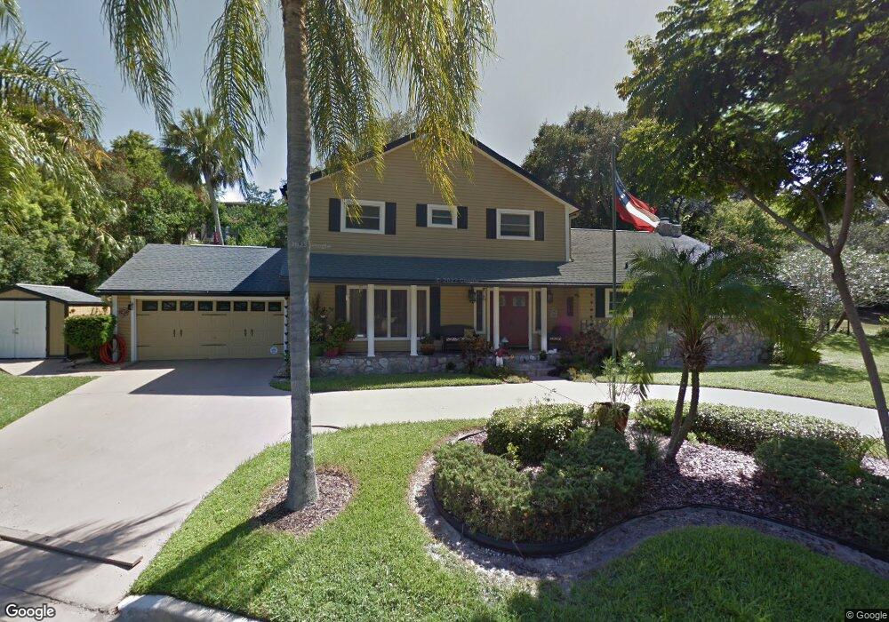
This home is located at 399 High Point Dr, Cocoa, FL 32926 and is currently estimated at $587,487, approximately $207 per square foot. 399 High Point Dr is a home located in Brevard County with nearby schools including Fairglen Elementary School, Cocoa High School, and Space Coast Christian Academy.
Ownership History
Date
Name
Owned For
Owner Type
Purchase Details
Closed on
Nov 30, 2023
Sold by
Heredia Frank B and Heredia Janice C
Bought by
Heredia Family Trust and Heredia
Current Estimated Value
Purchase Details
Closed on
Jul 21, 2000
Sold by
Lazar Robert G
Bought by
Heredia Frank B and Heredia Janice C
Home Financials for this Owner
Home Financials are based on the most recent Mortgage that was taken out on this home.
Original Mortgage
$42,000
Interest Rate
8.23%
Mortgage Type
Purchase Money Mortgage
Create a Home Valuation Report for This Property
The Home Valuation Report is an in-depth analysis detailing your home's value as well as a comparison with similar homes in the area
Home Values in the Area
Average Home Value in this Area
Purchase History
| Date | Buyer | Sale Price | Title Company |
|---|---|---|---|
| Heredia Family Trust | $100 | None Listed On Document | |
| Heredia Family Trust | $100 | None Listed On Document | |
| Heredia Frank B | $142,000 | -- |
Source: Public Records
Mortgage History
| Date | Status | Borrower | Loan Amount |
|---|---|---|---|
| Previous Owner | Heredia Frank B | $42,000 |
Source: Public Records
Tax History
| Year | Tax Paid | Tax Assessment Tax Assessment Total Assessment is a certain percentage of the fair market value that is determined by local assessors to be the total taxable value of land and additions on the property. | Land | Improvement |
|---|---|---|---|---|
| 2025 | $2,583 | $193,610 | -- | -- |
| 2024 | $2,537 | $188,160 | -- | -- |
| 2023 | $2,537 | $182,680 | $0 | $0 |
| 2022 | $2,368 | $177,360 | $0 | $0 |
| 2021 | $2,404 | $172,200 | $0 | $0 |
| 2020 | $2,251 | $165,160 | $0 | $0 |
| 2019 | $2,192 | $161,450 | $0 | $0 |
| 2018 | $2,192 | $158,440 | $0 | $0 |
| 2017 | $2,199 | $155,190 | $0 | $0 |
| 2016 | $2,230 | $152,000 | $66,000 | $86,000 |
| 2015 | $2,284 | $150,950 | $66,000 | $84,950 |
| 2014 | $2,298 | $149,760 | $44,000 | $105,760 |
Source: Public Records
Map
Nearby Homes
- 1 Point View Place
- 3057 Skyline Dr
- 117 Gary Ln
- 108 River Heights Dr
- 11 Highview Dr
- 000 N Highway 1
- 324 Bellaire Dr
- 308 Bellair Dr
- 2636 N Indian River Dr
- 1956 Quail Ridge Ct Unit 1802
- 1942 Quail Ridge Ct Unit 504
- 2545 N Indian River Dr
- 135 N Twin Lakes Rd
- 2514 N Indian River Dr
- 1933 Quail Ridge Ct Unit 1101
- 1612 Calvados Dr
- 155 Vanguard Cir
- 2123 N Indian River Dr
- 2111 Otterbein Ave
- 2430 Legay St
- 3 High Point
- 412 Westchester Dr
- 3222 High Point Dr
- 414 Westchester Dr
- 3228 Forest Hill Dr
- 410 Westchester Dr
- 3214 High Point Dr
- 3227 Forest Hill Dr
- 3221 Nottingham Ln
- 3213 Nottingham Ln
- 3232 Forest Hill Dr
- 3206 High Point Dr
- 3231 Nottingham Ln
- 0 High Point
- 418 Westchester Dr
- 413 Westchester Dr
- 3231 Forest Hill Dr
- 3209 Nottingham La Ln
- 0 Unknown Dr Unit 320826
- 3202 High Point Dr
Your Personal Tour Guide
Ask me questions while you tour the home.