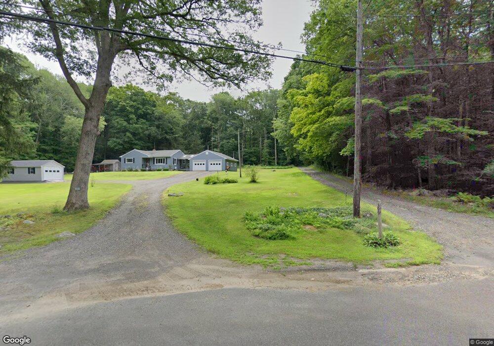
399 Hubbard Rd Higganum, CT 06441
Estimated Value: $434,217 - $502,000
3
Beds
2
Baths
1,760
Sq Ft
$268/Sq Ft
Est. Value
About This Home
This home is located at 399 Hubbard Rd, Higganum, CT 06441 and is currently estimated at $471,804, approximately $268 per square foot. 399 Hubbard Rd is a home located in Middlesex County with nearby schools including Haddam-Killingworth High School.
Ownership History
Date
Name
Owned For
Owner Type
Purchase Details
Closed on
Jul 17, 2024
Sold by
Sandoval Edgar F
Bought by
Sandoval Edgar F and Perales Elisa A
Current Estimated Value
Purchase Details
Closed on
Sep 24, 2021
Sold by
Sandoval Lesley A
Bought by
Sandoval Edgar F
Purchase Details
Closed on
Jan 11, 2010
Sold by
Jubinville Ronald A and Jubinville Linda A
Bought by
Sandoval Lesley A
Home Financials for this Owner
Home Financials are based on the most recent Mortgage that was taken out on this home.
Original Mortgage
$217,500
Interest Rate
4.78%
Create a Home Valuation Report for This Property
The Home Valuation Report is an in-depth analysis detailing your home's value as well as a comparison with similar homes in the area
Home Values in the Area
Average Home Value in this Area
Purchase History
| Date | Buyer | Sale Price | Title Company |
|---|---|---|---|
| Sandoval Edgar F | -- | None Available | |
| Sandoval Edgar F | -- | None Available | |
| Sandoval Edgar F | -- | None Available | |
| Sandoval Edgar F | -- | None Available | |
| Sandoval Lesley A | $297,500 | -- | |
| Sandoval Lesley A | $297,500 | -- |
Source: Public Records
Mortgage History
| Date | Status | Borrower | Loan Amount |
|---|---|---|---|
| Previous Owner | Sandoval Lesley A | $217,500 | |
| Previous Owner | Sandoval Lesley A | $70,000 |
Source: Public Records
Tax History Compared to Growth
Tax History
| Year | Tax Paid | Tax Assessment Tax Assessment Total Assessment is a certain percentage of the fair market value that is determined by local assessors to be the total taxable value of land and additions on the property. | Land | Improvement |
|---|---|---|---|---|
| 2025 | $6,037 | $175,760 | $63,740 | $112,020 |
| 2024 | $6,037 | $175,760 | $63,740 | $112,020 |
| 2023 | $5,953 | $175,760 | $63,740 | $112,020 |
| 2022 | $5,682 | $175,760 | $63,740 | $112,020 |
| 2021 | $5,652 | $175,760 | $63,740 | $112,020 |
| 2020 | $5,285 | $166,770 | $73,090 | $93,680 |
| 2019 | $6,073 | $166,770 | $73,090 | $93,680 |
| 2018 | $5,285 | $166,770 | $73,090 | $93,680 |
| 2017 | $5,285 | $166,770 | $73,090 | $93,680 |
| 2016 | $5,203 | $166,770 | $73,090 | $93,680 |
| 2015 | $5,863 | $187,910 | $73,090 | $114,820 |
| 2014 | $5,805 | $187,910 | $73,090 | $114,820 |
Source: Public Records
Map
Nearby Homes
- 8 Little City Rd
- 0 S Dish Mill Rd Unit 24082788
- 82 Harvest Woods Ln
- 279 Pokorny Rd
- 28 Fieldstone Ln
- 882 Killingworth Rd
- 16 Hidden Lake Rd
- 153 Meeting House Rd
- 69 Bamforth Rd
- 45 Summersweet Dr
- 3 Copley Rd
- 67 Hayden Hill Rd
- 0 Parmelee Rd
- 25 Island Dock Rd
- 0 Saybrook Rd
- 32 Maple Ave W
- 8 Neffs Corner Rd
- 72 Dickinson Rd
- 114 Walkley Hill Rd
- 34 Skunk Misery Rd
- 397 Hubbard Rd
- 582 Killingworth Rd
- 573 Killingworth Rd
- 581 Killingworth Rd
- 6 Pokorny Rd
- 548 Killingworth Rd
- 590 Killingworth Rd
- 14 Pokorny Rd
- 46 Pokorny Rd
- 369 Hubbard Rd
- 20 Pokorny Rd
- 11 Pokorny Rd
- 0 Killingworth Rd
- 599 Killingworth Rd
- 530 Killingworth Rd
- 370 Hubbard Rd
- 53 Pokorny Rd
- 59 Pokorny Rd
- 19 Pokorny Rd