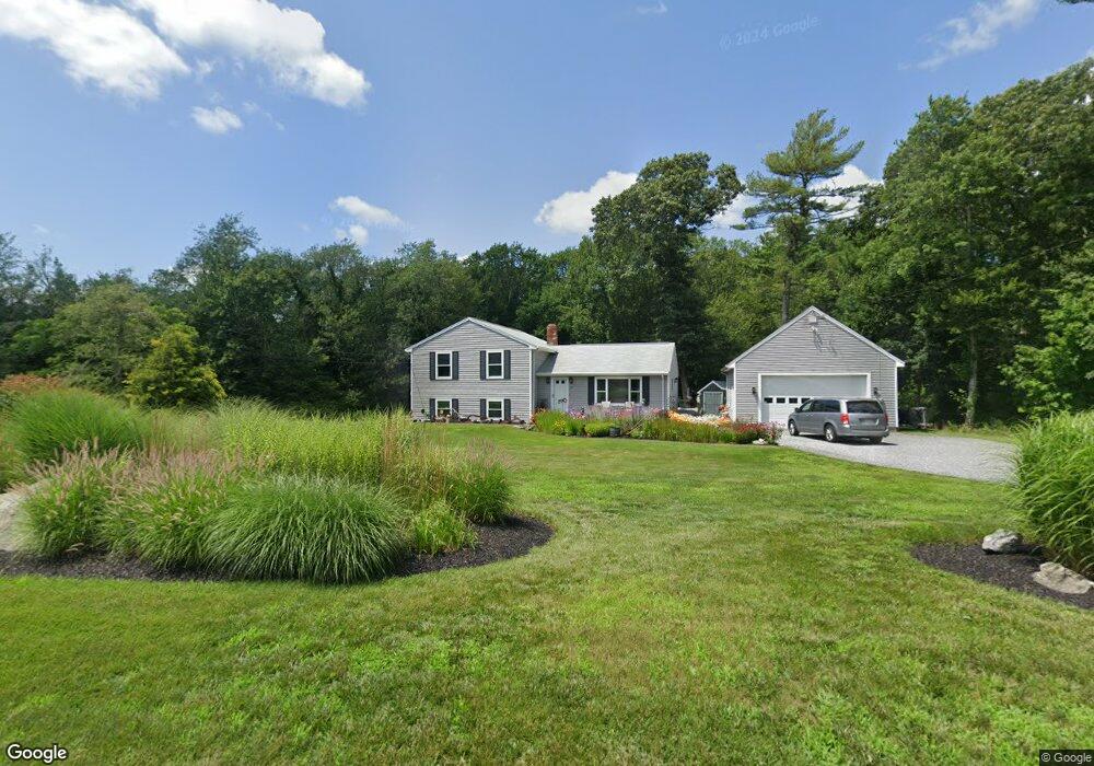
399 Main St Acushnet, MA 02743
Upper Acushnet NeighborhoodEstimated Value: $560,186 - $640,000
Studio
1
Bath
2,064
Sq Ft
$293/Sq Ft
Est. Value
About This Home
This home is located at 399 Main St, Acushnet, MA 02743 and is currently estimated at $605,297, approximately $293 per square foot. 399 Main St is a home located in Bristol County with nearby schools including Acushnet Elementary School, Albert F Ford Middle School, and Alma Del Mar Charter School.
Create a Home Valuation Report for This Property
The Home Valuation Report is an in-depth analysis detailing your home's value as well as a comparison with similar homes in the area
Home Values in the Area
Average Home Value in this Area
Tax History
| Year | Tax Paid | Tax Assessment Tax Assessment Total Assessment is a certain percentage of the fair market value that is determined by local assessors to be the total taxable value of land and additions on the property. | Land | Improvement |
|---|---|---|---|---|
| 2025 | $51 | $470,800 | $175,900 | $294,900 |
| 2024 | $5,052 | $442,800 | $166,700 | $276,100 |
| 2023 | $4,966 | $413,800 | $151,200 | $262,600 |
| 2022 | $4,631 | $349,000 | $142,200 | $206,800 |
| 2021 | $4,693 | $339,300 | $142,200 | $197,100 |
| 2020 | $4,604 | $330,300 | $133,200 | $197,100 |
| 2019 | $4,623 | $326,000 | $127,200 | $198,800 |
| 2018 | $4,456 | $309,000 | $127,200 | $181,800 |
| 2017 | $4,338 | $300,400 | $127,200 | $173,200 |
| 2016 | $4,051 | $278,800 | $127,200 | $151,600 |
| 2015 | $3,981 | $278,800 | $127,200 | $151,600 |
Source: Public Records
Map
Nearby Homes
- 363 Main St
- 489 Main St
- 25 Pershing Ave
- 23 Oliveira Ave
- 12 White St
- 0 Hathaway Rd Unit 73469544
- 329 Middle Rd
- 7 Hamlin St
- 191 Hathaway Rd
- 11 Boylston St
- 23 Coury Dr
- 14 Hayes St Unit 1
- 12 Hayes St Unit 1
- 134 Nyes Ln
- 27 Meadow Ln
- 15 Ball St
- 0 Land Way Unit 73479153
- 65 Armsby St
- 1027 Kenmore St
- 122 Truro St
Your Personal Tour Guide
Ask me questions while you tour the home.