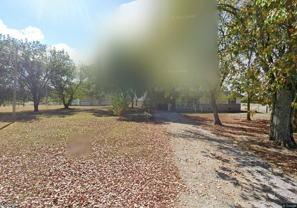
399 Swanson Rd Ringgold, GA 30736
Estimated Value: $251,000
Studio
2
Baths
1,352
Sq Ft
$186/Sq Ft
Est. Value
About This Home
This home is located at 399 Swanson Rd, Ringgold, GA 30736 and is currently estimated at $251,000, approximately $185 per square foot. 399 Swanson Rd is a home located in Catoosa County with nearby schools including Graysville Elementary School, Ringgold Middle School, and Ringgold High School.
Ownership History
Date
Name
Owned For
Owner Type
Purchase Details
Closed on
Oct 1, 2020
Sold by
Sega Farms Llc
Bought by
Expansion Enterprises Llc
Current Estimated Value
Purchase Details
Closed on
Dec 28, 2017
Sold by
Peters Kenneth Ira
Bought by
Sega Farms Llc
Purchase Details
Closed on
Nov 13, 2017
Sold by
Peters Howard Clinton
Bought by
Peters Kenneth Ira
Purchase Details
Closed on
Aug 10, 2017
Sold by
Peters Kenneth Ira
Bought by
Peters Howard Clinton and Peters Johnnie Ruth
Purchase Details
Closed on
Dec 14, 2011
Sold by
Peters Florence Lucy
Bought by
Peters Howard
Purchase Details
Closed on
Dec 12, 2011
Sold by
Peters Florence Lucy
Bought by
Peters Howard
Create a Home Valuation Report for This Property
The Home Valuation Report is an in-depth analysis detailing your home's value as well as a comparison with similar homes in the area
Home Values in the Area
Average Home Value in this Area
Purchase History
| Date | Buyer | Sale Price | Title Company |
|---|---|---|---|
| Expansion Enterprises Llc | $100,000 | -- | |
| Sega Farms Llc | $90,000 | -- | |
| Peters Kenneth Ira | -- | -- | |
| Kapherr Brenda Peters | -- | -- | |
| Peters Gary Curtis | -- | -- | |
| Peters Howard Clinton | -- | -- | |
| Peters Howard | -- | -- | |
| Peters Kenneth Ira | -- | -- | |
| Peters Howard | -- | -- | |
| Peters Kenneth Ira | -- | -- |
Source: Public Records
Tax History
| Year | Tax Paid | Tax Assessment Tax Assessment Total Assessment is a certain percentage of the fair market value that is determined by local assessors to be the total taxable value of land and additions on the property. | Land | Improvement |
|---|---|---|---|---|
| 2025 | $101 | $45,368 | $45,368 | $0 |
| 2024 | $110 | $27,473 | $27,473 | $0 |
| 2023 | $107 | $27,473 | $27,473 | $0 |
| 2022 | $109 | $26,164 | $26,164 | $0 |
| 2021 | $99 | $26,164 | $26,164 | $0 |
| 2020 | $577 | $24,918 | $24,918 | $0 |
| 2019 | $105 | $24,918 | $24,918 | $0 |
| 2018 | $104 | $24,918 | $24,918 | $0 |
Source: Public Records
Map
Nearby Homes
- 0 Swanson Rd Unit 1517125
- 35 S Links Dr
- 643 Cardinal Rd
- 28 N Links Dr
- 1926 Windstone Dr
- 464 Blue Jay Pkwy
- 467 Wisley Way
- 19 Laura Ln
- 2119 Ooltewah Ringgold Rd
- 59 Briarwood Dr
- 2049 Saunders Rd
- 0 Saunders Rd Unit 1527205
- 106 Woodpecker Place
- 1768 Windstone Dr
- 195 Mallard Hill
- 0 Blue Jay Pkwy Unit 10577001
- 2311 Saunders Rd
- 312 Autumn Trail
- 103 Circlestone Dr
- 9235 Shay Cove
- 19 Mountain Brook Dr
- 355 Swanson Rd
- 16 Mountain Brook Dr
- 432 Swanson Rd
- 26 Mountain Brook Dr
- 29 Mountain Brook Dr
- 60 Mountain Brook Dr
- 63 Mountain Brook Dr
- 69 Mountain Brook Dr
- 76 Mountain Brook Dr
- 293 Swanson Rd
- 89 Mountain Brook Dr
- 454 Swanson Rd
- 77 Mountain Brook Dr
- 100 Mountain Brook Dr
- 503 Swanson Rd
- 107 Mountain Brook Dr
- 4735 Swanson Rd
- 12272 Davis Rd
- 114 Mountain Brook Dr
Your Personal Tour Guide
Ask me questions while you tour the home.