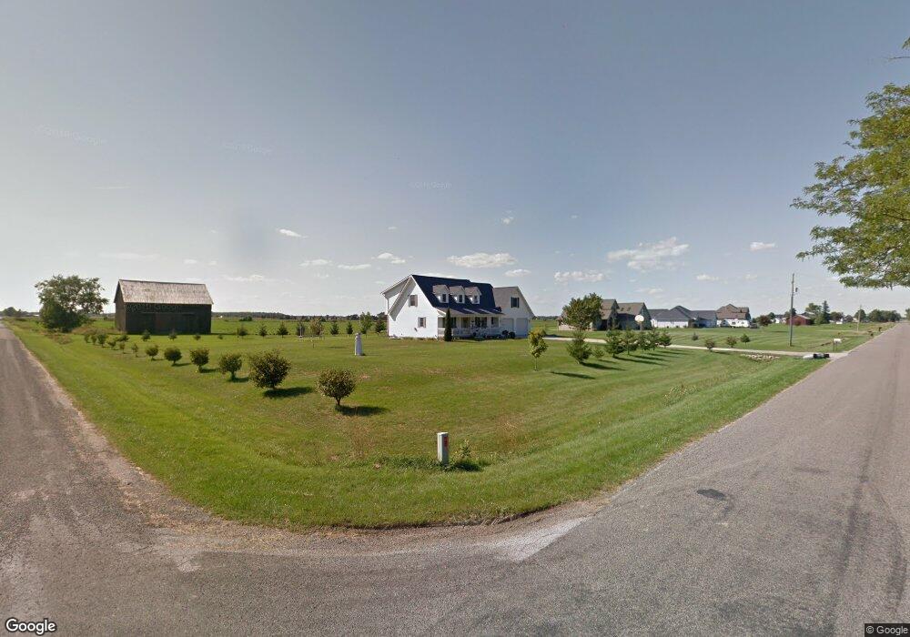
3990 Maple Rd Frankenmuth, MI 48734
Estimated Value: $385,018 - $496,000
3
Beds
3
Baths
2,572
Sq Ft
$170/Sq Ft
Est. Value
About This Home
This home is located at 3990 Maple Rd, Frankenmuth, MI 48734 and is currently estimated at $437,673, approximately $170 per square foot. 3990 Maple Rd is a home located in Saginaw County with nearby schools including List Elementary, E.F. Rittmueller Middle School, and Frankenmuth High School.
Ownership History
Date
Name
Owned For
Owner Type
Purchase Details
Closed on
Nov 18, 2022
Sold by
Bullock Mark Francis
Bought by
Bullock Mark Francis and Bullock Dillon
Current Estimated Value
Purchase Details
Closed on
Nov 11, 2022
Sold by
Bullock Mark Francis
Bought by
Bullock Dillon
Purchase Details
Closed on
Mar 8, 2010
Sold by
Bullock Kimberly D
Bought by
Bullock Mark F
Purchase Details
Closed on
Jun 4, 2001
Sold by
Bullock Mark F and Bullock Thomas
Bought by
Bullock Mark F
Purchase Details
Closed on
Sep 21, 1999
Sold by
Bruns James P and Bruns Karen A
Bought by
Bullock Mark Francis and Bullock Kimberly Dawn
Purchase Details
Closed on
Jun 14, 1999
Sold by
Nuechterlein Melvin H and Nuechterlein Elsie L
Bought by
Bruns James P and Bruns Karen A
Home Financials for this Owner
Home Financials are based on the most recent Mortgage that was taken out on this home.
Original Mortgage
$62,000
Interest Rate
7.7%
Create a Home Valuation Report for This Property
The Home Valuation Report is an in-depth analysis detailing your home's value as well as a comparison with similar homes in the area
Purchase History
| Date | Buyer | Sale Price | Title Company |
|---|---|---|---|
| Bullock Dillon | -- | -- | |
| Bullock Mark F | -- | -- | |
| Bullock Mark F | -- | -- | |
| Bullock Mark Francis | $30,000 | -- | |
| Bruns James P | $77,500 | -- |
Source: Public Records
Mortgage History
| Date | Status | Borrower | Loan Amount |
|---|---|---|---|
| Previous Owner | Bruns James P | $62,000 |
Source: Public Records
Tax History
| Year | Tax Paid | Tax Assessment Tax Assessment Total Assessment is a certain percentage of the fair market value that is determined by local assessors to be the total taxable value of land and additions on the property. | Land | Improvement |
|---|---|---|---|---|
| 2025 | $1,577 | $174,300 | $0 | $0 |
| 2024 | $1,529 | $163,700 | $0 | $0 |
| 2023 | $1,456 | $152,300 | $0 | $0 |
| 2022 | $4,545 | $146,500 | $0 | $0 |
| 2021 | $4,160 | $135,300 | $0 | $0 |
| 2020 | $4,069 | $131,700 | $0 | $0 |
| 2019 | $3,882 | $118,600 | $0 | $0 |
| 2018 | $1,311 | $120,200 | $0 | $0 |
| 2017 | $3,604 | $131,800 | $0 | $0 |
| 2016 | $3,571 | $124,700 | $0 | $0 |
| 2014 | -- | $123,100 | $0 | $109,400 |
| 2013 | -- | $121,700 | $0 | $0 |
Source: Public Records
Map
Nearby Homes
- 4705 Weiss Rd
- 4256 Emerald Dr
- 5885 McGrandy Rd
- 9495 Bender Rd
- 1484 S Beyer Rd
- 9670 Junction Rd
- 10487 Roedel Rd
- Parcel E W Rolling Hills Dr
- Parcel B W Rolling Hills Dr
- Parcel D W Rolling Hills Dr
- Parcel F W Rolling Hills Dr
- Parcel C W Rolling Hills Dr
- 1105 S Mueller Rd
- 4140 S Gera Rd
- 12 Wilshire Dr
- 6 Wilshire Dr Unit A6
- 2 Wilshire Dr Unit A4
- 6605 Bridgeport Hwy
- 249 Churchgrove Rd
- 4770 King Rd
Your Personal Tour Guide
Ask me questions while you tour the home.