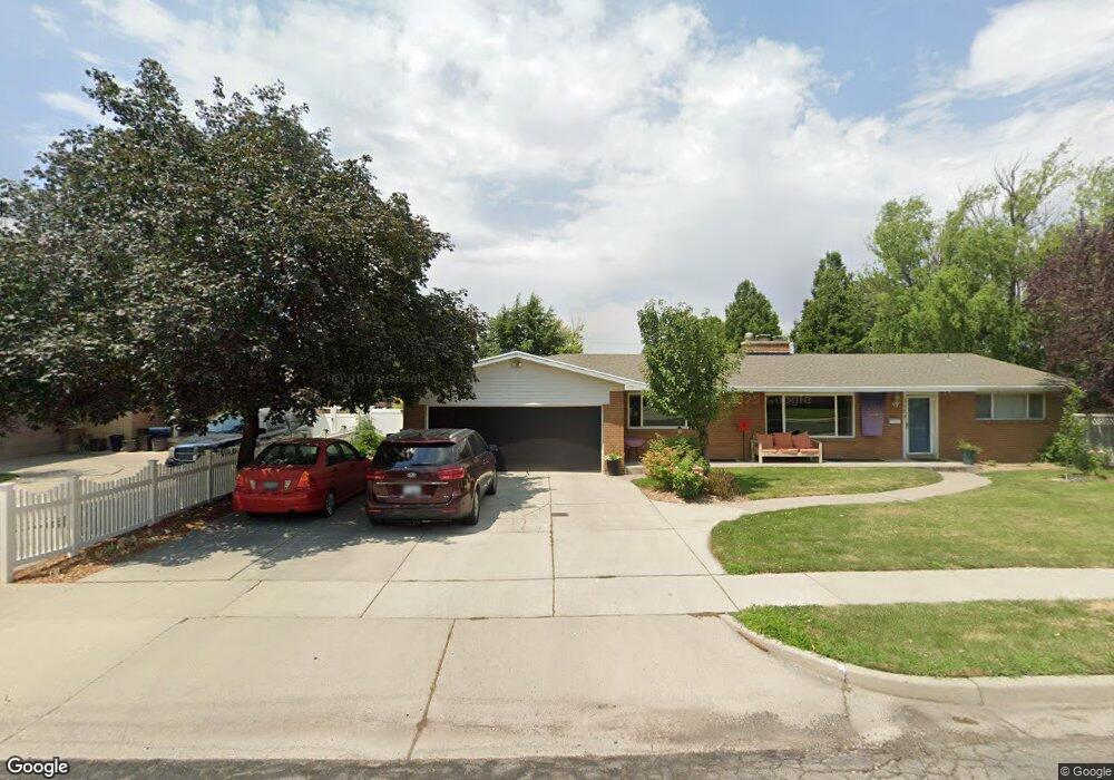
3990 S 1925 E Salt Lake City, UT 84124
Estimated Value: $787,000 - $1,040,000
5
Beds
3
Baths
1,769
Sq Ft
$502/Sq Ft
Est. Value
About This Home
This home is located at 3990 S 1925 E, Salt Lake City, UT 84124 and is currently estimated at $888,325, approximately $502 per square foot. 3990 S 1925 E is a home located in Salt Lake County with nearby schools including Crestview Elementary School, Olympus Junior High School, and Olympus High School.
Ownership History
Date
Name
Owned For
Owner Type
Purchase Details
Closed on
Feb 8, 2017
Sold by
Davis Scott T and Davis Sheri L
Bought by
Davis Scott T and Davis Sheri L
Current Estimated Value
Purchase Details
Closed on
Jul 22, 2013
Sold by
Schow Family Trust
Bought by
Davis Scott T and Davis Sheri L
Home Financials for this Owner
Home Financials are based on the most recent Mortgage that was taken out on this home.
Original Mortgage
$267,200
Outstanding Balance
$193,965
Interest Rate
3.88%
Mortgage Type
New Conventional
Estimated Equity
$694,360
Purchase Details
Closed on
Aug 10, 2005
Sold by
Schow Blake and Schow Betty S
Bought by
Schow Blake and Schow Betty
Purchase Details
Closed on
Feb 12, 1997
Sold by
Ridges Annette N
Bought by
Zions First National Bank and Annette N Ridges Trust
Create a Home Valuation Report for This Property
The Home Valuation Report is an in-depth analysis detailing your home's value as well as a comparison with similar homes in the area
Home Values in the Area
Average Home Value in this Area
Purchase History
| Date | Buyer | Sale Price | Title Company |
|---|---|---|---|
| Davis Scott T | -- | None Available | |
| Davis Scott T | -- | Highland Title Agency | |
| Schow Blake | -- | -- | |
| Zions First National Bank | -- | -- |
Source: Public Records
Mortgage History
| Date | Status | Borrower | Loan Amount |
|---|---|---|---|
| Open | Davis Scott T | $267,200 |
Source: Public Records
Tax History Compared to Growth
Tax History
| Year | Tax Paid | Tax Assessment Tax Assessment Total Assessment is a certain percentage of the fair market value that is determined by local assessors to be the total taxable value of land and additions on the property. | Land | Improvement |
|---|---|---|---|---|
| 2025 | $3,723 | $713,800 | $312,300 | $401,500 |
| 2024 | $3,723 | $673,800 | $302,700 | $371,100 |
| 2023 | $3,612 | $637,000 | $250,700 | $386,300 |
| 2022 | $3,710 | $657,500 | $245,800 | $411,700 |
| 2021 | $3,569 | $549,400 | $227,300 | $322,100 |
| 2020 | $2,656 | $405,400 | $225,300 | $180,100 |
| 2019 | $2,468 | $366,800 | $213,000 | $153,800 |
| 2018 | $2,420 | $347,900 | $213,000 | $134,900 |
| 2017 | $2,163 | $328,300 | $213,000 | $115,300 |
| 2016 | $1,909 | $291,400 | $154,600 | $136,800 |
| 2015 | $1,946 | $265,900 | $175,100 | $90,800 |
| 2014 | $1,786 | $250,200 | $171,600 | $78,600 |
Source: Public Records
Map
Nearby Homes
- 1870 E 3900 S
- 1818 E 3900 S
- 1958 E Longview Dr
- 4129 Colt Haven Cir
- 1801 E 3900 S
- 2087 Lincoln Ln
- 4215 S Holladay Blvd
- 4097 S Highland Dr Unit 3A
- 4128 S Winder Ward Dr Unit 2-122
- Turner 2 Plan at Axis
- 4126 S Winder Ward Dr Unit 2-123
- 4132 S Winder Ward Dr Unit 2-120
- 1840 E Grover Ln
- 1648 E 4150 S
- 4008 S Vernon Cir Unit C
- 4305 S Albright Dr
- 2183 E 3780 S
- 1562 E 3900 S Unit 107
- 1562 E 3900 S Unit 104
- 1562 E 3900 S Unit 106
- 4000 S 1925 E
- 1916 Eldorado Dr
- 4010 S 1925 E
- 3985 S Eldorado Dr
- 3995 S Eldorado Dr
- 3995 Eldorado Dr
- 3985 Eldorado Dr
- 3983 S 1925 E
- 4005 S Eldorado Dr
- 3975 Eldorado Dr
- 1933 E Woodside Dr
- 4005 S 1925 E
- 4005 Eldorado Dr
- 1896 E Woodside Dr
- 4015 Eldorado Dr
- 4015 S Eldorado Dr
- 4020 S 1925 E
- 1797 E Woodside Dr
- 1942 Eldorado Dr
- 1837 E Woodside Dr