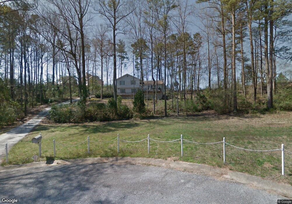
3991 Wrexham Dr Unit 1 Snellville, GA 30039
Estimated Value: $272,000 - $298,000
3
Beds
2
Baths
1,446
Sq Ft
$200/Sq Ft
Est. Value
About This Home
This home is located at 3991 Wrexham Dr Unit 1, Snellville, GA 30039 and is currently estimated at $288,939, approximately $199 per square foot. 3991 Wrexham Dr Unit 1 is a home located in Gwinnett County with nearby schools including Anderson-Livsey Elementary School, Shiloh Middle School, and Shiloh High School.
Ownership History
Date
Name
Owned For
Owner Type
Purchase Details
Closed on
Dec 13, 2023
Sold by
Simpson Willie
Bought by
Willie Simpson 3 Living Trust and Simpson Willie Iii Trust
Current Estimated Value
Purchase Details
Closed on
Jul 24, 2001
Sold by
Jones Margie E
Bought by
Simpson Willie
Home Financials for this Owner
Home Financials are based on the most recent Mortgage that was taken out on this home.
Original Mortgage
$122,806
Interest Rate
7.08%
Mortgage Type
FHA
Create a Home Valuation Report for This Property
The Home Valuation Report is an in-depth analysis detailing your home's value as well as a comparison with similar homes in the area
Home Values in the Area
Average Home Value in this Area
Purchase History
| Date | Buyer | Sale Price | Title Company |
|---|---|---|---|
| Willie Simpson 3 Living Trust | -- | -- | |
| Simpson Willie | $124,000 | -- |
Source: Public Records
Mortgage History
| Date | Status | Borrower | Loan Amount |
|---|---|---|---|
| Previous Owner | Simpson Willie | $122,806 |
Source: Public Records
Tax History Compared to Growth
Tax History
| Year | Tax Paid | Tax Assessment Tax Assessment Total Assessment is a certain percentage of the fair market value that is determined by local assessors to be the total taxable value of land and additions on the property. | Land | Improvement |
|---|---|---|---|---|
| 2024 | $457 | $115,960 | $26,600 | $89,360 |
| 2023 | $457 | $102,440 | $22,080 | $80,360 |
| 2022 | $356 | $95,560 | $22,080 | $73,480 |
| 2021 | $339 | $74,240 | $17,680 | $56,560 |
| 2020 | $336 | $64,480 | $14,280 | $50,200 |
| 2019 | $334 | $28,000 | $10,000 | $18,000 |
| 2018 | $1,095 | $28,000 | $10,000 | $18,000 |
| 2016 | $934 | $22,720 | $7,240 | $15,480 |
| 2015 | $941 | $22,720 | $7,240 | $15,480 |
| 2014 | $1,202 | $29,960 | $7,240 | $22,720 |
Source: Public Records
Map
Nearby Homes
- 3992 Wrexham Dr
- 4111 Wrexham Dr
- 4237 Shoreside Cir Unit 1
- 4107 Round Stone Trail
- 4211 Crestside Ridge
- 3885 Laurens Ln
- 3909 Laurens Ln
- 4262 Mountain Glen Trace
- 4184 Red Laurel Way
- 3911 Mountain Way Cove
- 3760 Mountain Cove Rd
- 4212 Medlock River Ct
- 0 Anderson Livsey Ln Unit 10624770
- 0 Anderson Livsey Ln Unit 10621987
- 3711 Mountain Cove Rd
- 4605 Tims Place
- 4357 James Wade Dr
- 3840 Mountain Cove Rd
- 4001 Wrexham Dr
- 4048 Anderson Livsey Ln
- 0 Anderson-Livsey (Hwy 124) Ln Unit 10092888
- 0 Anderson-Livsey (Hwy 124) Ln Unit 7114119
- 4021 Wrexham Dr
- 3982 Wrexham Dr
- 4002 Wrexham Dr
- 4002 Wrexham Dr Unit 6
- 4052 Anderson Livsey Ln
- 4031 Wrexham Dr
- 4012 Wrexham Dr Unit 2
- 4058 Anderson Livsey Ln
- 4283 Ipwich Ct
- 3964 Centerville Hwy
- 4041 Wrexham Dr
- 4022 Wrexham Dr
- 0 Ipwich Ct SW Unit 3196304
- 0 Ipwich Ct SW Unit 7560459
- 0 Ipwich Ct SW Unit 3136769
- 0 Ipwich Ct SW