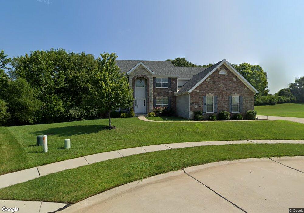
3992 Albers Pointe Dr Florissant, MO 63034
Estimated Value: $464,000 - $552,000
4
Beds
3
Baths
3,890
Sq Ft
$129/Sq Ft
Est. Value
About This Home
This home is located at 3992 Albers Pointe Dr, Florissant, MO 63034 and is currently estimated at $503,639, approximately $129 per square foot. 3992 Albers Pointe Dr is a home with nearby schools including North Middle School, Hazelwood Central High School, and St Norbert School.
Ownership History
Date
Name
Owned For
Owner Type
Purchase Details
Closed on
Jun 12, 2014
Sold by
Mcbride Riverside Llc
Bought by
West Jonathan and Layton Ian
Current Estimated Value
Home Financials for this Owner
Home Financials are based on the most recent Mortgage that was taken out on this home.
Original Mortgage
$332,500
Outstanding Balance
$254,327
Interest Rate
4.35%
Mortgage Type
New Conventional
Estimated Equity
$249,312
Purchase Details
Closed on
Feb 21, 2014
Sold by
Cypress Riverside Llc
Bought by
Mcbride Riverside Llc
Create a Home Valuation Report for This Property
The Home Valuation Report is an in-depth analysis detailing your home's value as well as a comparison with similar homes in the area
Home Values in the Area
Average Home Value in this Area
Purchase History
| Date | Buyer | Sale Price | Title Company |
|---|---|---|---|
| West Jonathan | $418,337 | Title Partners Agency Llc | |
| Mcbride Riverside Llc | -- | -- | |
| Mcbride Riverside Llc | -- | -- |
Source: Public Records
Mortgage History
| Date | Status | Borrower | Loan Amount |
|---|---|---|---|
| Open | West Jonathan | $332,500 |
Source: Public Records
Tax History Compared to Growth
Tax History
| Year | Tax Paid | Tax Assessment Tax Assessment Total Assessment is a certain percentage of the fair market value that is determined by local assessors to be the total taxable value of land and additions on the property. | Land | Improvement |
|---|---|---|---|---|
| 2025 | $7,220 | $91,480 | $9,290 | $82,190 |
| 2024 | $7,220 | $80,350 | $6,100 | $74,250 |
| 2023 | $7,195 | $80,350 | $6,100 | $74,250 |
| 2022 | $7,194 | $71,500 | $13,280 | $58,220 |
| 2021 | $6,804 | $71,500 | $13,280 | $58,220 |
| 2020 | $6,852 | $67,090 | $8,840 | $58,250 |
| 2019 | $6,798 | $67,090 | $8,840 | $58,250 |
| 2018 | $7,405 | $67,610 | $5,990 | $61,620 |
| 2017 | $7,397 | $67,610 | $5,990 | $61,620 |
| 2016 | $8,264 | $74,330 | $6,560 | $67,770 |
| 2015 | $7,948 | $74,330 | $6,560 | $67,770 |
| 2014 | $244 | $2,280 | $2,280 | $0 |
Source: Public Records
Map
Nearby Homes
- 19726 Old Jamestown Rd
- 3809 Albers Pointe Dr
- 1273 Hermans Orchard Dr
- 3932 Secretariat Dr
- 3859 Sonora Stone Dr
- 2 Aspen at Riverstone
- 3844 Rapids Dr
- 1303 Topsider Ct
- 3839 Sonora Stone Dr
- 3840 Sonora Stone Dr
- 235 Quindaro Dr
- 3828 Sonora Stone Dr
- 2 Maple at Riverstone
- 2 Ashford at Riverstone
- 3819 Sonora Stone Dr
- 2 Aspen II at Riverstone
- 2 Berwick at Riverstone
- 16804 River Stone Dr
- 16787 River Stone Dr
- 3849 Secretariat Dr
- 3997 Albers Pointe Dr
- 3980 Albers Pointe Dr
- 3993 Albers Pointe Dr
- 3976 Albers Pointe Dr
- 3989 Albers Pointe Dr
- 3981 Albers Pointe Dr
- 3985 Albers Pointe Dr
- 3977 Albers Pointe Dr
- 3973 Albers Pointe Dr
- 3972 Albers Pointe Dr
- 3965 Albers Pointe Dr
- 3961 Albers Pointe Dr
- 3957 Albers Pointe Dr
- 3968 Albers Pointe Dr
- 3964 Albers Pointe Dr
- 3953 Albers Pointe Dr
- 3960 Albers Pointe Dr
- 3956 Albers Pointe Dr
- 3949 Albers Pointe Dr
- 3952 Albers Pointe Dr