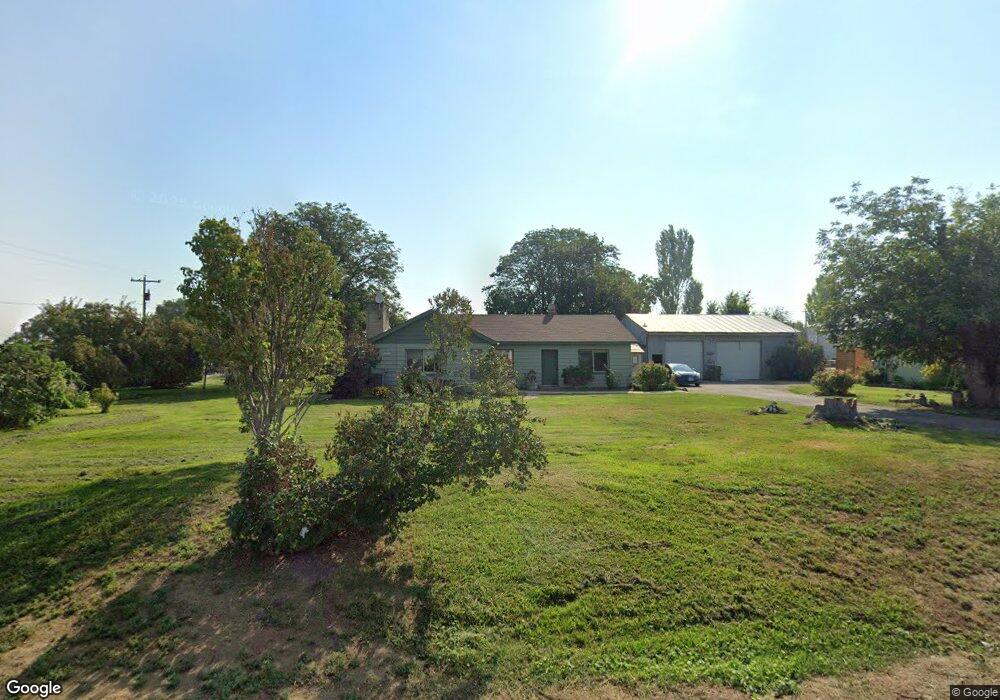
3992 Clark Blvd Ontario, OR 97914
Estimated Value: $162,000 - $261,293
2
Beds
1
Bath
1,418
Sq Ft
$149/Sq Ft
Est. Value
About This Home
This home is located at 3992 Clark Blvd, Ontario, OR 97914 and is currently estimated at $211,647, approximately $149 per square foot. 3992 Clark Blvd is a home located in Malheur County with nearby schools including Ontario High School, Four Rivers Community School, and Treasure Valley Christian School.
Ownership History
Date
Name
Owned For
Owner Type
Purchase Details
Closed on
Jan 6, 2020
Sold by
Jones Jay Lavern and Jones Susan Kay
Bought by
Jones Jay Lavern and Jones Susan Kay
Current Estimated Value
Purchase Details
Closed on
Apr 14, 2014
Sold by
Meldrum Donald K
Bought by
Jones Susan K and Jones Jay Lavern
Home Financials for this Owner
Home Financials are based on the most recent Mortgage that was taken out on this home.
Original Mortgage
$55,500
Interest Rate
4.38%
Mortgage Type
Purchase Money Mortgage
Create a Home Valuation Report for This Property
The Home Valuation Report is an in-depth analysis detailing your home's value as well as a comparison with similar homes in the area
Home Values in the Area
Average Home Value in this Area
Purchase History
| Date | Buyer | Sale Price | Title Company |
|---|---|---|---|
| Jones Jay Lavern | -- | None Available | |
| Jones Susan K | $60,000 | Malheur County Title Co Inc |
Source: Public Records
Mortgage History
| Date | Status | Borrower | Loan Amount |
|---|---|---|---|
| Closed | Jones Susan K | $55,500 |
Source: Public Records
Tax History Compared to Growth
Tax History
| Year | Tax Paid | Tax Assessment Tax Assessment Total Assessment is a certain percentage of the fair market value that is determined by local assessors to be the total taxable value of land and additions on the property. | Land | Improvement |
|---|---|---|---|---|
| 2024 | $1,636 | $121,517 | $42,588 | $78,929 |
| 2023 | $1,612 | $117,978 | $38,422 | $79,556 |
| 2022 | $1,578 | $114,542 | $39,380 | $75,162 |
| 2021 | $1,550 | $111,206 | $37,405 | $73,801 |
| 2020 | $1,499 | $107,967 | $37,747 | $70,220 |
| 2019 | $1,404 | $101,620 | $36,060 | $65,560 |
| 2018 | $1,375 | $102,860 | $37,960 | $64,900 |
| 2017 | $1,396 | $104,823 | $34,021 | $70,802 |
| 2016 | $1,366 | $100,190 | $34,600 | $65,590 |
| 2015 | $1,307 | $95,300 | $35,670 | $59,630 |
| 2014 | $1,268 | $92,450 | $35,670 | $56,780 |
Source: Public Records
Map
Nearby Homes
- 627 Sugar Ave
- 683 Butler Blvd
- 1317 SW 30th St
- 650 Sugar Ave
- 3335 NW 4th Ave
- 1817 Laurel Dr
- 2578 SW 2nd Ave
- 2105 Laurel Dr
- 2562 Lauren Dr
- 2543 Lauren Dr
- 2430 Sunset Dr
- 41 N Dorian Dr
- 1921 Arcata Way
- 163 Hill St
- 3987 Lincoln Dr
- 1863 SW 1st Ave
- 49 NW 19th St
- 1371 SW 11th Ave
- 1752 SW 1st Place
- 1251 Phillips Cir
- 3990 Clark Blvd
- 3991 Clark Blvd
- 604 Butler Blvd
- 3725 SW 18th Ave
- 3600 SW 18th Ave
- 4014 Clark Blvd
- 3974 Clark Blvd
- 3966 Clark Blvd
- 640 Butler Blvd
- 634 Butler Blvd
- 3375 SW 18th Ave
- tbd Chester
- 00 Sunset Rd & Ash Rd
- 0 Annex Area Unit 98091613
- 1 Annex Rd & Various
- TBD Buckhorn Rd
- 00 Evergreen & Power Line
- 652 Butler Blvd
- Lot 58 NW 14th St
- Lot 57 NW 14th St