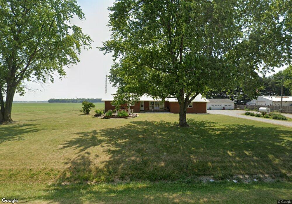
3992 S Us Highway 52 Frankfort, IN 46041
Estimated Value: $208,000 - $351,271
3
Beds
3
Baths
1,770
Sq Ft
$177/Sq Ft
Est. Value
About This Home
This home is located at 3992 S Us Highway 52, Frankfort, IN 46041 and is currently estimated at $312,818, approximately $176 per square foot. 3992 S Us Highway 52 is a home located in Clinton County with nearby schools including Clinton Prairie Elementary School and Clinton Prairie Junior/Senior High School.
Ownership History
Date
Name
Owned For
Owner Type
Purchase Details
Closed on
Sep 17, 2018
Sold by
Platt Glen R and Platt Martha E
Bought by
Smith James and Smith Mary
Current Estimated Value
Home Financials for this Owner
Home Financials are based on the most recent Mortgage that was taken out on this home.
Original Mortgage
$178,703
Outstanding Balance
$156,742
Interest Rate
4.87%
Mortgage Type
FHA
Estimated Equity
$156,076
Purchase Details
Closed on
Sep 14, 2018
Sold by
Glen Martha Platt Trust
Bought by
James Smith
Home Financials for this Owner
Home Financials are based on the most recent Mortgage that was taken out on this home.
Original Mortgage
$178,703
Outstanding Balance
$156,742
Interest Rate
4.87%
Mortgage Type
FHA
Estimated Equity
$156,076
Purchase Details
Closed on
Jul 28, 2000
Sold by
Neal Joseph A
Bought by
Stillwell Jason A and Stillwell Jennifer S
Create a Home Valuation Report for This Property
The Home Valuation Report is an in-depth analysis detailing your home's value as well as a comparison with similar homes in the area
Home Values in the Area
Average Home Value in this Area
Purchase History
| Date | Buyer | Sale Price | Title Company |
|---|---|---|---|
| Smith James | -- | None Available | |
| James Smith | $182,000 | -- | |
| Stillwell Jason A | -- | -- |
Source: Public Records
Mortgage History
| Date | Status | Borrower | Loan Amount |
|---|---|---|---|
| Open | Smith James | $178,703 |
Source: Public Records
Tax History Compared to Growth
Tax History
| Year | Tax Paid | Tax Assessment Tax Assessment Total Assessment is a certain percentage of the fair market value that is determined by local assessors to be the total taxable value of land and additions on the property. | Land | Improvement |
|---|---|---|---|---|
| 2024 | $2,464 | $278,900 | $29,500 | $249,400 |
| 2023 | $2,612 | $279,200 | $29,500 | $249,700 |
| 2022 | $1,899 | $233,200 | $29,500 | $203,700 |
| 2021 | $1,472 | $178,900 | $29,500 | $149,400 |
| 2020 | $1,321 | $157,500 | $29,500 | $128,000 |
| 2019 | $1,299 | $167,100 | $29,500 | $137,600 |
| 2018 | $726 | $167,100 | $29,500 | $137,600 |
| 2017 | $680 | $165,300 | $29,500 | $135,800 |
| 2016 | $650 | $144,300 | $30,600 | $113,700 |
| 2014 | $645 | $140,100 | $30,600 | $109,500 |
Source: Public Records
Map
Nearby Homes
- 406 W Linden St
- 304 W Jefferson St
- 404 W Franklin St
- 208 E Midway St
- 11818 Madison St
- 504 S Clark St
- 9315 High St
- 5778 W County Road 300 S
- 9305 Main St
- 2718 S County Road 450 W
- 5478 W State Road 28
- 8900 Cornell Ct
- 7018 S County Road 430 W
- 7604 N 1000 E
- 7001 N 1075 W
- 7279 N 950 E
- 7255 W Mulberry Jefferson Rd
- 9205 Yorktown St
- 7858 E 800 S
- 6220 W Co Road 200 N
- 3946 S Us Highway 52
- 4072 Us Rt 52
- 3943 S Us Highway 52
- 3930 S Us Highway 52
- 4026 S County Road 880 W
- 3916 S Us Highway 52
- 3887 S Us Highway 52
- 3898 S Us Highway 52
- 4351 S Us Highway 52
- 4436 S County Road 880 W
- 4448 S County Road 880 W
- 8974 W County Road 450 S
- 4468 S County Road 880 W
- 4376 S Us Highway 52
- 4488 S County Road 880 W
- 3521 S Us Highway 52
- 9227 W County Road 450 S
- 4485 S Us Highway 52
- 3448 S Us Highway 52
- 4768 S County Road 880 W