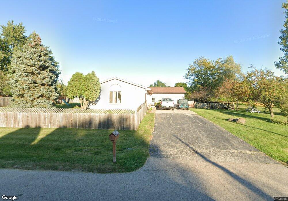
39961 N Adelphi Ave Beach Park, IL 60099
Estimated Value: $290,000 - $393,000
5
Beds
2
Baths
1,288
Sq Ft
$262/Sq Ft
Est. Value
About This Home
This home is located at 39961 N Adelphi Ave, Beach Park, IL 60099 and is currently estimated at $337,826, approximately $262 per square foot. 39961 N Adelphi Ave is a home located in Lake County with nearby schools including Kenneth Murphy School, Beach Park Middle School, and Zion-Benton Township High School.
Ownership History
Date
Name
Owned For
Owner Type
Purchase Details
Closed on
Apr 24, 2018
Sold by
Oregel David
Bought by
Oregel Rigoberto
Current Estimated Value
Purchase Details
Closed on
Nov 16, 2006
Sold by
Tjader Douglas
Bought by
Oregel David
Home Financials for this Owner
Home Financials are based on the most recent Mortgage that was taken out on this home.
Original Mortgage
$176,000
Outstanding Balance
$105,620
Interest Rate
6.47%
Mortgage Type
Purchase Money Mortgage
Estimated Equity
$232,206
Create a Home Valuation Report for This Property
The Home Valuation Report is an in-depth analysis detailing your home's value as well as a comparison with similar homes in the area
Home Values in the Area
Average Home Value in this Area
Purchase History
| Date | Buyer | Sale Price | Title Company |
|---|---|---|---|
| Oregel Rigoberto | -- | None Available | |
| Oregel David | $220,000 | First American Title |
Source: Public Records
Mortgage History
| Date | Status | Borrower | Loan Amount |
|---|---|---|---|
| Open | Oregel David | $176,000 |
Source: Public Records
Tax History Compared to Growth
Tax History
| Year | Tax Paid | Tax Assessment Tax Assessment Total Assessment is a certain percentage of the fair market value that is determined by local assessors to be the total taxable value of land and additions on the property. | Land | Improvement |
|---|---|---|---|---|
| 2024 | $7,703 | $90,066 | $10,452 | $79,614 |
| 2023 | $7,303 | $81,333 | $10,090 | $71,243 |
| 2022 | $7,303 | $74,561 | $9,882 | $64,679 |
| 2021 | $6,659 | $64,924 | $9,631 | $55,293 |
| 2020 | $6,523 | $61,957 | $9,191 | $52,766 |
| 2019 | $6,498 | $58,783 | $8,720 | $50,063 |
| 2018 | $6,624 | $57,901 | $10,577 | $47,324 |
| 2017 | $6,567 | $54,469 | $9,950 | $44,519 |
| 2016 | $6,388 | $51,856 | $9,473 | $42,383 |
| 2015 | $6,185 | $47,557 | $8,688 | $38,869 |
| 2014 | $5,653 | $46,858 | $3,955 | $42,903 |
| 2012 | $5,708 | $48,694 | $4,110 | $44,584 |
Source: Public Records
Map
Nearby Homes
- 13051 Bucksburn Ct
- 39520 N Green Bay Rd
- 13129 W Shannon Dr
- 39787 Torry Ln
- 13154 W Sheffield Ln
- 39401 N Green Bay Rd
- 39631 N Warren Ln Unit 4625
- 39616 N Warren Ln Unit 4824
- 13661 W Adams Rd
- 13551 W Adams Rd
- 13428 Victoria Ln
- 2414 Phillip Dr
- 39113 N Green Bay Rd
- 2407 Phillip Dr
- 2407 Miriam Ave
- 2413 Michael Ave
- 39122 Welsh Ln
- 39092 Welsh Ln Unit 5501
- 39111 N Aberdeen Ln Unit 39111
- 42334 N Heritage Lot 7 Trail
- 12731 W 29th St
- 12764 W Maplewood Rd
- 12705 W 29th St
- 12771 W 29th St
- 12778 W Maplewood Rd
- 12757 W Maplewood Rd
- 12668 W Maplewood Rd
- 40015 N Adelphi Ave
- 12714 W 29th St
- 12798 W Maplewood Rd
- 12675 W 29th St
- 40020 N Adelphi Ave
- 12668 Maplewood Rd
- 12795 W 29th St
- 12737 W 28th Place
- 12651 W 29th St
- 12824 W Maplewood Rd
- 12721 W 28th Place
- 12771 W 28th Place
- 12825 W 29th St