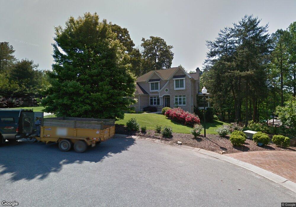
3997 Channel Point Ln Denver, NC 28037
Estimated Value: $1,459,522 - $1,953,000
4
Beds
4
Baths
3,667
Sq Ft
$445/Sq Ft
Est. Value
About This Home
This home is located at 3997 Channel Point Ln, Denver, NC 28037 and is currently estimated at $1,630,631, approximately $444 per square foot. 3997 Channel Point Ln is a home located in Lincoln County with nearby schools including Rock Springs Elementary School, North Lincoln Middle School, and North Lincoln High School.
Ownership History
Date
Name
Owned For
Owner Type
Purchase Details
Closed on
Aug 4, 2006
Sold by
Roberts Brian F and Roberts Nadine L
Bought by
Townson Thomas and Townson Kelly
Current Estimated Value
Home Financials for this Owner
Home Financials are based on the most recent Mortgage that was taken out on this home.
Original Mortgage
$140,000
Interest Rate
6.68%
Mortgage Type
Purchase Money Mortgage
Purchase Details
Closed on
Sep 10, 2001
Bought by
Roberts Brian F and Roberts Nadine L
Purchase Details
Closed on
Nov 15, 2000
Bought by
Crider Linda H
Create a Home Valuation Report for This Property
The Home Valuation Report is an in-depth analysis detailing your home's value as well as a comparison with similar homes in the area
Home Values in the Area
Average Home Value in this Area
Purchase History
| Date | Buyer | Sale Price | Title Company |
|---|---|---|---|
| Townson Thomas | $877,000 | None Available | |
| Roberts Brian F | $86,500 | -- | |
| Crider Linda H | $90,000 | -- |
Source: Public Records
Mortgage History
| Date | Status | Borrower | Loan Amount |
|---|---|---|---|
| Closed | Townson Thomas | $140,000 |
Source: Public Records
Tax History Compared to Growth
Tax History
| Year | Tax Paid | Tax Assessment Tax Assessment Total Assessment is a certain percentage of the fair market value that is determined by local assessors to be the total taxable value of land and additions on the property. | Land | Improvement |
|---|---|---|---|---|
| 2025 | $8,365 | $1,359,566 | $321,819 | $1,037,747 |
| 2024 | $8,318 | $1,359,566 | $321,819 | $1,037,747 |
| 2023 | $8,313 | $1,359,566 | $321,819 | $1,037,747 |
| 2022 | $6,466 | $857,043 | $242,364 | $614,679 |
| 2021 | $6,406 | $857,043 | $242,364 | $614,679 |
| 2020 | $6,119 | $857,043 | $242,364 | $614,679 |
| 2019 | $6,119 | $857,043 | $242,364 | $614,679 |
| 2018 | $5,502 | $728,155 | $232,294 | $495,861 |
| 2017 | $5,286 | $728,155 | $232,294 | $495,861 |
| 2016 | $5,268 | $728,155 | $232,294 | $495,861 |
| 2015 | $5,636 | $728,155 | $232,294 | $495,861 |
| 2014 | $5,495 | $743,600 | $249,494 | $494,106 |
Source: Public Records
Map
Nearby Homes
- 4599 Rustling Woods Dr
- 3988 Channel Point Ln
- 4536 Rustling Woods Dr
- 8065 Bay Pointe Dr
- 7980 Bradford Ln
- 8170 Bay Pointe Dr
- 4628 Sierra View Dr
- 7405 Albemarle Dr
- 7464 Albemarle Dr
- 4550 Osprey Run Ct
- 4424 Augusta Ridge Ct
- 00 Hawkes Bay Ct Unit 121
- 4511 Morning Dove Ct
- 3995 Burton Ln
- 00 Summit Ridge Ln
- 7113 Spyglass Ridge Dr
- 512 Stonemarker Rd
- 4853 Austin Shores Dr
- 7861 Live Oaks Dr
- 102 Stone Point Ct
- 3983 Channel Point Ln
- 3946 Lake Spring Cove Ct
- 3954 Lake Spring Cove Ct
- Lot 256 Channel Pointe Ln
- 3973 Channel Point Ln Unit 249
- 3973 Channel Point Ln
- 3953 Lake Spring Cove Ct Unit 237
- 3953 Lake Spring Cove Ct
- 3942 Lake Spring Cove Ct
- 4000 Channel Point Ln
- 3970 Channel Point Ln
- 3938 Lake Spring Cove Ct
- 3951 Lake Spring Cove Ct Unit 236
- 3951 Lake Spring Cove Ct
- 3958 Channel Point Ln
- 3949 Lake Spring Cove Ct
- 4587 Rustling Woods Dr
- Lot 234 Lake Spring Cove Ct
- 4575 Rustling Woods Dr
- 3928 Lake Spring Cove Ct