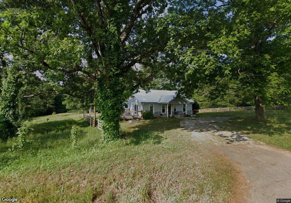
3997 Highway 197 Mt. Airy, GA 30563
Estimated Value: $299,000 - $368,000
3
Beds
2
Baths
1,596
Sq Ft
$216/Sq Ft
Est. Value
About This Home
This home is located at 3997 Highway 197, Mt. Airy, GA 30563 and is currently estimated at $345,025, approximately $216 per square foot. 3997 Highway 197 is a home located in Habersham County with nearby schools including Demorest Elementary School, Habersham Success Academy, and Wilbanks Middle School.
Ownership History
Date
Name
Owned For
Owner Type
Purchase Details
Closed on
May 9, 2022
Sold by
James Tyler Paul
Bought by
Smith Willa B and Smith Christopher N
Current Estimated Value
Home Financials for this Owner
Home Financials are based on the most recent Mortgage that was taken out on this home.
Original Mortgage
$140,000
Outstanding Balance
$124,720
Interest Rate
4.67%
Mortgage Type
New Conventional
Estimated Equity
$220,305
Purchase Details
Closed on
Jun 23, 2017
Sold by
Batson Julie Ferguson
Bought by
James Tyler Paul
Home Financials for this Owner
Home Financials are based on the most recent Mortgage that was taken out on this home.
Original Mortgage
$76,000
Interest Rate
3.95%
Mortgage Type
New Conventional
Purchase Details
Closed on
Feb 1, 2008
Sold by
Not Provided
Bought by
Batson Julie Gale
Purchase Details
Closed on
Dec 3, 2004
Sold by
Hall Diane Franklin
Bought by
Batson Lane T
Create a Home Valuation Report for This Property
The Home Valuation Report is an in-depth analysis detailing your home's value as well as a comparison with similar homes in the area
Home Values in the Area
Average Home Value in this Area
Purchase History
| Date | Buyer | Sale Price | Title Company |
|---|---|---|---|
| Smith Willa B | $317,500 | -- | |
| James Tyler Paul | $80,000 | -- | |
| Batson Julie Gale | -- | -- | |
| Batson Lane T | -- | -- | |
| Batson Lane T | -- | -- | |
| Batson Lane T | -- | -- | |
| Batson Lane T | -- | -- | |
| Batson Lane T | $162,500 | -- |
Source: Public Records
Mortgage History
| Date | Status | Borrower | Loan Amount |
|---|---|---|---|
| Open | Smith Willa B | $140,000 | |
| Previous Owner | James Tyler Paul | $76,000 |
Source: Public Records
Tax History Compared to Growth
Tax History
| Year | Tax Paid | Tax Assessment Tax Assessment Total Assessment is a certain percentage of the fair market value that is determined by local assessors to be the total taxable value of land and additions on the property. | Land | Improvement |
|---|---|---|---|---|
| 2025 | $2,521 | $110,213 | $37,369 | $72,844 |
| 2024 | -- | $119,824 | $26,008 | $93,816 |
| 2023 | $2,320 | $121,572 | $26,008 | $95,564 |
| 2022 | $2,509 | $96,240 | $21,784 | $74,456 |
| 2021 | $1,224 | $47,156 | $19,060 | $28,096 |
| 2020 | $930 | $34,560 | $16,336 | $18,224 |
| 2019 | $930 | $34,560 | $16,336 | $18,224 |
| 2018 | $855 | $32,000 | $16,320 | $15,680 |
| 2017 | $1,028 | $40,188 | $14,632 | $25,556 |
| 2016 | $996 | $100,470 | $14,632 | $25,556 |
| 2015 | $984 | $100,470 | $14,632 | $25,556 |
| 2014 | $989 | $99,160 | $14,632 | $25,032 |
| 2013 | -- | $39,664 | $14,632 | $25,032 |
Source: Public Records
Map
Nearby Homes
- 222 N Mize Rd
- 0 Gladston Rd
- 2240 Hazel Creek Rd
- 787 Ansley Rd
- 111 Dewberry Ln
- 799 Sweetgrass Dr
- 1132 Sydney Ln
- 1126 Sydney Ln
- 136 Sweetgrass Dr
- 1605 Cody Rd
- 676 Sweetgrass Dr
- 815 Sweetgrass Ct
- 309 Morning Star Ln
- 865 Sweetgrass Ct
- 405 Roper Dr
- 409 Roper Dr
- 877 Sweetgrass Ct
- 0 Sweetgrass Dr Unit 7658113
- 0 Sweetgrass Dr Unit 7658111
- 1780 Double Bridge Rd
- 3997 Highway 197
- 4000 Highway 197
- 102 Blacksnake Rd
- 253 Blacksnake Rd
- 3825 Highway 197
- 00 Cody Rd
- 4092 Highway 197
- 155 Cody Rd
- 4092 Georgia 197
- 209 Cody Rd
- 0 Blacksnake Rd Unit 8266659
- 0 Blacksnake Rd Unit TR4 7434594
- 0 Blacksnake Rd Unit TR4 7609367
- 0 Blacksnake Rd Unit 30.67 ACRES 8726321
- 0 Blacksnake Rd Unit 8756725
- 0 Blacksnake Rd Unit 8762284
- 0 Blacksnake Rd Unit 8726321
- 0 Blacksnake Rd Unit 8763914
- 0 Blacksnake Rd Unit 3258857
- 0 Blacksnake Rd Unit 7029613