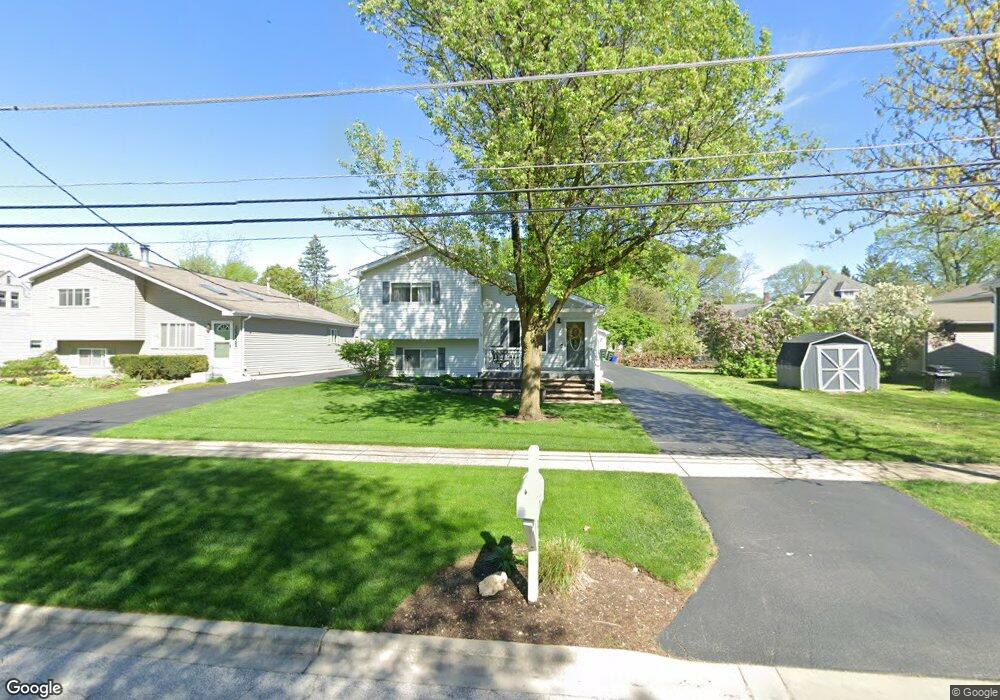
3S445 Manning Ave Warrenville, IL 60555
Estimated Value: $363,444 - $466,000
--
Bed
--
Bath
1,564
Sq Ft
$271/Sq Ft
Est. Value
About This Home
This home is located at 3S445 Manning Ave, Warrenville, IL 60555 and is currently estimated at $423,611, approximately $270 per square foot. 3S445 Manning Ave is a home located in DuPage County with nearby schools including Bower Elementary School, Hubble Middle School, and Wheaton Warrenville South High School.
Ownership History
Date
Name
Owned For
Owner Type
Purchase Details
Closed on
Jun 2, 1999
Sold by
Neal C David and Neal Barbara C
Bought by
Neal David W and Neal Lynette J
Current Estimated Value
Home Financials for this Owner
Home Financials are based on the most recent Mortgage that was taken out on this home.
Original Mortgage
$132,500
Outstanding Balance
$63,756
Interest Rate
2.95%
Mortgage Type
Purchase Money Mortgage
Estimated Equity
$359,855
Create a Home Valuation Report for This Property
The Home Valuation Report is an in-depth analysis detailing your home's value as well as a comparison with similar homes in the area
Home Values in the Area
Average Home Value in this Area
Purchase History
| Date | Buyer | Sale Price | Title Company |
|---|---|---|---|
| Neal David W | -- | First American Title Ins |
Source: Public Records
Mortgage History
| Date | Status | Borrower | Loan Amount |
|---|---|---|---|
| Open | Neal David W | $132,500 |
Source: Public Records
Tax History Compared to Growth
Tax History
| Year | Tax Paid | Tax Assessment Tax Assessment Total Assessment is a certain percentage of the fair market value that is determined by local assessors to be the total taxable value of land and additions on the property. | Land | Improvement |
|---|---|---|---|---|
| 2024 | $8,253 | $120,713 | $20,584 | $100,129 |
| 2023 | $7,810 | $110,250 | $18,800 | $91,450 |
| 2022 | $7,473 | $103,050 | $17,580 | $85,470 |
| 2021 | $7,093 | $98,780 | $16,850 | $81,930 |
| 2020 | $6,912 | $95,780 | $16,340 | $79,440 |
| 2019 | $6,544 | $91,210 | $15,560 | $75,650 |
| 2018 | $5,972 | $85,260 | $14,560 | $70,700 |
| 2017 | $5,807 | $81,010 | $13,830 | $67,180 |
| 2016 | $5,580 | $75,530 | $12,890 | $62,640 |
| 2015 | $5,368 | $69,380 | $11,930 | $57,450 |
| 2014 | $5,135 | $64,270 | $11,250 | $53,020 |
| 2013 | $5,168 | $66,620 | $11,660 | $54,960 |
Source: Public Records
Map
Nearby Homes
- 28W569 Warrenville Rd
- 28W773 Stafford Place
- 3S281 Rockwell St
- 28W544 Rogers Ave
- 28W671 Rogers Ave
- 3S511 4th St
- 28W686 Townline Rd
- 28W556 Forestview Dr
- 31306 Kline Cir
- 29W409 White Oak Dr Unit 5
- 29W425 Thornwood Ln
- 3S656 Landon Ave
- 3S268 Twin Pines Dr
- 31104 Carpenter Ct
- 28W041 Greenview Ave
- 29W420 Tanglewood Ln
- 29W101 Morris Ct
- 2S749 Grove Ln
- 29W441 Butternut Ln
- 3S184 Birchwood Dr
- 3S435 Manning Ave
- 3S425 Manning Ave
- 28W646 Warrenville Rd
- 28W650 Warrenville Rd
- 28W640 Warrenville Rd
- 3S415 Manning Ave
- 3S430 Manning Ave
- 28W630 Warrenville Rd
- 28W623 Main St
- 28W670 Warrenville Rd
- 3S410 Manning Ave
- 28W678 Warrenville Rd
- 28W620 Warrenville Rd
- 28W684 Warrenville Rd
- 28W605 Main St
- 28W645 Warrenville Rd
- 28W700 Warrenville Rd
- 28W650 Main St
- 28W681 Main St
- 28W665 Warrenville Rd