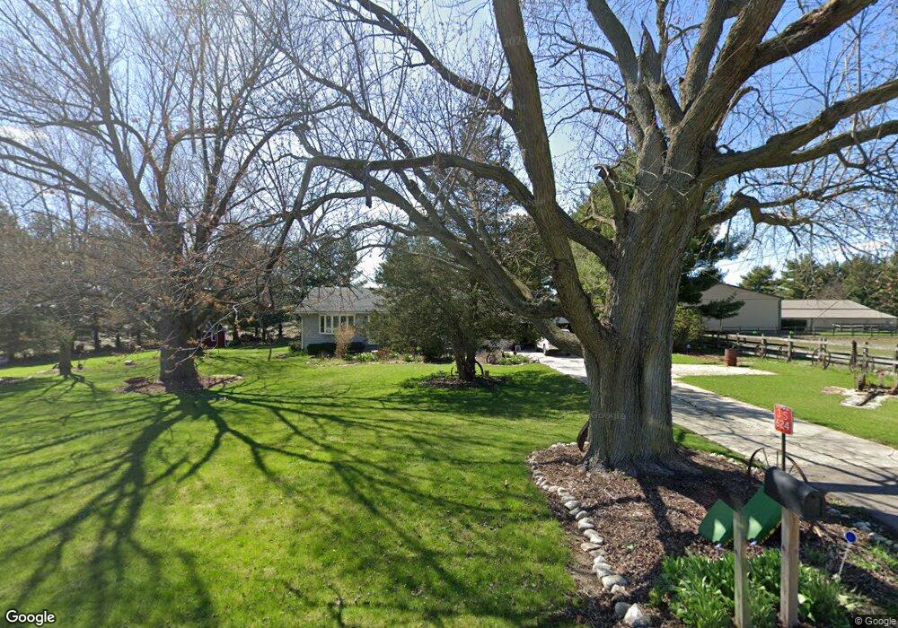
3S624 Norris Rd Sugar Grove, IL 60554
Nelson Lake NeighborhoodEstimated Value: $373,828 - $612,000
--
Bed
--
Bath
--
Sq Ft
1.2
Acres
About This Home
This home is located at 3S624 Norris Rd, Sugar Grove, IL 60554 and is currently estimated at $470,957. 3S624 Norris Rd is a home located in Kane County with nearby schools including Kaneland Blackberry Creek Elementary School, Harter Middle School, and Kaneland Senior High School.
Ownership History
Date
Name
Owned For
Owner Type
Purchase Details
Closed on
Jun 25, 2012
Sold by
Slyford Steven G and Slyford Debra L
Bought by
Slyford Debra L
Current Estimated Value
Purchase Details
Closed on
May 29, 1998
Sold by
Elwer Stephen P and Giosso Christine E
Bought by
Slyford Steven G and Slyford Debra L
Home Financials for this Owner
Home Financials are based on the most recent Mortgage that was taken out on this home.
Original Mortgage
$156,000
Interest Rate
7.27%
Purchase Details
Closed on
Mar 3, 1995
Sold by
Mutehart Patricia G and Mutehart Duane J
Bought by
Elwer Stephen P and Giosso Christine E
Home Financials for this Owner
Home Financials are based on the most recent Mortgage that was taken out on this home.
Original Mortgage
$122,393
Interest Rate
9.13%
Mortgage Type
FHA
Create a Home Valuation Report for This Property
The Home Valuation Report is an in-depth analysis detailing your home's value as well as a comparison with similar homes in the area
Home Values in the Area
Average Home Value in this Area
Purchase History
| Date | Buyer | Sale Price | Title Company |
|---|---|---|---|
| Slyford Debra L | -- | None Available | |
| Slyford Steven G | $164,500 | Law Title Insurance Company | |
| Elwer Stephen P | $133,000 | Ticor Title Ins |
Source: Public Records
Mortgage History
| Date | Status | Borrower | Loan Amount |
|---|---|---|---|
| Previous Owner | Slyford Steven G | $156,000 | |
| Previous Owner | Elwer Stephen P | $122,393 |
Source: Public Records
Tax History Compared to Growth
Tax History
| Year | Tax Paid | Tax Assessment Tax Assessment Total Assessment is a certain percentage of the fair market value that is determined by local assessors to be the total taxable value of land and additions on the property. | Land | Improvement |
|---|---|---|---|---|
| 2024 | $5,171 | $73,274 | $15,792 | $57,482 |
| 2023 | $4,960 | $66,132 | $14,253 | $51,879 |
| 2022 | $4,345 | $55,533 | $13,081 | $42,452 |
| 2021 | $4,021 | $51,172 | $12,520 | $38,652 |
| 2020 | $3,949 | $49,973 | $12,227 | $37,746 |
| 2019 | $3,960 | $49,239 | $12,047 | $37,192 |
| 2018 | $3,617 | $44,556 | $12,047 | $32,509 |
| 2017 | $3,629 | $44,049 | $11,910 | $32,139 |
| 2016 | $4,260 | $49,662 | $20,775 | $28,887 |
| 2015 | -- | $53,078 | $19,964 | $33,114 |
| 2014 | -- | $64,290 | $12,793 | $51,497 |
| 2013 | -- | $64,290 | $12,793 | $51,497 |
Source: Public Records
Map
Nearby Homes
- 2772 Berman Rd Unit 1A
- 965 Carmen Rd
- 954 Black Walnut Dr
- 1010 Forest Trail
- 1303 Dorr Dr
- 1271 Mcdole Dr Unit 1
- 947 Lakeridge Ct
- 933 Lakeridge Ct
- 841 Black Walnut Dr
- 868 Edgewood Dr
- 618 Pine St Unit 2
- 512 Bennett Dr
- 723 Queens Gate Cir
- 905 Merrill New Rd
- 1070 Wheatfield Ave
- 604 Hickory
- 1004 Wheatfield Ave
- 1044 Redbud Ln
- 966 Wheatfield Ave
- 740 Manor Hill Place
- 40W699 Norris Rd
- 3S559 Norris Rd
- 40W781 Norris Rd
- 3S505 Norris Rd
- 40W778 Norris Rd
- 3S679 Norris Rd
- 3S730 Norris Rd
- 40W789 Norris Rd
- 40W835 Norris Rd
- 40w Norris Rd
- 40W839 Norris Rd
- 40W574 Tanner Rd
- 40W903 Norris Rd
- 40W505 Tanner Rd
- 3s Norris Rd
- 3S557 Norris Rd
- 40W254 Tanner Rd
- 40W218 Tanner Rd
- 4S267 Norris Rd
- 4S053 Norris Rd