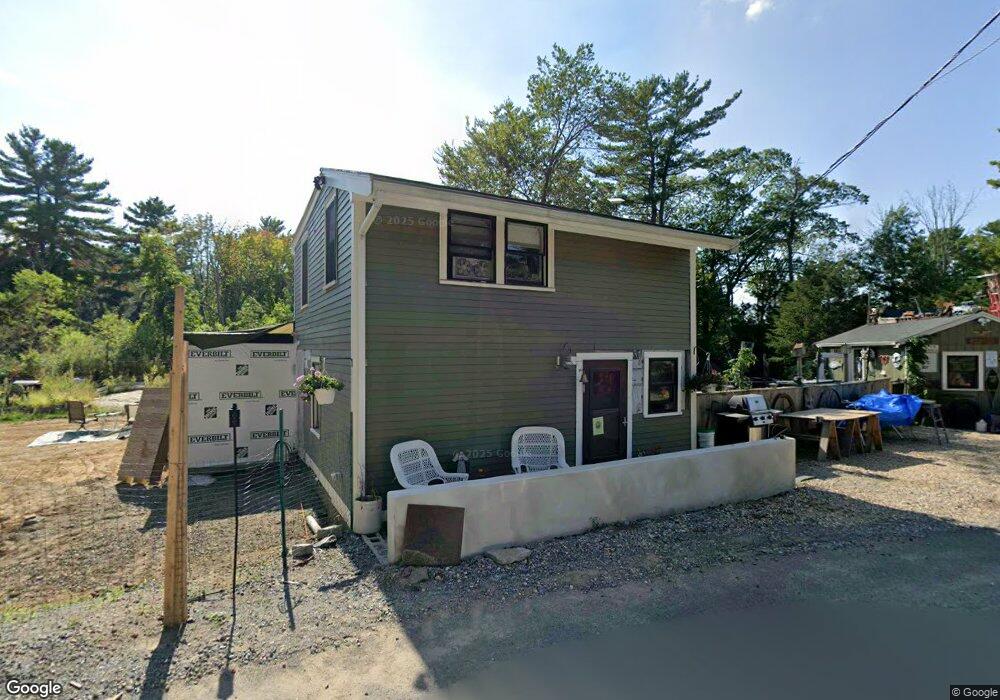
4 Andrews Ct Gloucester, MA 01930
West Gloucester NeighborhoodEstimated Value: $488,000 - $628,000
2
Beds
1
Bath
1,000
Sq Ft
$582/Sq Ft
Est. Value
About This Home
This home is located at 4 Andrews Ct, Gloucester, MA 01930 and is currently estimated at $581,626, approximately $581 per square foot. 4 Andrews Ct is a home located in Essex County with nearby schools including West Parish, Ralph B O'maley Middle School, and Gloucester High School.
Ownership History
Date
Name
Owned For
Owner Type
Purchase Details
Closed on
Oct 15, 2018
Sold by
Clayton Heidi E
Bought by
Marques Christopher T
Current Estimated Value
Home Financials for this Owner
Home Financials are based on the most recent Mortgage that was taken out on this home.
Original Mortgage
$148,000
Outstanding Balance
$127,649
Interest Rate
4%
Mortgage Type
New Conventional
Estimated Equity
$453,977
Purchase Details
Closed on
Mar 13, 2014
Sold by
Clayton Norma
Bought by
Clayton Heidi E
Create a Home Valuation Report for This Property
The Home Valuation Report is an in-depth analysis detailing your home's value as well as a comparison with similar homes in the area
Home Values in the Area
Average Home Value in this Area
Purchase History
| Date | Buyer | Sale Price | Title Company |
|---|---|---|---|
| Marques Christopher T | $185,000 | -- | |
| Clayton Heidi E | -- | -- |
Source: Public Records
Mortgage History
| Date | Status | Borrower | Loan Amount |
|---|---|---|---|
| Open | Marques Christopher T | $148,000 |
Source: Public Records
Tax History
| Year | Tax Paid | Tax Assessment Tax Assessment Total Assessment is a certain percentage of the fair market value that is determined by local assessors to be the total taxable value of land and additions on the property. | Land | Improvement |
|---|---|---|---|---|
| 2025 | $4,960 | $510,300 | $214,600 | $295,700 |
| 2024 | $4,866 | $500,100 | $204,400 | $295,700 |
| 2023 | $4,523 | $427,100 | $182,500 | $244,600 |
| 2022 | $4,484 | $382,300 | $158,600 | $223,700 |
| 2021 | $4,282 | $344,200 | $144,200 | $200,000 |
| 2020 | $3,840 | $311,400 | $144,200 | $167,200 |
| 2019 | $3,634 | $286,400 | $144,200 | $142,200 |
| 2018 | $3,509 | $271,400 | $144,200 | $127,200 |
| 2017 | $3,381 | $256,300 | $137,300 | $119,000 |
| 2016 | $3,326 | $244,400 | $143,200 | $101,200 |
| 2015 | $3,246 | $237,800 | $143,200 | $94,600 |
Source: Public Records
Map
Nearby Homes
- 587 Essex Ave
- 7 Leaman Dr
- 15 Lufkin Point Rd
- 162 Main St
- 90 Southern Ave Unit 90
- 145 Main St Unit 1
- 145 Main St Unit 4
- 368 Essex Ave
- 34 & 34R Pickering St
- 85 Martin St
- 4 Tara Rd
- 3 Hardy Ln
- 5 Samoset Rd Unit B
- 167 Atlantic St
- 5 Lepage Ln
- 24 Cobblestone Ln Unit 603
- 178 Atlantic St
- 145 Essex Ave Unit 402
- 450 Summer St
- 468 Summer St
Your Personal Tour Guide
Ask me questions while you tour the home.