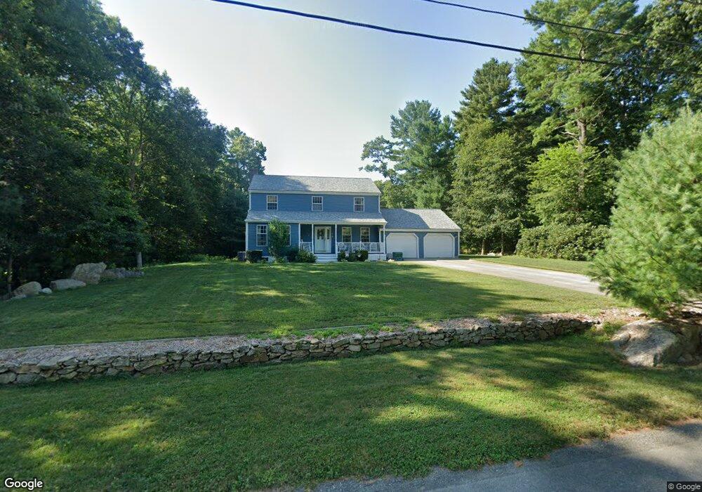
4 Andys Ct Acushnet, MA 02743
Estimated Value: $586,000 - $680,000
Studio
3
Baths
1,992
Sq Ft
$310/Sq Ft
Est. Value
About This Home
This home is located at 4 Andys Ct, Acushnet, MA 02743 and is currently estimated at $616,557, approximately $309 per square foot. 4 Andys Ct is a home located in Bristol County with nearby schools including Acushnet Elementary School, Albert F Ford Middle School, and Alma Del Mar Charter School.
Ownership History
Date
Name
Owned For
Owner Type
Purchase Details
Closed on
Nov 14, 2024
Sold by
Demello Joseph P and Demello Mary E
Bought by
Demello Irt and Corts
Current Estimated Value
Create a Home Valuation Report for This Property
The Home Valuation Report is an in-depth analysis detailing your home's value as well as a comparison with similar homes in the area
Purchase History
| Date | Buyer | Sale Price | Title Company |
|---|---|---|---|
| Demello Irt | -- | None Available | |
| Demello Irt | -- | None Available |
Source: Public Records
Tax History
| Year | Tax Paid | Tax Assessment Tax Assessment Total Assessment is a certain percentage of the fair market value that is determined by local assessors to be the total taxable value of land and additions on the property. | Land | Improvement |
|---|---|---|---|---|
| 2025 | $54 | $499,200 | $136,100 | $363,100 |
| 2024 | $5,185 | $454,400 | $128,700 | $325,700 |
| 2023 | $5,074 | $422,800 | $111,400 | $311,400 |
| 2022 | $4,776 | $359,900 | $106,400 | $253,500 |
| 2021 | $4,675 | $338,000 | $106,400 | $231,600 |
| 2020 | $4,712 | $338,000 | $106,400 | $231,600 |
| 2019 | $4,745 | $334,600 | $108,900 | $225,700 |
| 2018 | $4,596 | $318,700 | $108,900 | $209,800 |
| 2017 | $4,465 | $309,200 | $108,900 | $200,300 |
| 2016 | $4,196 | $288,800 | $101,500 | $187,300 |
| 2015 | $4,124 | $288,800 | $101,500 | $187,300 |
Source: Public Records
Map
Nearby Homes
Your Personal Tour Guide
Ask me questions while you tour the home.