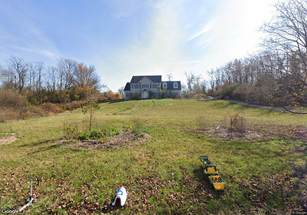
4 Angus Ln Blairstown, NJ 07825
Estimated Value: $673,417 - $720,000
--
Bed
--
Bath
3,080
Sq Ft
$224/Sq Ft
Est. Value
About This Home
This home is located at 4 Angus Ln, Blairstown, NJ 07825 and is currently estimated at $689,354, approximately $223 per square foot. 4 Angus Ln is a home located in Warren County with nearby schools including Blairstown Elementary School and North Warren Regional School.
Ownership History
Date
Name
Owned For
Owner Type
Purchase Details
Closed on
Jul 23, 2020
Sold by
Rhode Melissa and Jablonski Jonathan
Bought by
Jablonski Jonathan and Jablonski Melissa
Current Estimated Value
Home Financials for this Owner
Home Financials are based on the most recent Mortgage that was taken out on this home.
Original Mortgage
$265,340
Interest Rate
2.9%
Mortgage Type
New Conventional
Purchase Details
Closed on
Jul 27, 2011
Sold by
Bauer Bruce M and Bauer Dineen
Bought by
Jablonski Jonathan and Rhode Melissa
Home Financials for this Owner
Home Financials are based on the most recent Mortgage that was taken out on this home.
Original Mortgage
$361,000
Interest Rate
4.52%
Mortgage Type
New Conventional
Purchase Details
Closed on
Jun 15, 2000
Sold by
J M R Builders Inc
Bought by
Bauer Bruce M and Bauer Dineen
Home Financials for this Owner
Home Financials are based on the most recent Mortgage that was taken out on this home.
Original Mortgage
$299,250
Interest Rate
8.48%
Create a Home Valuation Report for This Property
The Home Valuation Report is an in-depth analysis detailing your home's value as well as a comparison with similar homes in the area
Home Values in the Area
Average Home Value in this Area
Purchase History
| Date | Buyer | Sale Price | Title Company |
|---|---|---|---|
| Jablonski Jonathan | -- | None Listed On Document | |
| Jablonski Jonathan | $380,000 | Chicago Title Insurance Co | |
| Bauer Bruce M | $329,000 | -- |
Source: Public Records
Mortgage History
| Date | Status | Borrower | Loan Amount |
|---|---|---|---|
| Previous Owner | Jablonski Jonathan | $265,340 | |
| Previous Owner | Jablonski Jonathan | $361,000 | |
| Previous Owner | Bauer Bruce M | $299,250 |
Source: Public Records
Tax History Compared to Growth
Tax History
| Year | Tax Paid | Tax Assessment Tax Assessment Total Assessment is a certain percentage of the fair market value that is determined by local assessors to be the total taxable value of land and additions on the property. | Land | Improvement |
|---|---|---|---|---|
| 2025 | $12,382 | $399,300 | $118,800 | $280,500 |
| 2024 | $11,508 | $399,300 | $118,800 | $280,500 |
| 2023 | $11,272 | $399,300 | $118,800 | $280,500 |
| 2022 | $11,272 | $399,300 | $118,800 | $280,500 |
| 2021 | $9,647 | $399,300 | $118,800 | $280,500 |
| 2020 | $9,871 | $399,300 | $118,800 | $280,500 |
| 2019 | $9,184 | $399,300 | $118,800 | $280,500 |
| 2018 | $9,184 | $399,300 | $118,800 | $280,500 |
| 2017 | $9,216 | $399,300 | $118,800 | $280,500 |
| 2016 | $9,248 | $399,300 | $118,800 | $280,500 |
| 2015 | $9,088 | $399,300 | $118,800 | $280,500 |
| 2014 | $8,912 | $399,300 | $118,800 | $280,500 |
Source: Public Records
Map
Nearby Homes
- 5 Alice Ct
- 3 Hoagland Rd
- 2 Frontage Rd
- 60 Vail Rd
- 20 Polkville Rd
- 123 Vail Rd
- 143 Vail Rd
- 18 W Crisman Rd
- 3 Hickory Ridge Dr
- 0 Cedar Lake Rd Unit 3936605
- 7 Gap View Dr
- 148 Vail Rd
- 1 Bridge Rd
- 10 Poppys Ct
- 94 Hoagland Rd
- 135 N Locust Lake Rd
- 77 Union Brick Rd
- 5 N Terrace Rd
- 46 Union Brick Rd
- 49 Mount Pleasant Rd
- 5 Angus Ln
- 1 Angus Ln
- 39 Kishpaugh Rd
- 41 Kishpaugh Rd
- 37 Kishpaugh Rd
- 18 Shotwell Rd
- 45 Kishpaugh Rd
- 47 Kishpaugh Rd
- 38 Kishpaugh Rd
- 40 Kishpaugh Rd
- 36 Kishpaugh Rd
- 31 Kishpaugh Rd
- 33 Kishpaugh Rd
- 42 Kishpaugh Rd
- 51 Kishpaugh Rd
- 44 Kishpaugh Rd
- 46 Kishpaugh Rd
- 30 Kishpaugh Rd
- 29 Kishpaugh Rd
- 29 Kishpaugh Rd