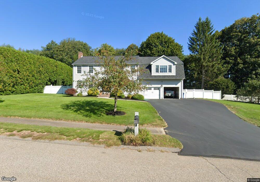
4 Appleton Way Medway, MA 02053
Estimated Value: $838,684 - $937,000
3
Beds
3
Baths
2,452
Sq Ft
$364/Sq Ft
Est. Value
About This Home
This home is located at 4 Appleton Way, Medway, MA 02053 and is currently estimated at $891,921, approximately $363 per square foot. 4 Appleton Way is a home located in Norfolk County with nearby schools including John D. McGovern Elementary School, Burke-Memorial Elementary, and Medway Middle School.
Ownership History
Date
Name
Owned For
Owner Type
Purchase Details
Closed on
Jan 31, 1997
Sold by
Whelan Tr W Gregory
Bought by
Potty Jeffrey A and Potty Dorothy E
Current Estimated Value
Create a Home Valuation Report for This Property
The Home Valuation Report is an in-depth analysis detailing your home's value as well as a comparison with similar homes in the area
Home Values in the Area
Average Home Value in this Area
Purchase History
| Date | Buyer | Sale Price | Title Company |
|---|---|---|---|
| Potty Jeffrey A | $228,900 | -- |
Source: Public Records
Mortgage History
| Date | Status | Borrower | Loan Amount |
|---|---|---|---|
| Open | Potty Jeffrey A | $175,000 | |
| Closed | Potty Jeffrey A | $206,287 | |
| Closed | Potty Jeffrey A | $20,000 |
Source: Public Records
Tax History
| Year | Tax Paid | Tax Assessment Tax Assessment Total Assessment is a certain percentage of the fair market value that is determined by local assessors to be the total taxable value of land and additions on the property. | Land | Improvement |
|---|---|---|---|---|
| 2025 | $10,596 | $743,600 | $328,800 | $414,800 |
| 2024 | $10,708 | $743,600 | $328,800 | $414,800 |
| 2023 | $10,624 | $666,500 | $299,300 | $367,200 |
| 2022 | $9,823 | $580,200 | $221,300 | $358,900 |
| 2021 | $9,872 | $565,400 | $206,500 | $358,900 |
| 2020 | $9,846 | $562,600 | $206,500 | $356,100 |
| 2019 | $9,194 | $541,800 | $198,100 | $343,700 |
| 2018 | $9,282 | $525,600 | $189,700 | $335,900 |
| 2017 | $9,154 | $510,800 | $185,500 | $325,300 |
| 2016 | $8,787 | $485,200 | $170,700 | $314,500 |
| 2015 | $8,721 | $478,100 | $168,600 | $309,500 |
| 2014 | $8,474 | $449,800 | $168,600 | $281,200 |
Source: Public Records
Map
Nearby Homes
- 58 Holliston St
- 50 Main St
- 33 Gorwin Dr
- 19 Evergreen St Unit A
- 8 Winthrop St
- 253 Village St
- 20 Broad St Unit 1
- 20 Broad St Unit 6
- 20 Broad St Unit A
- 20 Broad St Unit 4
- 10 Barber St
- 79 Lovering St Unit B
- 14 Sanford St Unit 47
- 10 Franklin St
- 19 Sycamore Way
- 839 Lincoln St
- 40 Timber Crest Dr
- 1391 Pond St
- 26 Timber Crest Dr
- 11 Fairway Ln
- 71 Holliston St
- 6 Appleton Way
- 73 Holliston St
- 78 Holliston St
- 77 Main St Lower Lvl Units
- 77 Main St Unit 1
- 77 Main St Unit A
- 77 Main St Unit B
- 77 Main St
- 3 Appleton Way
- 8 Appleton Way
- 69 Holliston St
- 5 Appleton Way
- 72 Holliston St
- 70 Holliston St
- 76 Holliston St
- 81 Main St
- 80 Holliston St
- 67 Holliston St
- 82 Holliston St Unit C
Your Personal Tour Guide
Ask me questions while you tour the home.