Estimated Value: $3,515,000 - $3,593,000
4
Beds
4
Baths
3,201
Sq Ft
$1,110/Sq Ft
Est. Value
About This Home
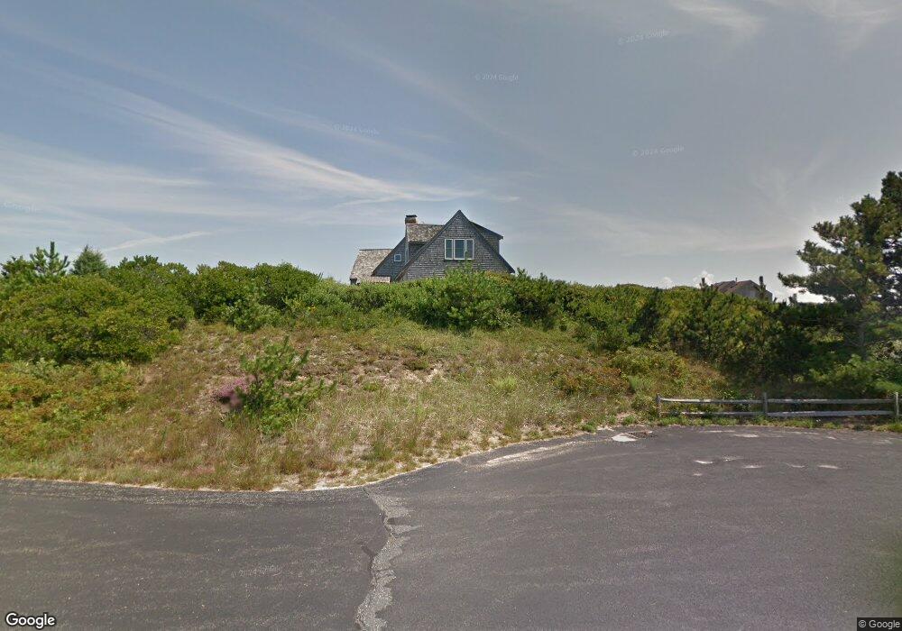
This home is located at 4 Bearberry Ln, Truro, MA 2666 and is currently estimated at $3,552,694, approximately $1,109 per square foot. 4 Bearberry Ln is a home located in Barnstable County.
Ownership History
Date
Name
Owned For
Owner Type
Purchase Details
Closed on
Feb 14, 2003
Sold by
Pierce Jean M
Bought by
Tobin Jesselyn L and Stoddard Audrey
Current Estimated Value
Purchase Details
Closed on
May 22, 1997
Sold by
Hilltop Great Holw Lp and Dain Carolyn
Bought by
Pierce James A and Pierce Jean M
Home Financials for this Owner
Home Financials are based on the most recent Mortgage that was taken out on this home.
Original Mortgage
$216,000
Interest Rate
8.08%
Mortgage Type
Purchase Money Mortgage
Create a Home Valuation Report for This Property
The Home Valuation Report is an in-depth analysis detailing your home's value as well as a comparison with similar homes in the area
Home Values in the Area
Average Home Value in this Area
Purchase History
| Date | Buyer | Sale Price | Title Company |
|---|---|---|---|
| Tobin Jesselyn L | $1,800,000 | -- | |
| Tobin Jesselyn L | $1,800,000 | -- | |
| Pierce James A | $270,000 | -- | |
| Pierce James A | $270,000 | -- |
Source: Public Records
Mortgage History
| Date | Status | Borrower | Loan Amount |
|---|---|---|---|
| Previous Owner | Pierce James A | $25,000 | |
| Previous Owner | Pierce James A | $216,000 |
Source: Public Records
Tax History Compared to Growth
Tax History
| Year | Tax Paid | Tax Assessment Tax Assessment Total Assessment is a certain percentage of the fair market value that is determined by local assessors to be the total taxable value of land and additions on the property. | Land | Improvement |
|---|---|---|---|---|
| 2025 | $18,936 | $3,064,100 | $1,350,300 | $1,713,800 |
| 2024 | $17,912 | $2,990,400 | $1,336,900 | $1,653,500 |
| 2023 | $16,368 | $2,502,700 | $1,162,400 | $1,340,300 |
| 2022 | $15,475 | $2,002,000 | $1,002,000 | $1,000,000 |
| 2021 | $14,134 | $1,915,200 | $1,002,000 | $913,200 |
| 2020 | $13,982 | $1,907,500 | $992,000 | $915,500 |
| 2019 | $13,908 | $1,866,900 | $992,000 | $874,900 |
| 2018 | $13,222 | $1,794,000 | $992,000 | $802,000 |
| 2017 | $12,268 | $1,757,600 | $992,000 | $765,600 |
| 2016 | $11,796 | $1,742,400 | $982,300 | $760,100 |
| 2015 | $11,354 | $1,712,500 | $972,700 | $739,800 |
Source: Public Records
Map
Nearby Homes
- 27 Fishermans Rd
- 23 Crestview Cir
- 7 Great Hollow Rd Unit 50
- 3 Bayberry Rd
- 25 Noons Dr
- 7 Great Hollow Rd Unit 50
- 7 Fishermans Rd
- 2 Aldrich Rd
- 2 Amanda Ln
- 4 Resolution Rd
- 25 Resolution Rd
- 52 Corn Hill Rd
- 4 S Highland Rd Unit C
- 5 Sylvan Ln
- 18 Hopkins Way
- 6 Long Nook Ln
- 22 Shore Rd
- 9 Kinnikinnick Rd
- 14 N Union Field Rd
- 6 Professional Heights Rd Unit 1
- 0 Bearberry Ln
- 7 Quail Run
- 6 Bearberry Ln
- 5 Bearberry Ln
- 1 Bearberry Ln
- 3 Kill Devil Rd
- 55 Fishermans Landing
- 55 Fishermans Rd
- 8 Heather Ln
- 29 Hart Rd
- 53 Fishermans Rd
- 6 Heather Ln
- 22 Hart Rd
- 7 Heather Ln
- 33 Great Hollow Ln
- 21 Hart Rd
- 51 Fishermans Rd
- 51 Fishermans Landing
- 6 Quail Way
- 4 Kill Devil Rd