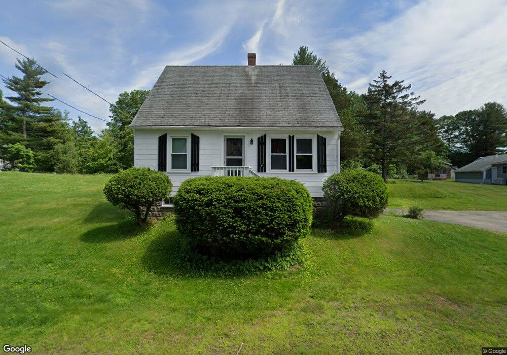
4 Beech Rd Eliot, ME 03903
South Eliot NeighborhoodEstimated Value: $263,181 - $380,000
2
Beds
1
Bath
675
Sq Ft
$478/Sq Ft
Est. Value
About This Home
This home is located at 4 Beech Rd, Eliot, ME 03903 and is currently estimated at $322,545, approximately $477 per square foot. 4 Beech Rd is a home located in York County with nearby schools including Marshwood High School and Seacoast Waldorf School.
Ownership History
Date
Name
Owned For
Owner Type
Purchase Details
Closed on
Mar 12, 2025
Sold by
Norman P Vetter Ret and Vetter
Bought by
Four Beech Road Llc
Current Estimated Value
Purchase Details
Closed on
Jun 6, 2024
Sold by
Vetter Scott A and Vetter Kathleen L
Bought by
Norman P Vetter Ret and Vetter
Create a Home Valuation Report for This Property
The Home Valuation Report is an in-depth analysis detailing your home's value as well as a comparison with similar homes in the area
Home Values in the Area
Average Home Value in this Area
Purchase History
| Date | Buyer | Sale Price | Title Company |
|---|---|---|---|
| Four Beech Road Llc | -- | None Available | |
| Four Beech Road Llc | -- | None Available | |
| Stacia R Vetter Ret | -- | None Available | |
| Stacia R Vetter Ret | -- | None Available | |
| Vetter Stacia R | -- | None Available | |
| Vetter Stacia R | -- | None Available | |
| Vetter Norman P | -- | None Available | |
| Vetter Norman P | -- | None Available | |
| Four Beech Road Llc | -- | None Available | |
| Stacia R Vetter Ret | -- | None Available | |
| Vetter Stacia R | -- | None Available | |
| Vetter Norman P | -- | None Available | |
| Norman P Vetter Ret | $240,000 | None Available | |
| Norman P Vetter Ret | $240,000 | None Available | |
| Norman P Vetter Ret | $240,000 | None Available | |
| Norman P Vetter Ret | $240,000 | None Available |
Source: Public Records
Tax History
| Year | Tax Paid | Tax Assessment Tax Assessment Total Assessment is a certain percentage of the fair market value that is determined by local assessors to be the total taxable value of land and additions on the property. | Land | Improvement |
|---|---|---|---|---|
| 2024 | $2,622 | $221,300 | $120,400 | $100,900 |
| 2023 | $2,532 | $206,700 | $114,500 | $92,200 |
| 2022 | $2,448 | $202,300 | $114,500 | $87,800 |
| 2021 | $2,569 | $190,300 | $104,500 | $85,800 |
| 2020 | $2,615 | $177,900 | $99,500 | $78,400 |
| 2019 | $2,615 | $177,900 | $99,500 | $78,400 |
| 2018 | $2,247 | $177,900 | $99,500 | $78,400 |
| 2017 | $2,172 | $177,900 | $99,500 | $78,400 |
| 2016 | $2,499 | $177,900 | $99,500 | $78,400 |
| 2015 | $2,474 | $176,700 | $99,500 | $77,200 |
| 2014 | $2,438 | $176,700 | $99,500 | $77,200 |
| 2013 | $2,327 | $176,700 | $99,500 | $77,200 |
Source: Public Records
Map
Nearby Homes
- 8 Caslyn Dr
- 18 Shipping Ln
- 0 Franks Fort Island Unit 1650383
- 62 Village Dr Unit 62
- 22 Summer Ln
- 18 Governor Hill Rd
- 1708 State Rd
- 10 Shipwright Way
- 19 Aspen Cir
- 5 Spinney Way Unit 9
- 71 Shipwright Way
- 18 Little Bay Dr
- 96 Spinnaker Way
- 45 Shearwater Dr
- 37 Shearwater Dr Unit 1906
- 0 Cote Dr Unit 55B
- 197 State Rd
- 1360 Woodbury Ave
- 348 Dover Point Rd
- 14 Birch St
Your Personal Tour Guide
Ask me questions while you tour the home.