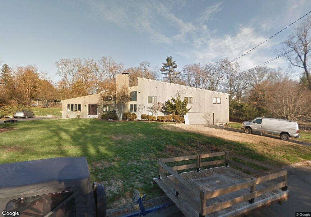
4 Blackberry Ln Westport, CT 06880
Staples NeighborhoodEstimated Value: $1,745,000 - $2,285,000
4
Beds
5
Baths
2,814
Sq Ft
$711/Sq Ft
Est. Value
About This Home
This home is located at 4 Blackberry Ln, Westport, CT 06880 and is currently estimated at $2,001,172, approximately $711 per square foot. 4 Blackberry Ln is a home located in Fairfield County with nearby schools including Long Lots School, Bedford Middle School, and Staples High School.
Ownership History
Date
Name
Owned For
Owner Type
Purchase Details
Closed on
Nov 5, 2004
Sold by
Lautman William D and Lautman Wendy K
Bought by
Cooper Russell J and Cooper Randi S
Current Estimated Value
Home Financials for this Owner
Home Financials are based on the most recent Mortgage that was taken out on this home.
Original Mortgage
$750,000
Outstanding Balance
$345,057
Interest Rate
4.62%
Estimated Equity
$1,656,115
Purchase Details
Closed on
Nov 21, 2003
Sold by
Hudock John M and Hurdock Jeanne H
Bought by
Lautman William D and Lautman Wendy K
Home Financials for this Owner
Home Financials are based on the most recent Mortgage that was taken out on this home.
Original Mortgage
$806,250
Interest Rate
4.62%
Create a Home Valuation Report for This Property
The Home Valuation Report is an in-depth analysis detailing your home's value as well as a comparison with similar homes in the area
Home Values in the Area
Average Home Value in this Area
Purchase History
| Date | Buyer | Sale Price | Title Company |
|---|---|---|---|
| Cooper Russell J | $1,135,820 | -- | |
| Cooper Russell J | $1,135,820 | -- | |
| Lautman William D | $1,075,000 | -- | |
| Lautman William D | $1,075,000 | -- |
Source: Public Records
Mortgage History
| Date | Status | Borrower | Loan Amount |
|---|---|---|---|
| Open | Lautman William D | $200,000 | |
| Open | Lautman William D | $750,000 | |
| Closed | Lautman William D | $750,000 | |
| Previous Owner | Lautman William D | $806,250 |
Source: Public Records
Tax History Compared to Growth
Tax History
| Year | Tax Paid | Tax Assessment Tax Assessment Total Assessment is a certain percentage of the fair market value that is determined by local assessors to be the total taxable value of land and additions on the property. | Land | Improvement |
|---|---|---|---|---|
| 2025 | $13,532 | $717,500 | $417,800 | $299,700 |
| 2024 | $13,360 | $717,500 | $417,800 | $299,700 |
| 2023 | $13,166 | $717,500 | $417,800 | $299,700 |
| 2022 | $12,965 | $717,500 | $417,800 | $299,700 |
| 2021 | $12,965 | $717,500 | $417,800 | $299,700 |
| 2020 | $12,805 | $789,400 | $439,700 | $349,700 |
| 2019 | $13,309 | $789,400 | $439,700 | $349,700 |
| 2018 | $9,602 | $789,400 | $439,700 | $349,700 |
| 2017 | $9,408 | $742,700 | $439,700 | $303,000 |
| 2016 | $12,522 | $742,700 | $439,700 | $303,000 |
| 2015 | $12,299 | $679,900 | $366,400 | $313,500 |
| 2014 | $12,197 | $679,900 | $366,400 | $313,500 |
Source: Public Records
Map
Nearby Homes
- 14 Burr School Rd
- 16 Burr School Rd
- 4 Burr Farms Rd
- 9 Burr Farms Rd
- 7 Morningside Ln
- 5 Willow Walk
- 13 Terhune Dr
- 20 Morningside Dr S
- 22 Morningside Dr S
- 40 Maple Ave N
- 116 Roseville Rd
- 21 Sturges Commons
- 785 Post Rd E Unit 301
- 785 Post Rd E Unit 303
- 785 Post Rd E Unit 302
- 785 Post Rd E Unit 201
- 785 Post Rd E Unit 304
- 785 Post Rd E Unit 102
- 785 Post Rd E Unit 104
- 6 Bayberry Common
- 1 Blackberry Ln
- 5 Blackberry Ln
- 6 Blackberry Ln
- 3 Greystone Farm Ln
- 2 Adams Farm Rd
- 18 North Ave
- 41 North Ave
- 14 North Ave
- 17 North Ave
- 11 North Ave
- 2 Plunkett Place
- 1 Greystone Farm Ln
- 1 Plunkett Place
- 5 Greystone Farm Ln
- 12 North Ave
- 1A Plunkett Place
- 5 Adams Farm Rd
- 7 North Ave
- 10 Adams Farm Rd
- 14 Adams Farm Rd