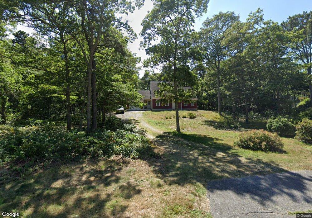
4 Bova Cove Rd Harwich, MA 02645
East Harwich NeighborhoodEstimated Value: $820,916 - $1,032,000
3
Beds
3
Baths
1,716
Sq Ft
$533/Sq Ft
Est. Value
About This Home
This home is located at 4 Bova Cove Rd, Harwich, MA 02645 and is currently estimated at $914,479, approximately $532 per square foot. 4 Bova Cove Rd is a home located in Barnstable County with nearby schools including Chatham Elementary School, Harwich Elementary School, and Monomoy Regional Middle School.
Ownership History
Date
Name
Owned For
Owner Type
Purchase Details
Closed on
May 6, 2019
Sold by
Shea Ann M
Bought by
Shea Ret
Current Estimated Value
Purchase Details
Closed on
May 6, 2010
Sold by
Kelley Elizabeth L and Hollenbach John A
Bought by
Shea Ann M
Purchase Details
Closed on
Apr 5, 1999
Sold by
Browns Lndg Land T
Bought by
Hollenbach John A and Hollenbach Laraine
Create a Home Valuation Report for This Property
The Home Valuation Report is an in-depth analysis detailing your home's value as well as a comparison with similar homes in the area
Home Values in the Area
Average Home Value in this Area
Purchase History
| Date | Buyer | Sale Price | Title Company |
|---|---|---|---|
| Shea Ret | -- | -- | |
| Shea Ann M | $417,500 | -- | |
| Hollenbach John A | $199,900 | -- |
Source: Public Records
Mortgage History
| Date | Status | Borrower | Loan Amount |
|---|---|---|---|
| Previous Owner | Hollenbach John A | $22,000 |
Source: Public Records
Tax History Compared to Growth
Tax History
| Year | Tax Paid | Tax Assessment Tax Assessment Total Assessment is a certain percentage of the fair market value that is determined by local assessors to be the total taxable value of land and additions on the property. | Land | Improvement |
|---|---|---|---|---|
| 2025 | $4,836 | $818,200 | $261,300 | $556,900 |
| 2024 | $4,545 | $753,800 | $221,800 | $532,000 |
| 2023 | $4,340 | $653,600 | $201,700 | $451,900 |
| 2022 | $4,212 | $519,400 | $175,400 | $344,000 |
| 2021 | $4,111 | $478,000 | $159,400 | $318,600 |
| 2020 | $4,079 | $467,200 | $157,700 | $309,500 |
| 2019 | $3,923 | $452,500 | $151,600 | $300,900 |
| 2018 | $3,831 | $422,700 | $137,800 | $284,900 |
| 2017 | $3,638 | $405,600 | $125,600 | $280,000 |
| 2016 | $3,541 | $390,400 | $125,600 | $264,800 |
| 2015 | $3,540 | $394,600 | $123,100 | $271,500 |
| 2014 | $3,360 | $383,100 | $119,400 | $263,700 |
Source: Public Records
Map
Nearby Homes
- 104 Wayside Dr
- 33 Pine Orchard Rd
- Lot 1 Ladue Landing
- 645 S Orleans Rd
- 76 Williamsburg Ave
- 15 Elijah's Woods
- 16 Partridge Ln
- 15 Whidah Dr
- 0 Pine Grove Rd Unit 73397945
- 0 Pine Grove Rd Unit 22505629
- 58 Sugar Hill Dr
- 0 Crows Pond Rd
- 507 S Orleans Rd
- 34 Lake Dr
- 2 Seapine Rd
- 13 Mill Pond Rd
- 33 Duck Marsh Ln
- 49 Duck Marsh Ln
- 558 Fox Hill Rd
- 24 Chickadee Ln
- 2 Bova Cove Rd
- 6 Bova Cove Rd
- 1747 Orleans Rd
- 1747 Orleans Rd
- 3 Bova Cove Rd
- 5 Bova Cove Rd
- 5 George Holbrook Way
- 7 Brothers Ln
- 1739 Orleans Rd
- 1739 N Orleans (Rt 39)
- 1771 Orleans Rd
- 11 Brothers Ln
- 39 Kimberley Way
- 1739 Orleans Rd
- 1764 Orleans Rd
- 1746 Orleans Rd
- 2 Connecticut Ave
- 1758 Orleans Rd
- 0 Brothers Ln
- 6 Brother's