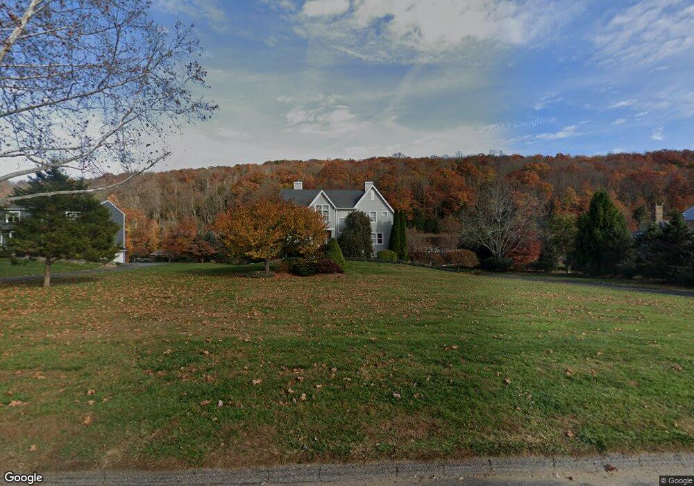
4 Bridge End Farm Ln Sandy Hook, CT 06482
Estimated Value: $982,000 - $1,090,000
4
Beds
4
Baths
2,824
Sq Ft
$370/Sq Ft
Est. Value
About This Home
This home is located at 4 Bridge End Farm Ln, Sandy Hook, CT 06482 and is currently estimated at $1,043,616, approximately $369 per square foot. 4 Bridge End Farm Ln is a home located in Fairfield County with nearby schools including Hawley Elementary School, Reed Intermediate School, and Newtown Middle School.
Ownership History
Date
Name
Owned For
Owner Type
Purchase Details
Closed on
Jun 28, 2024
Sold by
Mckinney Bruce A and Mckinney Dana K
Bought by
Iannucci Joseph and Muldoon Claire
Current Estimated Value
Home Financials for this Owner
Home Financials are based on the most recent Mortgage that was taken out on this home.
Original Mortgage
$655,000
Outstanding Balance
$647,222
Interest Rate
7.02%
Mortgage Type
Purchase Money Mortgage
Estimated Equity
$396,394
Purchase Details
Closed on
May 6, 1996
Sold by
Pel Susan
Bought by
Sabre Robert
Create a Home Valuation Report for This Property
The Home Valuation Report is an in-depth analysis detailing your home's value as well as a comparison with similar homes in the area
Home Values in the Area
Average Home Value in this Area
Purchase History
| Date | Buyer | Sale Price | Title Company |
|---|---|---|---|
| Iannucci Joseph | $955,000 | None Available | |
| Iannucci Joseph | $955,000 | None Available | |
| Sabre Robert | $150,000 | -- | |
| Sabre Robert | $150,000 | -- |
Source: Public Records
Mortgage History
| Date | Status | Borrower | Loan Amount |
|---|---|---|---|
| Open | Iannucci Joseph | $655,000 | |
| Closed | Iannucci Joseph | $655,000 | |
| Previous Owner | Sabre Robert | $200,000 | |
| Previous Owner | Sabre Robert | $145,000 | |
| Previous Owner | Sabre Robert | $227,000 |
Source: Public Records
Tax History Compared to Growth
Tax History
| Year | Tax Paid | Tax Assessment Tax Assessment Total Assessment is a certain percentage of the fair market value that is determined by local assessors to be the total taxable value of land and additions on the property. | Land | Improvement |
|---|---|---|---|---|
| 2025 | $18,291 | $636,420 | $318,830 | $317,590 |
| 2024 | $17,053 | $632,290 | $318,830 | $313,460 |
| 2023 | $16,591 | $632,290 | $318,830 | $313,460 |
| 2022 | $14,897 | $429,670 | $212,720 | $216,950 |
| 2021 | $14,888 | $429,680 | $212,730 | $216,950 |
| 2020 | $14,936 | $429,680 | $212,730 | $216,950 |
| 2019 | $14,940 | $429,680 | $212,730 | $216,950 |
| 2018 | $14,712 | $429,680 | $212,730 | $216,950 |
| 2017 | $14,658 | $432,770 | $213,070 | $219,700 |
| 2016 | $14,541 | $432,770 | $213,070 | $219,700 |
| 2015 | $14,312 | $432,770 | $213,070 | $219,700 |
| 2014 | $14,416 | $432,770 | $213,070 | $219,700 |
Source: Public Records
Map
Nearby Homes
- 211 Walnut Tree Hill Rd
- 7 Ford Rd
- 5 Fleetwood Dr
- 301 Berkshire Rd
- 17 Buttonball Dr
- 94 Glen Rd
- 5 Shepaug Rd
- 60 Pascoe Dr
- 600 Berkshire Rd
- 683 Berkshire Rd
- 297 Manor Rd
- 41 Chipmunk Trail
- 147 Oakdale Manor Rd
- 218 Fish Rock Rd
- 22 Hemlock Trail
- 199 Riverside Rd
- 108 Riverside Rd
- 89 Alpine Dr
- 25 Riverside Rd
- 105 Lower Fish Rock Rd
- 6 Bridge End Farm Ln
- 2 Bridge End Farm Ln
- 8 Bridge End Farm Ln
- 5 Bridge End Farm Ln
- 7 Bridge End Farm Ln
- 9 Bridge End Farm Ln
- 10 Bridge End Farm Ln
- 11 Bridge End Farm Ln
- 12 Bridge End Farm Ln
- 205 Walnut Tree Hill Rd
- 13 Bridge End Farm Ln
- 203 Walnut Tree Hill Rd
- 201 Walnut Tree Hill Rd
- 14 Bridge End Farm Ln
- 199 Walnut Tree Hill Rd
- 15 Bridge End Farm Ln
- 197 Walnut Tree Hill Rd
- 16 Bridge End Farm Ln
- 920 River Rd
- 17 Bridge End Farm Ln