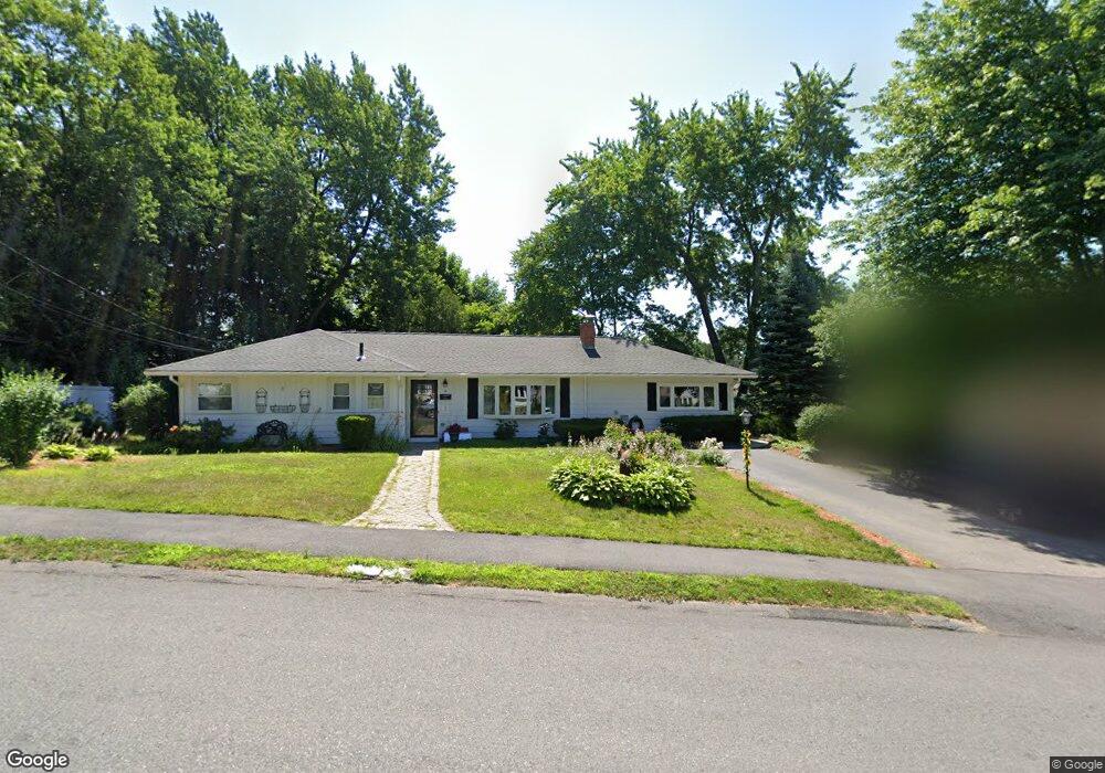
4 Brookdale Rd Natick, MA 01760
Estimated Value: $746,000 - $889,000
3
Beds
2
Baths
1,474
Sq Ft
$554/Sq Ft
Est. Value
About This Home
This home is located at 4 Brookdale Rd, Natick, MA 01760 and is currently estimated at $816,943, approximately $554 per square foot. 4 Brookdale Rd is a home located in Middlesex County with nearby schools including Natick High School, J F Kennedy Middle School, and Brown Elementary School.
Ownership History
Date
Name
Owned For
Owner Type
Purchase Details
Closed on
Oct 21, 1994
Sold by
Dowling Carmen M
Bought by
Armistead Daniel W and Foltz Carol E
Current Estimated Value
Home Financials for this Owner
Home Financials are based on the most recent Mortgage that was taken out on this home.
Original Mortgage
$152,000
Interest Rate
8.49%
Mortgage Type
Purchase Money Mortgage
Create a Home Valuation Report for This Property
The Home Valuation Report is an in-depth analysis detailing your home's value as well as a comparison with similar homes in the area
Home Values in the Area
Average Home Value in this Area
Purchase History
| Date | Buyer | Sale Price | Title Company |
|---|---|---|---|
| Armistead Daniel W | $160,000 | -- |
Source: Public Records
Mortgage History
| Date | Status | Borrower | Loan Amount |
|---|---|---|---|
| Open | Armistead Daniel W | $110,000 | |
| Closed | Armistead Daniel W | $105,000 | |
| Closed | Armistead Daniel W | $145,000 | |
| Closed | Armistead Daniel W | $152,000 |
Source: Public Records
Tax History Compared to Growth
Tax History
| Year | Tax Paid | Tax Assessment Tax Assessment Total Assessment is a certain percentage of the fair market value that is determined by local assessors to be the total taxable value of land and additions on the property. | Land | Improvement |
|---|---|---|---|---|
| 2025 | $7,288 | $609,400 | $430,100 | $179,300 |
| 2024 | $7,043 | $574,500 | $404,800 | $169,700 |
| 2023 | $6,960 | $550,600 | $389,100 | $161,500 |
| 2022 | $6,777 | $508,000 | $353,300 | $154,700 |
| 2021 | $4,482 | $478,200 | $333,100 | $145,100 |
| 2020 | $10,085 | $463,100 | $318,000 | $145,100 |
| 2019 | $9,635 | $463,100 | $318,000 | $145,100 |
| 2018 | $5,568 | $426,700 | $302,900 | $123,800 |
| 2017 | $5,128 | $380,100 | $258,600 | $121,500 |
| 2016 | $4,858 | $358,000 | $237,600 | $120,400 |
| 2015 | $4,793 | $346,800 | $237,600 | $109,200 |
Source: Public Records
Map
Nearby Homes
- 204 Hartford St
- 143 Howe St
- 369 Grant St
- 369 Grant St Unit 1
- 369 Grant St Unit 2
- 369 Grant St Unit 3
- 126 Bishop Dr
- 101 Bishop Dr Unit 101
- 155 Bishop Dr
- 8 Vernon Rd
- 31 Palmer Rd
- 287 W Central St
- 29 Aberdeen Rd
- 26 Willis St Unit 33
- 38 Ranger Rd
- 6 Clarks Hill Ln Unit 6
- 159 Bishop St
- 88 Pond St Unit 88
- 7 Village Way Unit 4
- 9 Village Hill Ln Unit 24
- 168 Hartford St
- 4 Hemlock Dr
- 6 Brookdale Rd
- 166 Hartford St
- 3 Brookdale Rd
- 6 Hemlock Dr
- 1 Brookdale Rd
- LOT 3 Waterview Estates
- LOT 67 Chalcom Cir
- LOT 3 Commonwealth Rd
- 164 Hartford St
- 1 Hemlock Dr
- 5 Brookdale Rd
- 172 Hartford St
- 3 Hemlock Dr
- 8 Hemlock Dr
- 171 Hartford St
- 175 Hartford St
- 169 Hartford St
- 7 Brookdale Rd