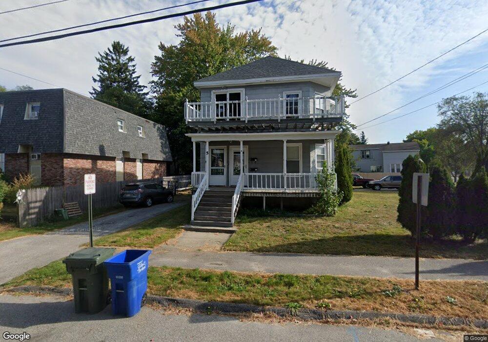
4 Burnham St South Portland, ME 04106
Pleasantdale NeighborhoodEstimated Value: $531,303 - $588,000
3
Beds
2
Baths
2,268
Sq Ft
$250/Sq Ft
Est. Value
About This Home
This home is located at 4 Burnham St, South Portland, ME 04106 and is currently estimated at $566,076, approximately $249 per square foot. 4 Burnham St is a home located in Cumberland County with nearby schools including James Otis Kaler Elementary School, Coloma High School, and Greater Portland Christian School.
Ownership History
Date
Name
Owned For
Owner Type
Purchase Details
Closed on
Sep 18, 2020
Sold by
Jonaitis Michael J
Bought by
Johannen Henry J
Current Estimated Value
Home Financials for this Owner
Home Financials are based on the most recent Mortgage that was taken out on this home.
Original Mortgage
$323,000
Outstanding Balance
$285,450
Interest Rate
2.8%
Mortgage Type
New Conventional
Estimated Equity
$280,626
Purchase Details
Closed on
Dec 6, 2010
Sold by
Jonaitis Thomas A
Bought by
Jonaitis Michael J
Home Financials for this Owner
Home Financials are based on the most recent Mortgage that was taken out on this home.
Original Mortgage
$0
Interest Rate
4.46%
Mortgage Type
Unknown
Create a Home Valuation Report for This Property
The Home Valuation Report is an in-depth analysis detailing your home's value as well as a comparison with similar homes in the area
Home Values in the Area
Average Home Value in this Area
Purchase History
| Date | Buyer | Sale Price | Title Company |
|---|---|---|---|
| Johannen Henry J | -- | None Available | |
| Jonaitis Michael J | -- | -- | |
| Jonaitis Thomas A | -- | -- |
Source: Public Records
Mortgage History
| Date | Status | Borrower | Loan Amount |
|---|---|---|---|
| Open | Johannen Henry J | $323,000 | |
| Previous Owner | Jonaitis Thomas A | $0 | |
| Previous Owner | Jonaitis Thomas A | $128,000 | |
| Previous Owner | Jonaitis Thomas A | $50,000 |
Source: Public Records
Tax History Compared to Growth
Tax History
| Year | Tax Paid | Tax Assessment Tax Assessment Total Assessment is a certain percentage of the fair market value that is determined by local assessors to be the total taxable value of land and additions on the property. | Land | Improvement |
|---|---|---|---|---|
| 2024 | $5,716 | $433,000 | $152,900 | $280,100 |
| 2023 | $4,878 | $345,000 | $100,800 | $244,200 |
| 2022 | $4,459 | $286,600 | $80,700 | $205,900 |
| 2021 | $4,213 | $286,600 | $80,700 | $205,900 |
| 2020 | $3,966 | $200,800 | $69,800 | $131,000 |
| 2019 | $3,745 | $200,800 | $69,800 | $131,000 |
| 2018 | $3,640 | $200,800 | $69,800 | $131,000 |
| 2017 | $3,614 | $200,800 | $69,800 | $131,000 |
| 2016 | $3,554 | $200,800 | $69,800 | $131,000 |
| 2015 | $3,494 | $200,800 | $69,800 | $131,000 |
| 2014 | $3,434 | $200,800 | $69,800 | $131,000 |
| 2013 | -- | $200,800 | $69,800 | $131,000 |
Source: Public Records
Map
Nearby Homes
- 34 Minott St Unit B7
- 42 Reynolds St
- 66 Evans St Unit 3
- 404 Lincoln St
- 11 Chestnut St
- 39 Morse St
- 7 Allen Rd
- 35 Palmer St
- 42 Buchanan St
- 1309 Broadway
- 17 b Peary Terrace
- 141 Mckinley St
- 56 Peary Terrace
- 1 Karynel Dr Unit 1
- 11 Jackson St
- 18 Plover Way Unit 29
- 24 Plover Way Unit 34
- 17 Plover Way Unit 27
- 15 Plover Way Unit 24
- 16 Plover Way Unit 26
- 1017 Broadway
- 1 Minott St Unit 2
- 1 Minott St Unit 4
- 1 Minott St
- 1035 Broadway
- 1034 Broadway
- 1040 Broadway
- 1012 Broadway
- 28 Minott St Unit A9
- 28 Minott St Unit A8
- 26 Minott St Unit A7
- 28 Minott St Unit A6
- 28 Minott St Unit A5
- 26 Minott St Unit A4
- 28 Minott St Unit A3
- 28 Minott St Unit A2
- 26 Minott St Unit A1
- 26 Minott St Unit 26
- 26 Minott St Unit 23
- 26 Minott St Unit 21