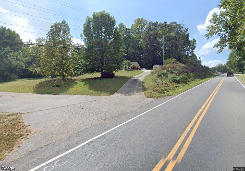
4 Camerons Corner Dahlonega, GA 30533
Estimated Value: $279,626 - $360,000
3
Beds
2
Baths
1,056
Sq Ft
$307/Sq Ft
Est. Value
About This Home
This home is located at 4 Camerons Corner, Dahlonega, GA 30533 and is currently estimated at $323,907, approximately $306 per square foot. 4 Camerons Corner is a home located in Lumpkin County with nearby schools including Clay County Middle School and Lumpkin County High School.
Ownership History
Date
Name
Owned For
Owner Type
Purchase Details
Closed on
May 28, 2021
Sold by
Johnson Helyn E
Bought by
Johnson Helyn E and Jonson Kenneth Lee
Current Estimated Value
Home Financials for this Owner
Home Financials are based on the most recent Mortgage that was taken out on this home.
Original Mortgage
$125,000
Outstanding Balance
$113,172
Interest Rate
2.9%
Mortgage Type
New Conventional
Estimated Equity
$210,735
Purchase Details
Closed on
Jun 30, 2004
Sold by
Cochran Douglas E
Bought by
Brooks William Jake and Brooks Helyn E
Purchase Details
Closed on
Feb 18, 2003
Sold by
Housley B B
Bought by
Cochran Douglas E
Purchase Details
Closed on
Dec 7, 1989
Sold by
Housley B B
Bought by
Housley B B
Purchase Details
Closed on
Jun 20, 1989
Sold by
Housley B B
Bought by
Housley B B
Purchase Details
Closed on
Jul 10, 1970
Bought by
Housley B B
Create a Home Valuation Report for This Property
The Home Valuation Report is an in-depth analysis detailing your home's value as well as a comparison with similar homes in the area
Home Values in the Area
Average Home Value in this Area
Purchase History
| Date | Buyer | Sale Price | Title Company |
|---|---|---|---|
| Johnson Helyn E | -- | -- | |
| Brooks William Jake | $119,500 | -- | |
| Cochran Douglas E | $58,000 | -- | |
| Housley B B | -- | -- | |
| Housley B B | -- | -- | |
| Housley B B | -- | -- |
Source: Public Records
Mortgage History
| Date | Status | Borrower | Loan Amount |
|---|---|---|---|
| Open | Johnson Helyn E | $125,000 |
Source: Public Records
Tax History Compared to Growth
Tax History
| Year | Tax Paid | Tax Assessment Tax Assessment Total Assessment is a certain percentage of the fair market value that is determined by local assessors to be the total taxable value of land and additions on the property. | Land | Improvement |
|---|---|---|---|---|
| 2024 | $1,871 | $78,042 | $10,858 | $67,184 |
| 2023 | $1,704 | $72,426 | $9,870 | $62,556 |
| 2022 | $1,503 | $60,704 | $8,231 | $52,473 |
| 2021 | $1,324 | $51,739 | $8,231 | $43,508 |
| 2020 | $1,323 | $50,159 | $7,884 | $42,275 |
| 2019 | $1,335 | $50,159 | $7,884 | $42,275 |
| 2018 | $1,281 | $45,169 | $7,884 | $37,285 |
| 2017 | $1,232 | $42,596 | $7,884 | $34,712 |
| 2016 | $1,137 | $38,028 | $7,884 | $30,144 |
| 2015 | $1,011 | $38,028 | $7,884 | $30,144 |
| 2014 | $1,011 | $38,340 | $7,884 | $30,456 |
| 2013 | -- | $38,653 | $7,884 | $30,769 |
Source: Public Records
Map
Nearby Homes
- 132 J Mountain Dr
- 121 Blair Ridge Rd
- 120 Blair Ridge Rd
- 1202 Oak Grove Rd
- 253 Blair Ridge Rd
- 549 Ivy Terrace
- 100 Sanders Blvd
- 120 Sanders Blvd
- 490 N Hall Rd
- 64 Hickory Ln
- 0 Dawsonville Hwy Unit 10631159
- 00 Dawsonville Hwy
- 70 Avery Trail
- 94 Mountain View Dr
- 114 Funaro Ln
- 0 Camp Wahsega Rd Unit 7600956
- 0 Camp Wahsega Rd Unit 10547292
- 357 Camp Wahsega Rd
- 97 Beaumont Dr
- 30 Camerons Corner
- 879 Oak Grove Rd
- 32 Camerons Corner
- 7 Hamp Mill Rd
- 965 Oak Grove Rd
- 789 Oak Grove Rd
- 935 Oak Grove Rd
- 88 Stoney Hill Dr
- 962 Oak Grove Rd
- 1188 Hamp Mill Rd
- 68 White Oak Ln
- 975 Oak Grove Rd
- 564 Oak Grove Rd
- 988 Oak Grove Rd
- 559 Oak Grove Rd
- 297 J Mountain Dr
- 260 Cross Creek Trail
- 1024 Oak Grove Rd
- 265 J Mountain Dr
- 835 J Mountain Dr
