S
Seller's Agent in 2022
Susan McCabe
Kinlin Grover Compass
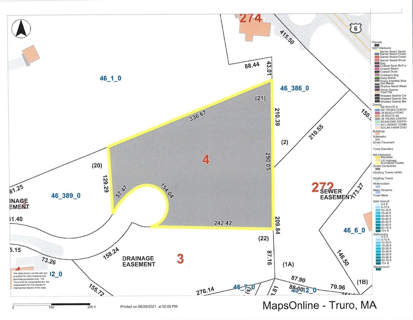


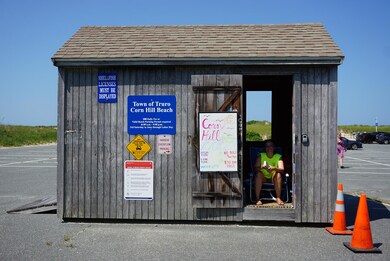
This wooded, bayside lot is located on Capt. Williams Way, a four-lot subdivision in an area of newly constructed fine homes. Capt. Williams Way is off Castle Road, which provides back road access to Truro Center, the Pamet Harbor, Ballston Beach, and Wellfleet Center without traveling on Route 6. Corn Hill Beach, one of Truro's finest bay beaches, is a one-mile drive. This lot can accommodate a six-bedroom home; it is conveniently close to Provincetown and Wellfleet, all area beaches and attractions. Build to suit your taste and needs.
Last Agent to Sell the Property
Susan McCabe
Kinlin Grover Compass Listed on: 07/01/2021
Last Buyer's Agent
Susan McCabe
Down Cape Realty
| Date | Event | Price | List to Sale | Price per Sq Ft |
|---|---|---|---|---|
| 07/01/2022 07/01/22 | Off Market | $379,000 | -- | -- |
| 05/18/2022 05/18/22 | Sold | $379,000 | 0.0% | -- |
| 07/01/2021 07/01/21 | For Sale | $379,000 | -- | -- |
S
Seller's Agent in 2022
Susan McCabe
Kinlin Grover Compass
Source: Cape Cod & Islands Association of REALTORS®
MLS Number: 22103819
Disclaimer: Certain information contained herein is derived from information provided by parties other than Homes.com. All information provided is deemed reliable, but is not guaranteed to be accurate and should be independently verified.
![]() All data relating to real estate for sale on this page comes from the Broker Reciprocity (BR) of the Cape Cod & Islands Multiple Listing Service, Inc. Detailed information about real estate listings held by brokerage firms other than CC&I Assoc. of REALTORS®, Inc. includes the name of the listing company. Neither the listing company nor CC&I Assoc. of REALTORS®, Inc. shall be responsible for any typographical errors, misinformation, misprints and shall be held totally harmless. The Broker providing this data believes it to be correct, but advises interested parties to confirm any item before relying on it in a purchase decision. All properties are subject to prior sale, changes, or withdrawal. Copyright 2026 © Cape Cod & Islands Multiple Listing Service, Inc. All rights reserved.
All data relating to real estate for sale on this page comes from the Broker Reciprocity (BR) of the Cape Cod & Islands Multiple Listing Service, Inc. Detailed information about real estate listings held by brokerage firms other than CC&I Assoc. of REALTORS®, Inc. includes the name of the listing company. Neither the listing company nor CC&I Assoc. of REALTORS®, Inc. shall be responsible for any typographical errors, misinformation, misprints and shall be held totally harmless. The Broker providing this data believes it to be correct, but advises interested parties to confirm any item before relying on it in a purchase decision. All properties are subject to prior sale, changes, or withdrawal. Copyright 2026 © Cape Cod & Islands Multiple Listing Service, Inc. All rights reserved.
Ask me questions while you tour the home.