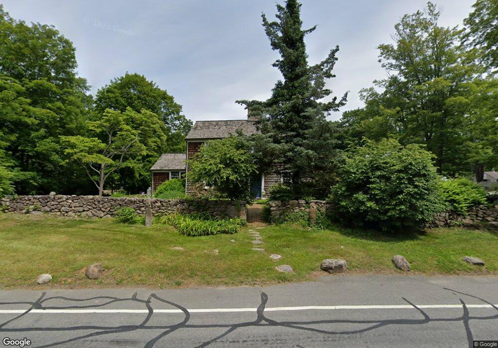
4 Carter St New Canaan, CT 06840
Estimated Value: $1,930,000 - $2,012,000
3
Beds
4
Baths
3,008
Sq Ft
$654/Sq Ft
Est. Value
About This Home
This home is located at 4 Carter St, New Canaan, CT 06840 and is currently estimated at $1,967,527, approximately $654 per square foot. 4 Carter St is a home located in Fairfield County with nearby schools including East Elementary School, Saxe Middle School, and New Canaan High School.
Ownership History
Date
Name
Owned For
Owner Type
Purchase Details
Closed on
Nov 30, 2022
Sold by
Robinson Charles L and Robinson Sarah T
Bought by
Sarah T Robinson Rt and Robinson
Current Estimated Value
Purchase Details
Closed on
Oct 21, 1997
Sold by
Sally A Hypes Trust and Hypes William P
Bought by
Robinson Charles L and Robinson Sarah T
Create a Home Valuation Report for This Property
The Home Valuation Report is an in-depth analysis detailing your home's value as well as a comparison with similar homes in the area
Home Values in the Area
Average Home Value in this Area
Purchase History
| Date | Buyer | Sale Price | Title Company |
|---|---|---|---|
| Sarah T Robinson Rt | -- | None Available | |
| Robinson Charles L | $237,500 | -- | |
| Robinson Charles L | $237,500 | -- |
Source: Public Records
Mortgage History
| Date | Status | Borrower | Loan Amount |
|---|---|---|---|
| Previous Owner | Robinson Charles L | $411,000 | |
| Previous Owner | Robinson Charles L | $442,000 | |
| Previous Owner | Robinson Charles L | $443,000 |
Source: Public Records
Tax History Compared to Growth
Tax History
| Year | Tax Paid | Tax Assessment Tax Assessment Total Assessment is a certain percentage of the fair market value that is determined by local assessors to be the total taxable value of land and additions on the property. | Land | Improvement |
|---|---|---|---|---|
| 2025 | $16,973 | $1,016,960 | $612,850 | $404,110 |
| 2024 | $16,414 | $1,016,960 | $612,850 | $404,110 |
| 2023 | $15,194 | $802,200 | $553,000 | $249,200 |
| 2022 | $14,736 | $802,200 | $553,000 | $249,200 |
| 2021 | $14,568 | $802,200 | $553,000 | $249,200 |
| 2020 | $14,568 | $802,200 | $553,000 | $249,200 |
| 2019 | $14,632 | $802,200 | $553,000 | $249,200 |
| 2018 | $16,646 | $981,470 | $544,040 | $437,430 |
| 2017 | $16,361 | $981,470 | $544,040 | $437,430 |
| 2016 | $15,078 | $924,490 | $544,040 | $380,450 |
| 2015 | $15,310 | $924,490 | $544,040 | $380,450 |
| 2014 | $14,437 | $929,040 | $544,040 | $385,000 |
Source: Public Records
Map
Nearby Homes
- 67 Carter St
- 136L Carter St
- 152L Carter St
- 158L Carter St
- 140L Carter St
- 250 Carter St
- 262 Brushy Ridge Rd
- 38 Fitch Ln
- 289 New Norwalk Rd Unit 22
- 30L Huckleberry Hill Rd
- 240 Rosebrook Rd
- 114 Ferris Hill Rd
- 152 Long Lots Rd
- 860 Silvermine Rd
- 145 River St
- 515 Carter St
- 52 Garibaldi Ln
- 61 Smith Ridge Rd
- 180 Summer St
- 64 East Ave
- 19 Carter St
- 407 Silvermine Rd
- 390 Silvermine Rd
- 5 Canoe Hill Rd
- 33 Carter St
- 406 Silvermine Rd
- 38 Canoe Hill Rd
- 424 Silvermine Rd
- 25 Canoe Hill Rd
- 344 Silvermine Rd
- 429 Silvermine Rd
- 421 Silvermine Rd
- 48 Salem Rd
- 33 Canoe Hill Rd
- 417 Silvermine Rd
- 438 Silvermine Rd
- 45 Canoe Hill Rd
- 64 Canoe Hill Rd
- 312 Silvermine Rd
- 138 Lone Tree Farm Rd