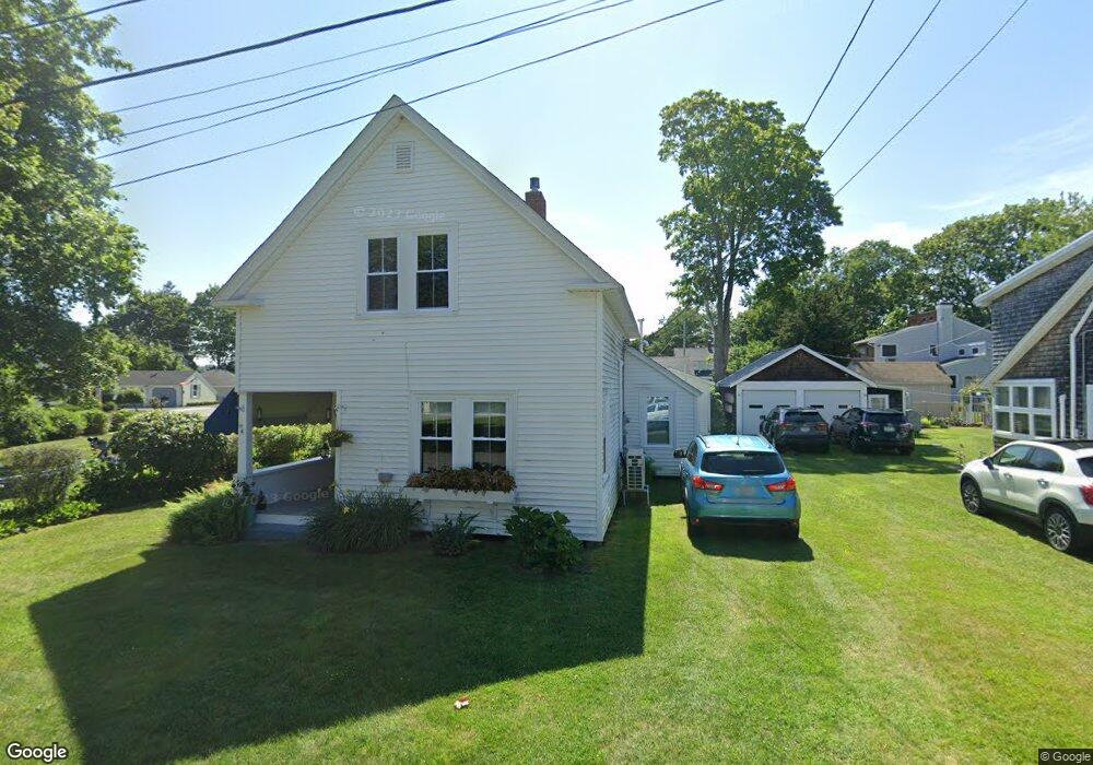
4 Coggeshall St Warren, RI 02885
Coggeshall NeighborhoodEstimated Value: $339,000 - $440,000
3
Beds
1
Bath
860
Sq Ft
$458/Sq Ft
Est. Value
About This Home
This home is located at 4 Coggeshall St, Warren, RI 02885 and is currently estimated at $393,875, approximately $457 per square foot. 4 Coggeshall St is a home with nearby schools including Mt. Hope High School.
Ownership History
Date
Name
Owned For
Owner Type
Purchase Details
Closed on
Sep 8, 2023
Sold by
Vellucci Lori A
Bought by
Lori A Vellucci Ret and Vellucci
Current Estimated Value
Purchase Details
Closed on
Apr 22, 2019
Sold by
Peter Leonard Sloan Ret and Sloan
Bought by
Vellucci Lori A
Home Financials for this Owner
Home Financials are based on the most recent Mortgage that was taken out on this home.
Original Mortgage
$127,500
Interest Rate
4.4%
Mortgage Type
New Conventional
Purchase Details
Closed on
Aug 25, 2014
Sold by
James A Falcon Ret and Falcon
Bought by
Peter Leonard Sloan Re and Sloan
Create a Home Valuation Report for This Property
The Home Valuation Report is an in-depth analysis detailing your home's value as well as a comparison with similar homes in the area
Home Values in the Area
Average Home Value in this Area
Purchase History
| Date | Buyer | Sale Price | Title Company |
|---|---|---|---|
| Lori A Vellucci Ret | -- | None Available | |
| Vellucci Lori A | $170,000 | -- | |
| Peter Leonard Sloan Re | $169,000 | -- |
Source: Public Records
Mortgage History
| Date | Status | Borrower | Loan Amount |
|---|---|---|---|
| Previous Owner | Vellucci Lori A | $127,500 |
Source: Public Records
Tax History Compared to Growth
Tax History
| Year | Tax Paid | Tax Assessment Tax Assessment Total Assessment is a certain percentage of the fair market value that is determined by local assessors to be the total taxable value of land and additions on the property. | Land | Improvement |
|---|---|---|---|---|
| 2025 | $4,049 | $271,900 | $166,800 | $105,100 |
| 2024 | $3,926 | $271,900 | $166,800 | $105,100 |
| 2023 | $3,714 | $271,900 | $166,800 | $105,100 |
| 2022 | $3,887 | $215,800 | $159,500 | $56,300 |
| 2021 | $3,824 | $215,800 | $159,500 | $56,300 |
| 2020 | $3,746 | $215,800 | $159,500 | $56,300 |
| 2019 | $3,797 | $198,700 | $135,700 | $63,000 |
| 2018 | $3,747 | $198,700 | $135,700 | $63,000 |
| 2017 | $3,738 | $198,700 | $135,700 | $63,000 |
| 2016 | $3,657 | $183,100 | $123,800 | $59,300 |
| 2015 | $3,657 | $183,100 | $123,800 | $59,300 |
| 2014 | $3,761 | $187,400 | $123,800 | $63,600 |
Source: Public Records
Map
Nearby Homes
- 21 Bradbury St
- 22 Harrison St
- 0 Platt St Unit 1383816
- 11 Stonegate Rd
- 16 Smith St
- 1 Betsy Dr
- 3 Betsy Dr
- 48 Narrows Rd
- 6 Scott Ln
- 7 Broadview Ave
- 6 Violet Ct
- 79 Hopeworth Ave
- 683 Metacom Ave Unit 79
- 669 Metacom Ave Unit 17
- 95 Winslow Way
- 0 Barton Ave
- 110 Seaview Ave
- 4 Read Ave
- 0 Overhill Rd Unit 1382248
- 7 Knowlton Ct