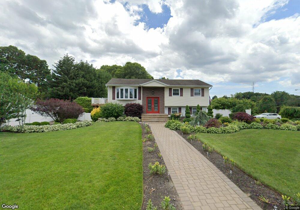
4 Dennard Rd Hauppauge, NY 11788
Estimated Value: $707,000 - $914,443
7
Beds
3
Baths
2,700
Sq Ft
$308/Sq Ft
Est. Value
About This Home
This home is located at 4 Dennard Rd, Hauppauge, NY 11788 and is currently estimated at $830,861, approximately $307 per square foot. 4 Dennard Rd is a home located in Suffolk County with nearby schools including Hauppauge Middle School, Hauppauge High School, and Smithtown Christian School.
Ownership History
Date
Name
Owned For
Owner Type
Purchase Details
Closed on
Jul 24, 2017
Sold by
Clarin Brett and Zhu Wenzheng
Bought by
Jennings Donald
Current Estimated Value
Home Financials for this Owner
Home Financials are based on the most recent Mortgage that was taken out on this home.
Original Mortgage
$500,000
Outstanding Balance
$412,294
Interest Rate
3.62%
Mortgage Type
Adjustable Rate Mortgage/ARM
Estimated Equity
$418,567
Purchase Details
Closed on
Dec 1, 2003
Sold by
Boscaino Anthony and Boscaino Veronica
Bought by
Clarin Brett and Zhu Wenzheng
Home Financials for this Owner
Home Financials are based on the most recent Mortgage that was taken out on this home.
Original Mortgage
$322,700
Interest Rate
4.62%
Mortgage Type
Purchase Money Mortgage
Create a Home Valuation Report for This Property
The Home Valuation Report is an in-depth analysis detailing your home's value as well as a comparison with similar homes in the area
Home Values in the Area
Average Home Value in this Area
Purchase History
| Date | Buyer | Sale Price | Title Company |
|---|---|---|---|
| Jennings Donald | $542,000 | None Available | |
| Clarin Brett | $535,000 | Titlewaves Title Agency Llc |
Source: Public Records
Mortgage History
| Date | Status | Borrower | Loan Amount |
|---|---|---|---|
| Open | Jennings Donald | $500,000 | |
| Previous Owner | Clarin Brett | $322,700 |
Source: Public Records
Tax History Compared to Growth
Tax History
| Year | Tax Paid | Tax Assessment Tax Assessment Total Assessment is a certain percentage of the fair market value that is determined by local assessors to be the total taxable value of land and additions on the property. | Land | Improvement |
|---|---|---|---|---|
| 2024 | $11,844 | $52,200 | $13,000 | $39,200 |
| 2023 | $11,844 | $52,200 | $13,000 | $39,200 |
| 2022 | $9,233 | $52,200 | $13,000 | $39,200 |
| 2021 | $9,233 | $52,200 | $13,000 | $39,200 |
| 2020 | $10,600 | $52,200 | $13,000 | $39,200 |
| 2019 | $10,600 | $0 | $0 | $0 |
| 2018 | -- | $52,200 | $13,000 | $39,200 |
| 2017 | $9,738 | $50,000 | $13,000 | $37,000 |
| 2016 | $9,356 | $50,000 | $13,000 | $37,000 |
| 2015 | -- | $50,000 | $13,000 | $37,000 |
| 2014 | -- | $50,000 | $13,000 | $37,000 |
Source: Public Records
Map
Nearby Homes
- 30 Dale Ln
- 6 Rolling Wood Ct
- 43 Harrison Ave
- 64 Woodbury Rd
- 1051 Veterans Memorial Hwy
- 32 Merrivale Dr
- 324 Mac Arthur Blvd
- 68 Joyce Dr
- 154 Mac Arthur Blvd
- 0 Bridge Rd Unit KEY814925
- 250 Wheeler Rd
- 3 Milford Dr
- 7 Whitespruce Ln
- 41 Berkshire Dr
- 385 Salem Ct
- 206 Brooksite Dr
- 236 Northfield Rd
- 61 Redan Dr
- 37 Carldon Ln
- 639 Townline Rd